and Chasing
[Index][Archives]
East Coast Low: Thursday 15th to Saturday 17th June 1995
by Michael Bath
| Storm News and Chasing [Index][Archives] |
East Coast Low: Thursday 15th to Saturday 17th June 1995 by Michael Bath |
49mm	Berry		44mm	Robertson
51mm	Gordon		48mm	Sydney
62mm	Greenwell Pt	60mm	Batemans Bay
51mm	Mosman		52mm	Turramurra
50mm	Kiama		57mm	Milton
50mm	Pymble		43mm	Epping
44mm	Nowra		51mm	Moruya Hds
51mm	Riverview	71mm	Ulladulla
Flooding was reported in Gerringong Creek at Kangaroo Valley around 6.30pm. A woman was trapped on the roof of her car when flood waters swept the vehicle into the creek.
Later in the day on the 16th a thunderstorm with severe wind and rain lashed the Central Coast area. Norah Head, Budgewoi, Terrigal and Ourimbah all reported wind damage and local flooding. 44 to 55 knot winds were reported from Norah Head. Significant rainfall readings to 9am on the 17th included:
37mm	Avoca Beach	33mm	Wyee
33mm	Palmdale	43mm	Maryville
35mm	Erina		39mm	Wyong
29mm	The Entrance	30mm	Norah Head
42mm	Gosford		36mm	Nobbys Head
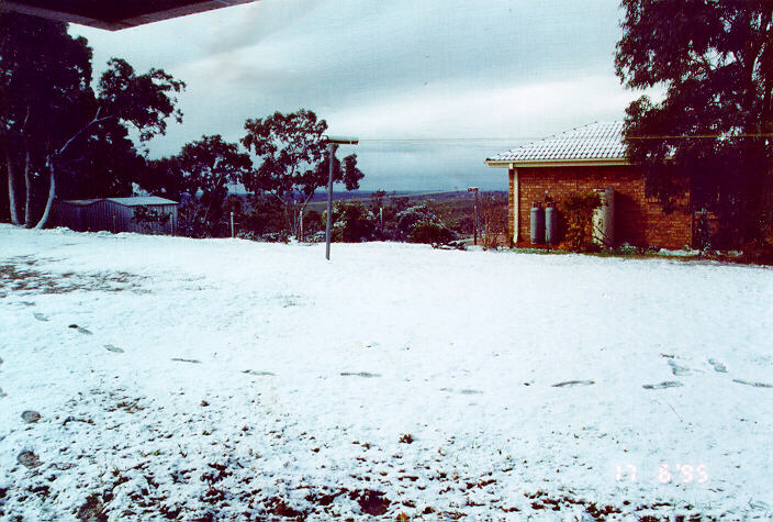
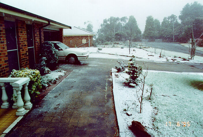
On Saturday, snow arrived at Katoomba and Oberon around noon but was welcome at the start of the Winter Magic Festival. Drifts of up to 9cm occurred from the snow which lasted about 2 hours. The temperature was only 4 degrees at noon.
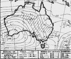
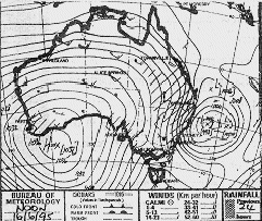
Synoptic Charts provided by the Bureau of Meteorology
|
Document: 9506-01.htm
Updated: 5th April, 2004 |
[Australian Severe Weather index] [Copyright Notice] [Email Contacts] [Search This Site] |