and Chasing
[Index][Archives]
The Horsley Park Storm Chase Radar Images
The Horsley Park Storm Chase report
| Storm News and Chasing [Index][Archives] |
The Horsley Park Storm Chase Radar Images The Horsley Park Storm Chase report |
Horsley Park is located in the middle of each image, just east of the red line, below the circle. Between 6:30 and 6:40 p.m. the most intense radar reflectivity (ie. the white within the red section) is over the Horsley Park area.
Location codes are:
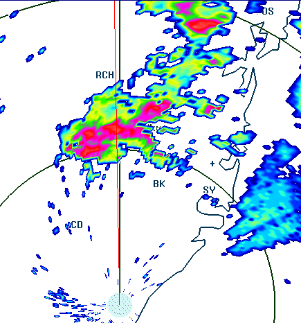 6:20 p.m.
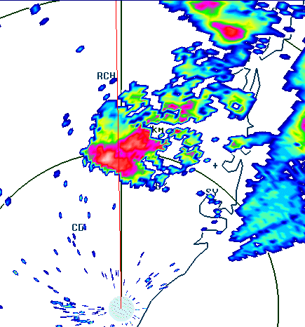 6:30 p.m.
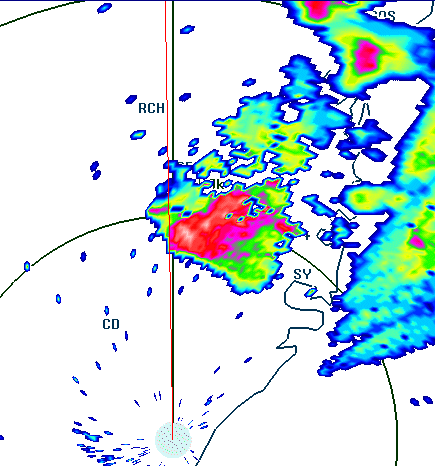 6:40 p.m.
|
Document: 9602-02.htm
Updated: 6th April, 2004 |
[Australian Severe Weather index] [Copyright Notice] [Email Contacts] [Search This Site] |