and Chasing
[Index][Archives]
Southern Tablelands to Sydney Storm Chase: Tuesday 19th January 1999
by David Croan
| Storm News and Chasing [Index][Archives] |
Southern Tablelands to Sydney Storm Chase: Tuesday 19th January 1999 by David Croan |
The 7am MSL chart showed a broad area of low pressure over much of NSW with a trough extending from the north west of the state down to the Canberra region. The AVN LI, which has proven to be a fairly reliable short-term forecast tool for data starved Australian chasers, was less than -6 for the Canberra region and extending south-east to the coast for the afternoon and evening (actual sounding data is never available until early in the afternoon which is effectively too late). Upper level winds were tipped to be around 70-80 knots although at other levels, including 850mb, there was not much happening. This suggested Canberra to be the best target area for a chase. Fortunately I had some things to do in Canberra through work with a friend who was also keen to tag along for a chase.
We headed out of Sydney along the freeway at about 9:30am EST with healthy castellanus to the S and SE although by Mittagong the wind was a dry NWer. A single tiny cumulus was first observed to the immediate S as we passed Marulan (11.30am) and by the time we got onto the Federal Hwy, just outside of Goulbourn (12:10pm), there were large congestus over the Goulburn area. While driving past Lake George I noticed that a small multi-cell storm had developed out of the congestus cluster and estimated this to be around the Lake Bathurst area. The dominant updraft of this cell had a nice 'lean' - probably expected with the WNW jet stream running over the top of us. By this stage I convinced myself (big mistake!) that it was looking great for severe storms later with a line of ACCAS and several cumulus towers to the S and SW taking on that 'mushroom cloud' shaped appearance, which is always a good sign of high instability. There was also a large cell to the distant SE. However in Canberra itself (1:00pm) it became apparent that everything was well capped as very vigorous looking updrafts were just hitting the proverbial brick wall. I was kept indoors until about 2:30pm and finally was free to chase. By this time a high-based storm had developed over the ranges just SW of Canberra so we made a dash to the national library to check things out - no severe advices out but mention of a significant storm on the ranges just W of Sydney (S*%T I thought) and one SE of Canberra. I decided to head SE towards Queenbeyan and the general area where LIs were predicted to be less than -6 and to keep abreast of the Canberra storm in the hope that it would run into more moisture. From there it was a trip south towards Captains flat with the aim of intercepting the storm along the beautiful open country there. About 15km down the road and we were at the crossroads (well a T junction with a gravel road anyway) - the storm to the Sth was decidedly larger now with a much lower base and was quite clearly dragging in moisture laden air. Another storm to the Nth was the typical high-based 1998/9 affair. The problem was that we only had about 40km of road to play with to the Sth and then it was all unsealed stuff into who-knows-where. So we reluctantly headed down a secondary road and Nth towards Bungendore. I was surpised that the 'Nth' storm was not looking too bad - contrast was poor and it was fairly high-based but it had a very thick rain curtain and put out some brilliant CGs quite close to us. As we got into it, the rain was very heavy with visibility reduced to within about 20 metres for a bried period. We arrived in Bungendore at about 4:30pm with flash flooding in the main street. After this we were Sydney bound in the hope that storms would fire up along the way. For about 100km to Marulan 'borderline' thunderstorms would go up, put out the required Cg/Cc or two and then die; a highlight being a spectacular anvil crawler from one of them. A relatively dissapointing chase (to what I expected!). At Berrima (now only about 120km from Sydney) I noticed low level scud racing Sth overhead. Sure enough at about 6:20pm, a cell looked to be getting its act together right behind us (S-SW) - not over some of the beautiful chase country we had just been through but on the freeway in the heavily forested and hilly Southern tablelands. We just kept driving and finally found a good spot at the Hilltop turnoff in Colo Vale. I set the video up on a tripod and just sat down on the hill with my camera and watched. To the left side (looking Sth) a roll cloud developed, however it was clear that the main updraft was going up in front of us (ie to our W-SW) and coming pretty well straight at us. Initially there was a fairly featureless rain curtain. Between the main updraft region (visible by the in and up movement of the fractus), and the rain curtain, a nice little 'false funnel' developed and persisted for several minutes before becoming enshrouded in rain - there were no obvious clues to suggest that it was rotating although it was too hard to determine this for sure. Gradually, over the space of about 10 minutes a 'nice' looking storm developed with an ominous looking gust front - probably not overly exciting for anyone who was expecting a rotating wall cloud or tornado. The next series of events were quite interesting to watch. A cloud lowering with the typical concave underside developed from upward rising scud, initially beneath the end of the shelf cloud. This then seemed become detached from the shelfcloud and associated with the main updraft area behind it. It then took on a more solid look, sloping down towards the adjacent downdraft which suggested to me that it was a wall cloud - this was no supercell and it definetly wasn't rotating but I suspect that it resulted from the rain cooled downdraft air being pulled into a fairly strong little updraft - it only persisted for about 10 minutes and then got enshrouded by rain. This area of the storm was was also quite active in the Cg department but, as usual, I could only manage three lousy bolts - and that was with a camcorder. When I was changing battery during the Bungendore storm three 'very' bright CGs simultaneously hit the ground about 1km in front of us - right where I had the camcorder facing. Now, to rub insult into injury, the 2nd battery 'carked it' right on the spot. I couldn't believe it as although what I had gotten on tape was ok, the precipitation curtain had just begun to take on a much more menacing appearance - I was expecting hail based on past storms I had witnessed with this appearance. Anyway we decided to get out of its path and continue on towards Sydney. The storm looked even larger as we got ahead of it and and I guessed that it formed on the southerly change. However by about 7:10pm and just out of Sydney, I was dissapointed to see that the storm looked pretty well gusted out, so we called it a day.
Looking at the map, this storm passed through forested country with perhaps only the towns Colo Vale and possibly Hilltop and Bargo being in the path. I have heard no reports of any severe weather associated with it which, given that path and the fact that it was fairly short lived, is not surpising. Certainly it was a fairly spectacular storm to watch and worth every bit of the 250km it took to get it.
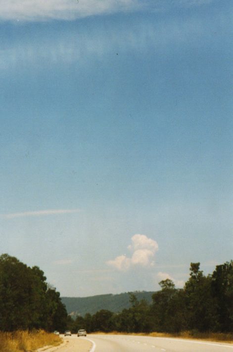 Towering cumulus such as this were a feature of the midday development. Picture taken on the Federal Hwy, just after having passed Lake George and about 20 km out from Canberra.
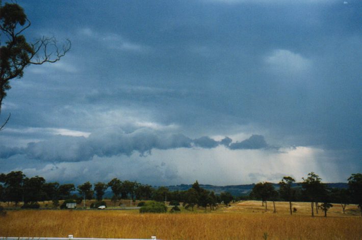
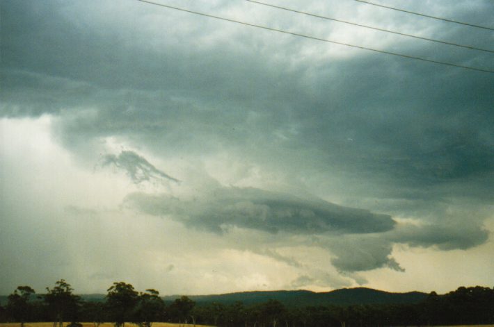
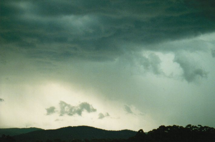
 This is the storm which moved over southern Canberra and which we followed SE towards Captains flat. While in Canberra this was a fairly uninteresting high based storm. This picture, taken 14 km along Captains Flat Rd from the Kings Hwy turnoff, shows the norternmost flank of the storm at a time when it was visibly drawing in a moist NE inflow. Unfortunately we would run out of road.
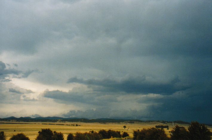
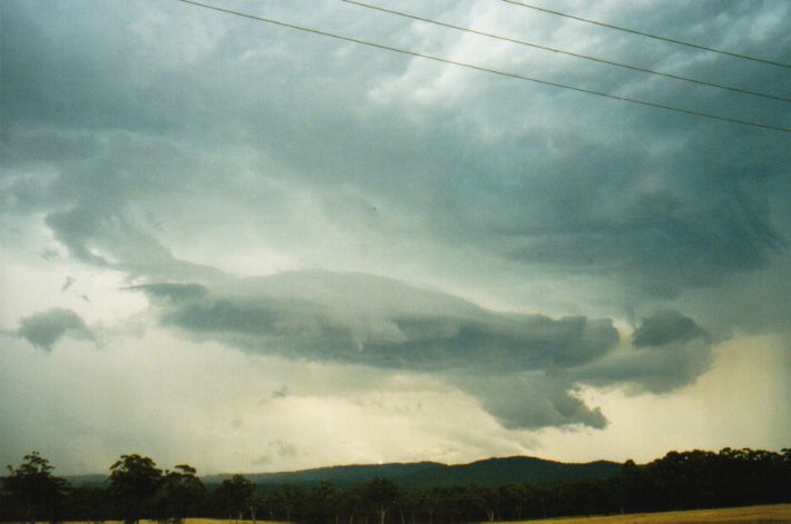
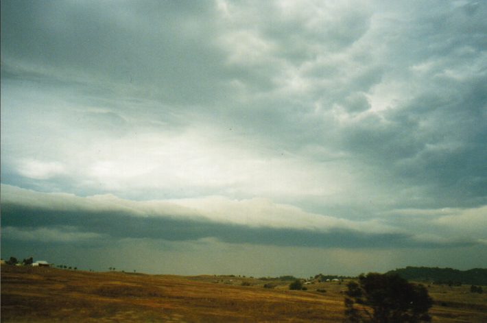
 3) Having given up any hope of playing catch-up with the Captains Flat storm, we decided on going after this one to the Nth. This looked, at first, to be a fairly weak storm although, as we got nearer to it, very dense rain curtains and fierce Cgs were apparent. The picture, taken about 10km S of Bungendore, shows an arcus cloud along the SW flank with the rain curtain just in view. Flash flooding was observed in Bungendore and the storm wasn't particularly slow moving.
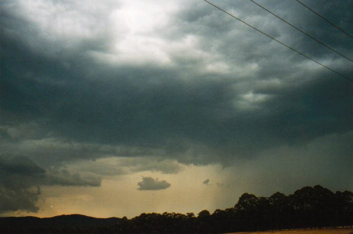
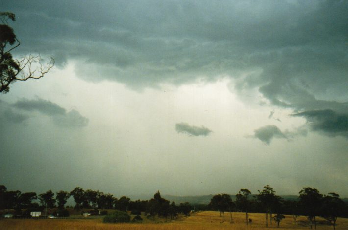
 The story for the next 100km. Updraft bases would develop with a few Cgs, precipitate and then die off. Picture taken between Tarago and Goulburn.
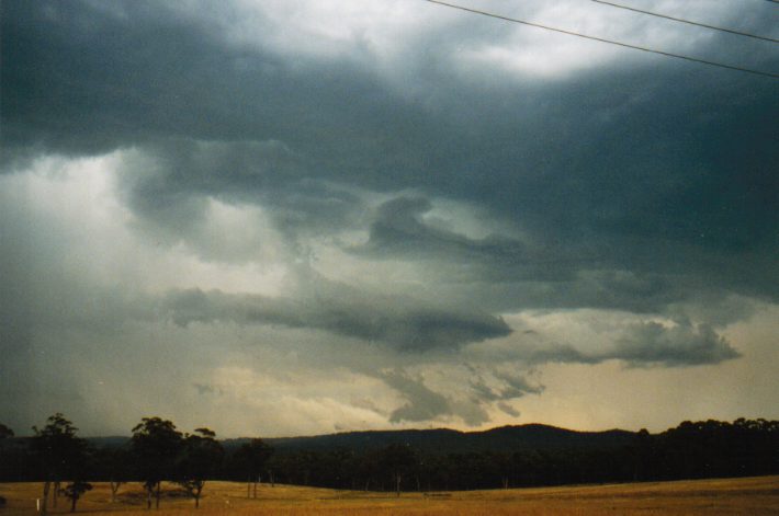
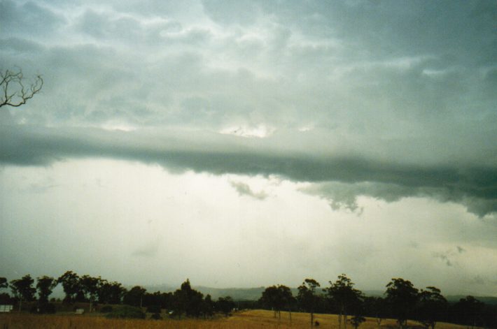
 Indications that a more organised storm was developing SW of us after having turned off the Sydney-Melbourne Freeway at Colo Vale - a roll cloud with discernible though not rapid horizontal turning. We were in a warm humid Ntherly inflow at the time.
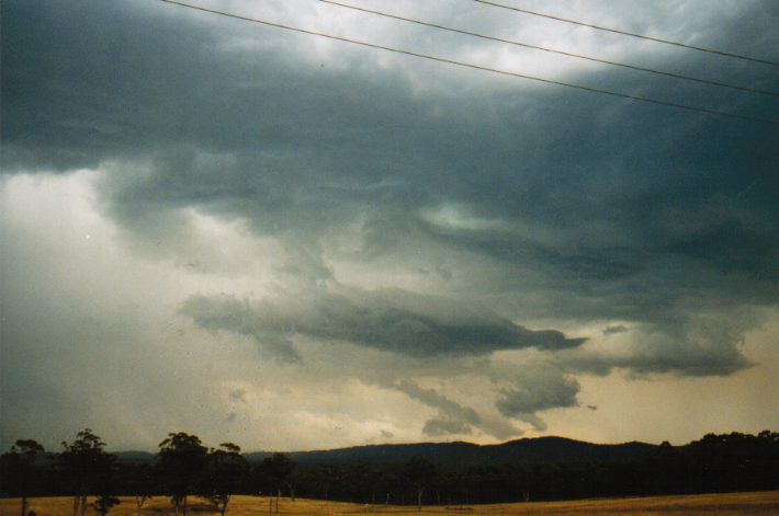
 A little 'false funnel' can be seen at the interface between the precipitation curtain on the right and the main updraft area (centre) where vertical scud motion was visible. This feature was maintained for several minutes, although, from the distance we observed it, it is impossibe to determine whether or not it was spinning. This was just before the gust front takes on a more organised appearance.
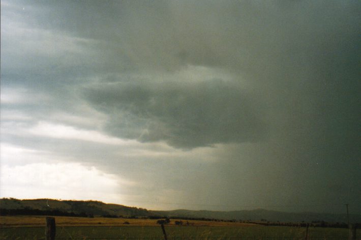
 Looking WSW at the development of a shelf cloud along the leading inflow-outflow boundary. These pictures were taken in succession over a five minute period. In addition to the formation of the shelf cloud, inflow scud (8) were seen to coalesce (9) and gradually develop into a probable wall cloud (12). Precipitation fell between the shelf cloud and the wall cloud feature and within a few minutes completely obscured the latter. The scud which developed below the lowering (12) had some upward motion and Cgs were quite active in this area.
 Rapid development of a shelf cloud to our immediate south. In a little more than a minute the fractus (13) had merged into a shelf cloud (14).
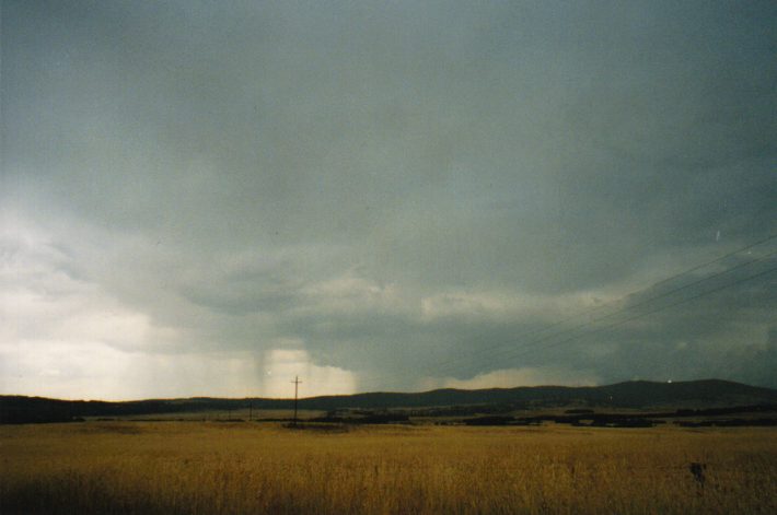
 The main updraft region of the approaching storm. At this stage the storm looked to be quite intense. The core region probably coincided with the area to the right of the picture. Cgs were within a few kms here - some very loud, sharp claps of thunder - and this, along with the ominous look to the precipitation curtain, forced us to move on.
 As we approached the outer SW suburbs of Sydney (30 minutes later) the storm had that 'gusted out' appearance.
|
Document: 9901-01.html
Updated: 13th January, 2003 |
[Australian Severe Weather index] [Copyright Notice] [Email Contacts] [Search This Site] |