and Chasing
[Index][Archives]
Chase in Tornado Alley 2001 - Special Report: Episode 1 - Now includes video
report compiled by Jimmy Deguara
| Storm News and Chasing [Index][Archives] |
Chase in Tornado Alley 2001 - Special Report: Episode 1 - Now includes video report compiled by Jimmy Deguara |
Both David Croan and myself had tried to organise last year (2000) a storm chasing holiday in the United States and the same this year. After balancing my work commitments this year, David and I were finally going to chase in the United States. Now this was a chase of significance: it was the first time that Australians would have set out to chase by themselves unaided. It would provide an opportunity to compare what is observed in the United States and Australia. Thence, there were expectations so that others who chased in the future can get some idea what one could expect. Unexpectantly, the trip was being monitored by other Australian chasers!
We arrived in the United States on 13th May 2001 and stayed with our hosts - Ted and Kim Best and family. This was such a great experience in providing an overall balance between storm chasing and also learning about the American culture.
What were we expecting? Obviously, any chaser that chases in the United States is there for a reason: to provide the best chance of seeing tornadoes. But David and I were absolutely serious in not expecting such. In fact we made the point that seeing good structure in thunderstorms as observed on documentaries such as the LP (Low Precipitation) supercell, would be an excellent experience. If we got a tornado, then that would certainly be well beyond expectations. Now please note that even having observed funnels and probable tornadoes in Australia, and some excellent thunderstorm structures, but we felt we were the underdogs in trying to get used to various conditions that are often dynamic and the reverse (mirrored to what we get here)!!! We did not know the road network and had to drive on the wrong side of the road� I had only studied 3 days of weather conditions before I gave up as it was like guessing - not knowing what was really happening. So it was more of let us see what we can get in the four weeks that we are in the United States.
The members that took part in the chase were;
This report will be divided up into the main excursions out into the field during storm events. Otherwise, we were at home in Plano. The Excursions in summary were:
I hope to take you on the journey as David Croan and I saw it - the changes in emotions throughout the chase. I certainly hope you enjoy it as much as we did. Please note that this report is meant to be somewhat detailed and perhaps should be read section by section. Since not as many photographs were taken, some video stills will be added later so report back if you would like to see them. I can assure you the video stills in most cases will reveal more impressive features than most of the photographs. For those who prefer articles in brief, go to David Croan's site.
Prelude
We arrived 13th May 2001 more or less exhausted by the long journey. ASWA member, Max King had warned me about the long flight and boy was he right. We had barely enough time to make the domestic flight to Dallas. I was puffed. When we arrived, David, and unshaven Jimmy, were greeted by our hosts Ted, Kim and daughter Ana. We really appreciated their welcome. Sometimes I wonder whether meeting them had them worried as I looked like an escapee from a correctional centre. I am certain they were much more comfortable with us by the end of our stay though.
The first few days were spent getting ourselves ready for the chase: equipping ourselves with a rental car. Because of misunderstanding about the insurance and the fact there was a bloody ridge over us, we waited until Thursday 17th May before renting a car.
Well, did you want to know what practice I had for driving?? David (who had driven in the US before) drove the car home and that same afternoon, after looking at models at the local library, we made the decision to go on our first chase. I made my first attempt at driving in the United States on our first storm chase. Seemed strange and I warned David to scream or bash me if he was to see approaching headlights!!! Besides a few small possible blunders, I drove ok from here on end. Perhaps confusing the wiper switch with the indicator switch got some more laughs. Thank God it wasn't manual, or I would have ripped the bloody door handle off.
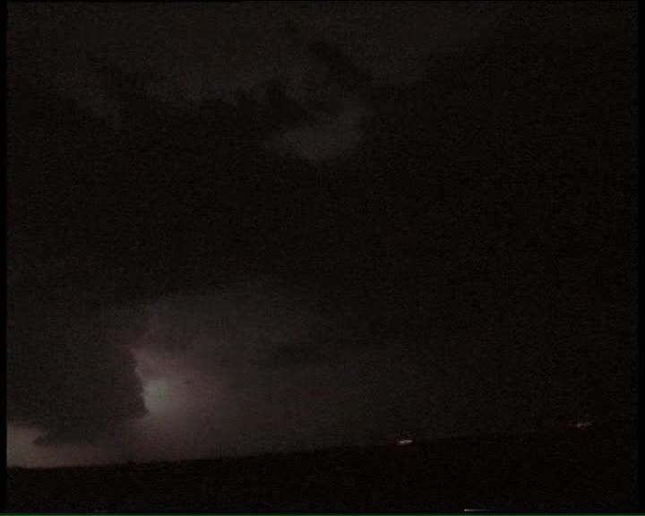
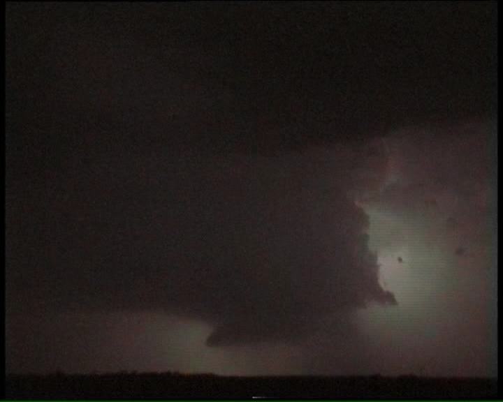
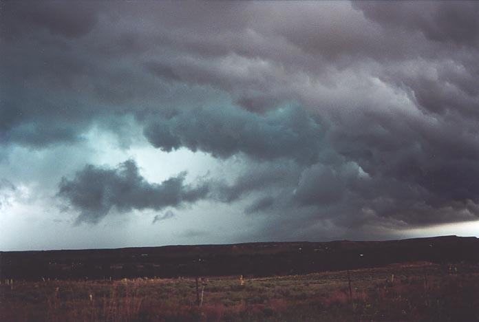
Click to view the video of this storm with overshoot to the north. [2.04mb WMV] This storm basically backbuilt and surprised us.
We were observing
lightning as we had noted before but I noticed a bright flash. Where though? Hell
another one - reflecting on the rear vision mirror. "David, the storm is behind
us!!" Dave looks back and a flash again occurs revealing some good structure.
Change of plan - we decided to park on a roadside to see what happens with this
storm. What unfolded was an incredible lightning display. This storm was very
electrically active and seemed to surprise me how quickly it had become so. I
then realised this storm was either the one we had observed to the north and had
back-built or had developed from an outflow boundary. Based on the wind flow dynamics,
back-building was not out of the question and this continued during the night.
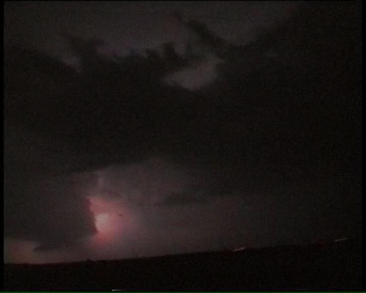
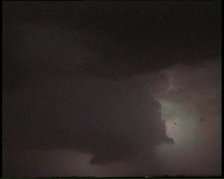
Although no photographs
were taken during the night, we took extensive video of the lightning and some
interesting structure including a probable wall cloud lowering illuminated by
lightning several times.
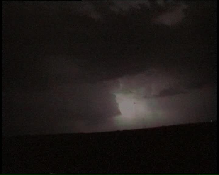
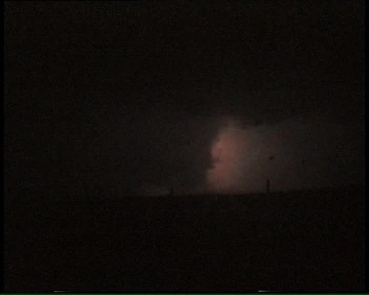
Eventually, we
headed back to the hotel noting that lightning from the west was nearing. Upon
looking at radar on the Weather Channel, a squall line was heading south east
from near Amarillo. There was also a tornado warning over the border in New Mexico.
Wow!!!!!!! Tornado warning�. First on this trip and a wake up call to the reality
that storms here meant business. We watched as the storms neared both on radar
and visually. It turned out to be a particularly strong squall line but what really
surprised me was the persistence of the winds after the main gust front had gone
through - unlike typical squall lines in Sydney. Some close bolts of lightning
and thunder were observed. A satisfying beginning to the chase.
We awoke to find
a mist had set in - well we were in low cloud. I suppose we were in the high plains.
David and I went to the local library to check the models. We were disgusted with
what we saw. I felt the only chance we had was to remain ahead of the approaching
and developing mid-level cloud.
After checking
the satellite pictures, both David and I noted that one of the storms was particularly
close to our location!! We check the radar and wow!!! There seemed to be a hook
echo - at about 10am?? No tornado warnings but we weren't going to wait around
to find out. It was a case of back to hotel, pack and off in record time.
We were still in
low cloud (mist) and we could pick up static on the AM radio. We headed northeast
and sometime before the town of Miami, the mist gave way to dark bases to the
north. At this point, I felt relieved as one would not want to chase a region
indicating a hook on radar in mist. However, we advanced carefully, both of us
checking the cloud behaviour. Then, as we were talking and with the radio on,
we both heard what seemed to be a siren sound. And to our astonishment, it was
the town sirens warning of the impending storm. I hate extending
reports especially when they are long enough, but this experience deserves a mention.
Since it was a Saturday, one should be able to find a library open. To save time,
we stopped and asked the local Sheriff where the library was and whether it was
open. He looked at us and said "Come on� in a town like this�on a Saturday?" We
then asked where else could we find the internet - I had to say something. "Oh
!!! You wanted the internet. Come on in - use ours." So I got to work and loaded
the usual 500 hundred frames of weather links whilst David had a cuppa coffee
provided by the Sheriff. Thanks for the job allocation, Dave. "Shit!!! Hurry up
computer�" I kept my hands to myself (felt like thumping it). I think the computer
is still recovering with the internet link being so slow. So I decided to get
the essential information, which wasn't much, and went outside. The Sheriff talked
about his trips around the world including Australia and we enjoyed a fairly -
let's say interesting conversation whilst a storm cg'd a few bolts over Wheeler.
Finally we left.
We heard the second
siren at the next town of Sayre. We made a pit stop and found even the locals
were getting excited about the sirens. Further south and we met up with a car
with emergency lights on the vehicle. I was cautious as you would expect drivers
were not allowed to pass police in these situations. Damn!!! But this one was
taking photos and seemed to be chasing?? Finally I relaxed when David finds out
it was a chaser after having a conversation with him. He had come out of the supercell
complex and noted 3 funnels. The storm complex was certainly indicating a HP (high
precipitation) variety. It certainly showed rotation and some strong inflow winds.
This storm complex seemed to be becoming outflow dominated and widespread more
of a squall line gust front oriented structure.
The day basically
ended up being what I had thought it would be; a continuous outflow domination
as each storm developed further south. Some of this outflow would aid in the rotation
but only briefly. So this meant only brief tornadic activity would occur with
such interactions between the inflow and outflow winds. Giant hail was reported
further south in northern Texas late afternoon. It was a Sunday
- expecting a moderate risk day and you know libraries don't open until 1pm. Storms
from overnight had given way to stratocumulus from the south. We followed a rough
target generally heading towards the east. We arrived in Norman and had to wait
until 1pm for the library to open.
The more we looked
at the models, the more excited we got. I printed the AVN (Aviation) weather models
and David the SPC (Storm Prediction Center) outlook information. We both agreed
the target area was southeast Oklahoma but the important information was the location
of the outflow boundary and regions of convergence. The SPC indicated storms would
develop during the early afternoon and quickly develop into supercells. My interest
was that we had to pick the correct storm when storms did develop based on the
low level inflow, the orientation of the storms and the position of the storms
in relation to others. The models were indicating a more southeast flow in eastern
and south eastern Oklahoma. Tornadoes were possible. Finally we had an opportunity
to see what it was like if tornadoes did occur.
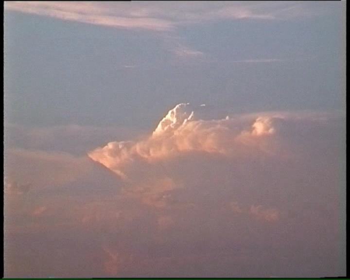
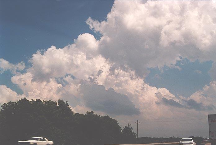
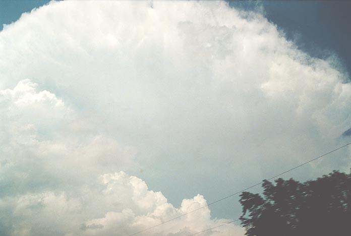
The storms were
developing so rapidly you could already see structure in the leaning towers. The
boiling updraughts were crisp and almost did not have time to glaciate. Here is some video of what we observed:
Now David was driving
and I was navigator. I basically stuffed up since the map lied. We were almost
up to the storm which was at this stage heading east-northeast. We could make
out some nice base structure but you guessed it, trees got in the way. We were
coming onto some other chasers and two news helicopters were out in force already.
We headed south back to the town of Konawa. Decision time. No other cells except
weak cells further southwest. Should we head south and then east or try catch-up
to the main cell. This decision proved to be vital. There was a river system and
Lake Eufala in our way limiting our road options. We decided to head after the
storm which still was active. Since it was hidden from view, it did not look that
impressive. One must have to be careful when making such judgements in decision
making as it could make or break a chase.
Once headed along
the correct road we should have taken, we could see the flanking line towering.
Although the storm was moving fast, this meant that back-building would help delay
the important rear section of the storm making it possible to catch.
I also noted that
the weaker towers were starting to catch up and merge with the system. Time was
running out as we needed a way to get south east to locate onto the southern side.
As we approached it was obvious we would never be able to get into position. We
had one choice and that was to get into the rainshaft - bears cage chasing. Or
we could remain behind but that meant you had no chance from what I could see
in the continuous towers to the southwest.
As we drove into
the rainshaft, David began to pick reports of a tornado further to our east. The
radio had begun a continuous coverage of the outbreak situation. We soon began
to pick up damage due to hailstones and copped a few 2-3cm hail ourselves. And
then without warnings, tree damage and low and behold leaning power poles. There
was absolutely no doubt in our minds this was tornado damage especially when we
saw the next pole leaning in the opposite direction. It seemed F1 (lower F2) damage.
It was here that
we faced reality of what we were chasing. Each radio report would alert to more
and more mesocyclones, rotation, funnels and more tornadoes. It was simply unbelievable.
We were mesmorised. David did well to keep up with warnings on counties. We got
so carried away that I did not realise a convoy was following me. My mind told
me that I was not travelling fast and there were opportunities to overtake. But
nobody did. Finally it clicked - it was basically a chaser traffic jam!
We allowed a few
vehicles to take over including one of the chaser tour groups. From here on, it
became difficult to know what was going on and we had to monitor the wind flow
within the precipitation region. At one stage, the winds and rain from the west
were going faster than the vehicle. Rear flank downdraught!! We knew that there
must be another mesocyclone somewhere ahead. But where. Finally, near Lake Eufala,
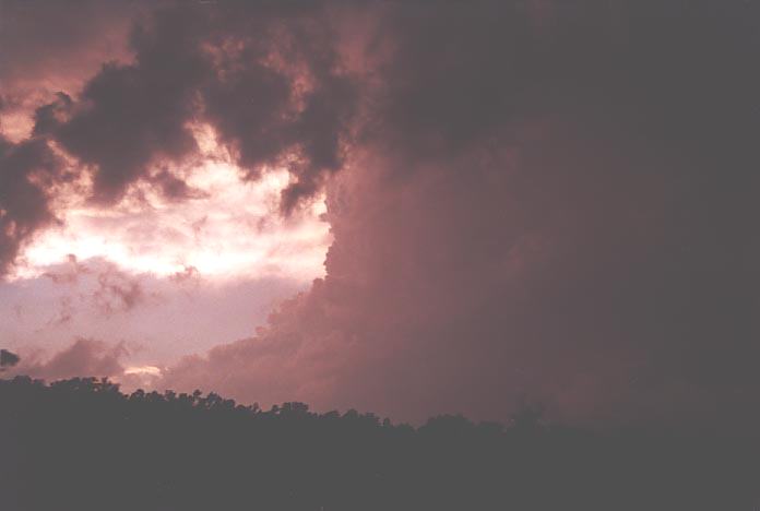
we could see organisation in the base and David could note rotation. After stopping
for a few minutes, we headed further east. Over a hill and David shouts "Hey look
at the funnel". "Yes there's a funnel", I shouted. The dynamics of the formation
of this funnel astounded us. This certainly touched down shortly afterwards, but due to the trees,
we lost sight of it only to get 5 - 10 seconds of footage of the tornado. We had
to wait until other chasers and spotters confirmed it as a tornado.
Click here to view
After chasing south
we felt the storm has basically become rain dominant and so we headed back to
the east west road. Chasers began to pile at the local service station discussing
what they had observed. It was evening and we heard reports of a storm with major
rotation well to the southwest. So we eventually made our way west and onto the
interstate heading south towards McAllister.
Here is some video of driving through large hail:
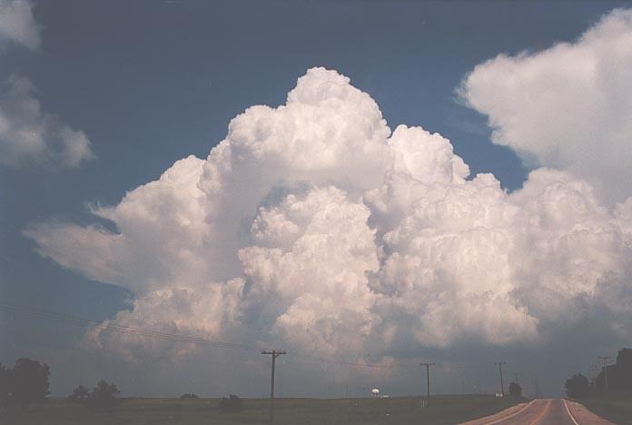
David was determined
to get the supercell we nicknamed the McAllister supercell. It was continuously
showing rotation and even produced a tornado. It was simply a textbook classic
supercell monster with flanking line merging into the powerful, crisp, corkscrew updraught.
An awesome sight.
Video of the McAllister Supercell
Unfortunately, we had to call it a day and headed back to Plano,
Texas. We certainly had enough to talk about. Outside Episode
1, we also had a chase down into southern Texas.
We can safely call
it a bust. Perhaps too much of a shallow moisture layer. The storms took off half
an hour after we left. We also noted a set of storms to the far southwest horizon
at sunset as we neared Dallas. This turned out to be a HP (high precipitation)
supercell and was our favoured target area but we simply thought the risk far
outweighed the distance. Oh well.
Chase
in Tornado Alley 2001 - Special Report: Episode 2
Chase
in Tornado Alley 2001 - Special Report: Episode 3
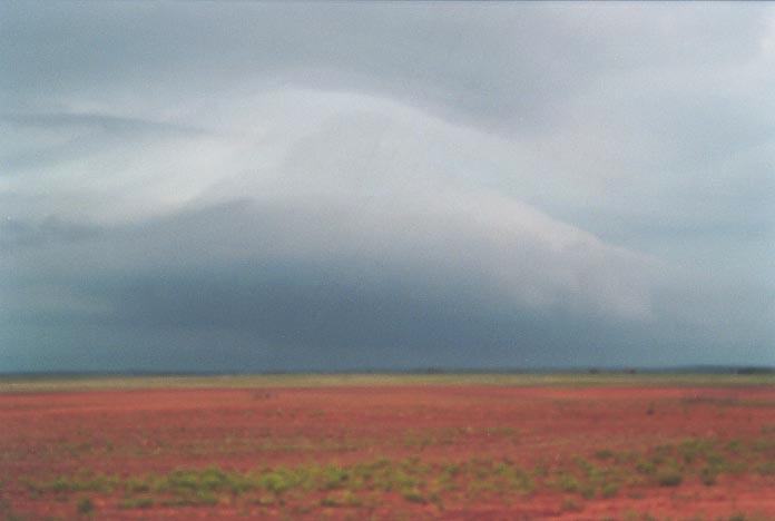
 We basically made our way through the northern outskirts of Dallas towards highway route 283 and onto childress. Through some castellanus, we noted that a storm had developed to the north. At first it did not look as impressive but it seemed to have a reasonable structure. It seemed to be getting closer to us - development occurring along the flanking line. We also noted that there were storms developing to the far northwest and also to the southwest. We booked a hotel at Childress and then opted to head west.


Friday 18 May
2001
 To
cut a long story short, we were expecting action but could not get to it before
it dissipated. Apparently there was an impressive LP (low precipitation) supercell
on the border of Texas and New Mexico well to the north. During the evening, when
we thought it was all over, another supercell approached the border again. We
spent the night in Pampa which was hit by an F4 tornado about 5 years earlier.
To
cut a long story short, we were expecting action but could not get to it before
it dissipated. Apparently there was an impressive LP (low precipitation) supercell
on the border of Texas and New Mexico well to the north. During the evening, when
we thought it was all over, another supercell approached the border again. We
spent the night in Pampa which was hit by an F4 tornado about 5 years earlier.
Saturday 19
May 2001 - Bell shaped supercell and tornado warnings and reports western Oklahoma
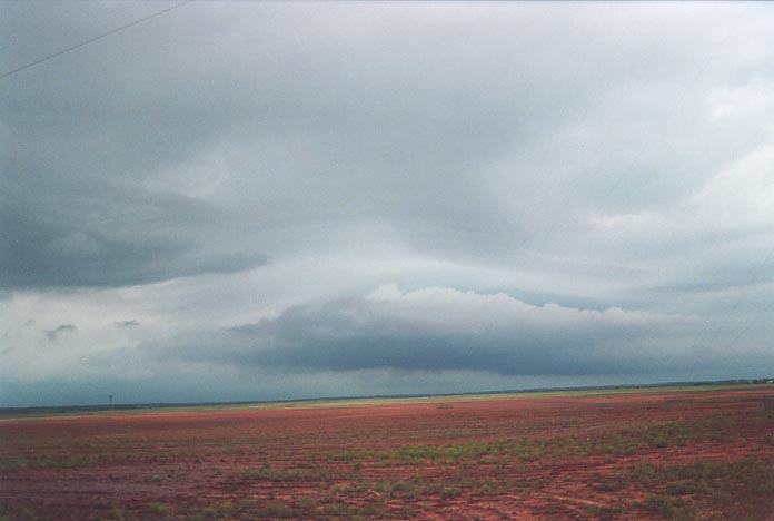
 We
had a region of circular cloud base with a cavity structure like a vault region.
We were pretty sure that the section to our north was rotating. We were both pumped
but still cautious. We headed further east and quickly out of the path of the
storm. We came across Skywarn Spotters who suggested that the tornado warning
for this storm had been allowed to expire. Next stop - Wheeler!!
We
had a region of circular cloud base with a cavity structure like a vault region.
We were pretty sure that the section to our north was rotating. We were both pumped
but still cautious. We headed further east and quickly out of the path of the
storm. We came across Skywarn Spotters who suggested that the tornado warning
for this storm had been allowed to expire. Next stop - Wheeler!!
 We
headed towards and crossed the border into Oklahoma just to the east (my first
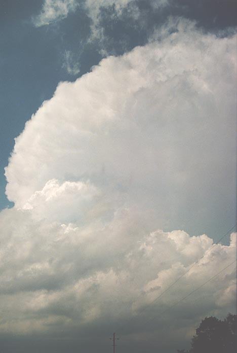
time in Oklahoma). David began to comment on the organisation occurring to the
north. We watched in amazement as an inflow band developed and then a perfect
bell shaped structure!!! I had not seen such a well-developed structure before.
And the lightning bolts were quite frequent particularly near the structure. We
filmed for a while and then took note that the storm was sending outflow out the
back into another low contrast region. We had two choices: get this right mover
or the one with the bell shaped structure to the north. We left that decision
until we arrived at the north-south route. We decided to head south. Finally,
out of the rain and we were able to see some interesting storm structure including
the side anvil and glimpses of storms developing ahead of this system. We also
learned both storms had tornado warnings on them.
We
headed towards and crossed the border into Oklahoma just to the east (my first
time in Oklahoma). David began to comment on the organisation occurring to the
north. We watched in amazement as an inflow band developed and then a perfect
bell shaped structure!!! I had not seen such a well-developed structure before.
And the lightning bolts were quite frequent particularly near the structure. We
filmed for a while and then took note that the storm was sending outflow out the
back into another low contrast region. We had two choices: get this right mover
or the one with the bell shaped structure to the north. We left that decision
until we arrived at the north-south route. We decided to head south. Finally,
out of the rain and we were able to see some interesting storm structure including
the side anvil and glimpses of storms developing ahead of this system. We also
learned both storms had tornado warnings on them.
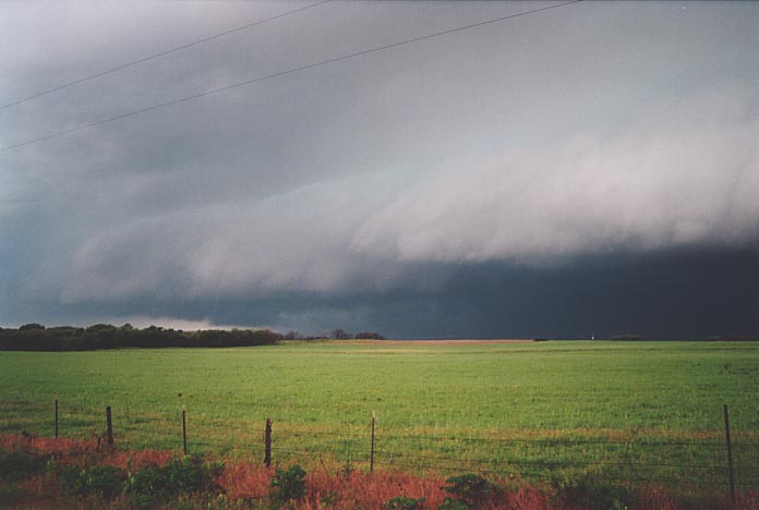
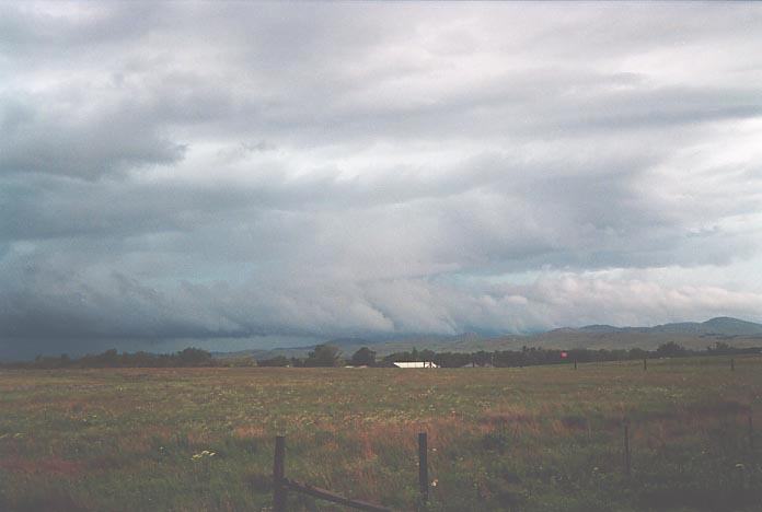 A few tornadoes were also reported including one at Elk City - related to the
storm we had followed. We stayed the night at Lawton. We had passed through some
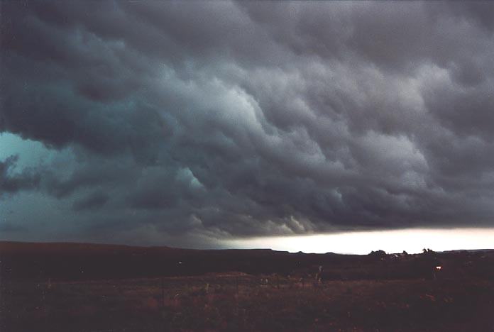
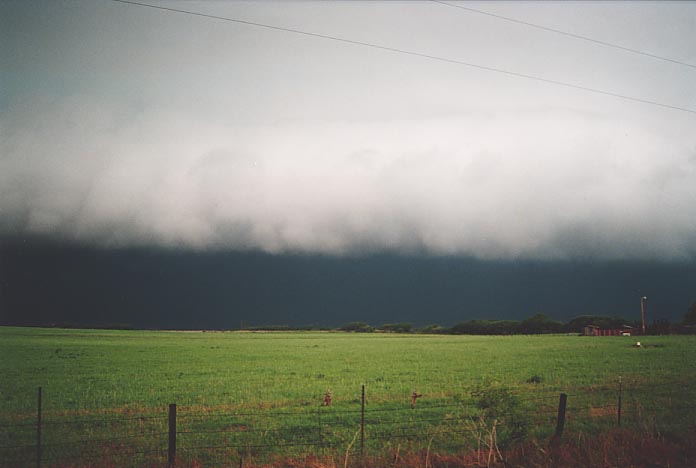
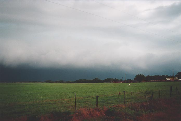
heavy rain to get there though and came out to view a spectacular shelf cloud.
There were storms overnight and flash flood warnings over a wide area. Ummm -
the experience at Altus was interesting. A close cg made a person almost shit
himself as he fuelled his car. Well we were concerned for his well-being but you
could not help laughing at his reaction.
A few tornadoes were also reported including one at Elk City - related to the
storm we had followed. We stayed the night at Lawton. We had passed through some
heavy rain to get there though and came out to view a spectacular shelf cloud.
There were storms overnight and flash flood warnings over a wide area. Ummm -
the experience at Altus was interesting. A close cg made a person almost shit
himself as he fuelled his car. Well we were concerned for his well-being but you
could not help laughing at his reaction.
Sunday 20 May
2001 - south east Oklahoma tornado outbreak Dustin, Eufala and impressive McAllister classic supercell great structure
 Well,
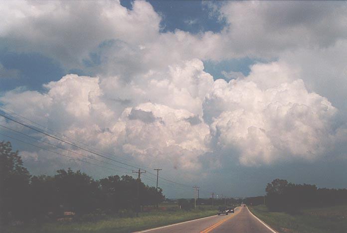
when we got outside, we were absolutely astonished. The cloud had basically cleared
and cumulonimbus already were developing to the south and southeast with large
cumulus oriented in a line northeast to southwest. We ran to the car park - got
our bearings and took off south from Norman and on to Lexington.
Well,
when we got outside, we were absolutely astonished. The cloud had basically cleared
and cumulonimbus already were developing to the south and southeast with large
cumulus oriented in a line northeast to southwest. We ran to the car park - got
our bearings and took off south from Norman and on to Lexington.
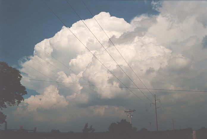 I
took photographs and video when opportunities arose. One of the towers remained
strong and dominated as other cells merged into this developing supercell. At
Lexington, we turned east and fuelled. Basically, we were in catch-up mode to
intercept this cell. The towers showed a cork-screw structure verifying the favourable
wind shear. Finally, the back-sheared anvil came into view.
I
took photographs and video when opportunities arose. One of the towers remained
strong and dominated as other cells merged into this developing supercell. At
Lexington, we turned east and fuelled. Basically, we were in catch-up mode to
intercept this cell. The towers showed a cork-screw structure verifying the favourable
wind shear. Finally, the back-sheared anvil came into view.
 It was here that I noted what this event had done to David. First, I noted an
LP supercell on the edge of the cloud shield. Knowing we were running out of time
I thought, "David, you wanna stop and view this LP". I was astonished to find
he had changed his mind about the order of importance in what to chase. Further
down the road some 20 minutes or so later I noted we would be crossing path with
a storm consisting of large hail. Well David punched straight through.
It was here that I noted what this event had done to David. First, I noted an
LP supercell on the edge of the cloud shield. Knowing we were running out of time
I thought, "David, you wanna stop and view this LP". I was astonished to find
he had changed his mind about the order of importance in what to chase. Further
down the road some 20 minutes or so later I noted we would be crossing path with
a storm consisting of large hail. Well David punched straight through. Thursday 24th
May 2001
Document: 200105-03.html
Updated: 17th May, 2002
[Australian Severe Weather index]
[Copyright Notice]
[Email Contacts]
[Search This Site]