and Chasing
[Index][Archives]
Prospect Hail Storm: Thursday 11th April 1996
by Jimmy Deguara
| Storm News and Chasing [Index][Archives] |
Prospect Hail Storm: Thursday 11th April 1996 by Jimmy Deguara |
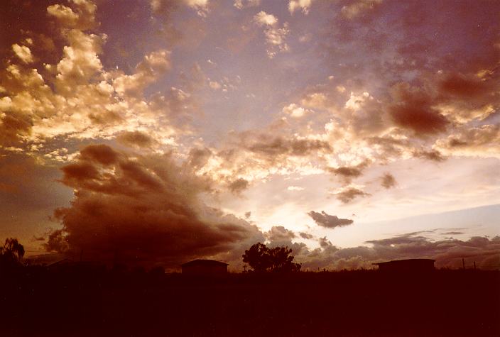
During the day, cumulus developed and began to dominate with altocumulus clearing off the coast. Around midday to early afternoon, isolated large cumulus produced a heavy shower near Richmond with heavy showers also developing to the southeast towards the coastal suburbs of Sydney. However, these definitely were far too early and gradually dissipated. My face turned to one of disappointment as I thought the signs of activity indicated during the morning were false. But the dissipation of these showers seemed to feed undercutting downdraughts and moisture to growing cumulus cells near Schofields. A thundery shower had developed to the far N and another large cell was producing precipitation near the Central Coast. As it moved slowly south, this storm increasingly displayed a base structure indicative of hail (including what appeared to be a light green tinge). It was at this time that the large cumulus to the E of Schofields began to grow rapidly with large high tops.
Precipitation began to fall (with the precipitation cascade indicative of large drops) and lightning was observed by 2:45pm around Baulkham Hills to Cherrybrook. Heavy falls of rain and then hail began to fall in localised cells. Multicellular development occurred on the front flank spreading south. In fact, it seemed that the only form of movement was the development of these new cells. I took some photos at this time.
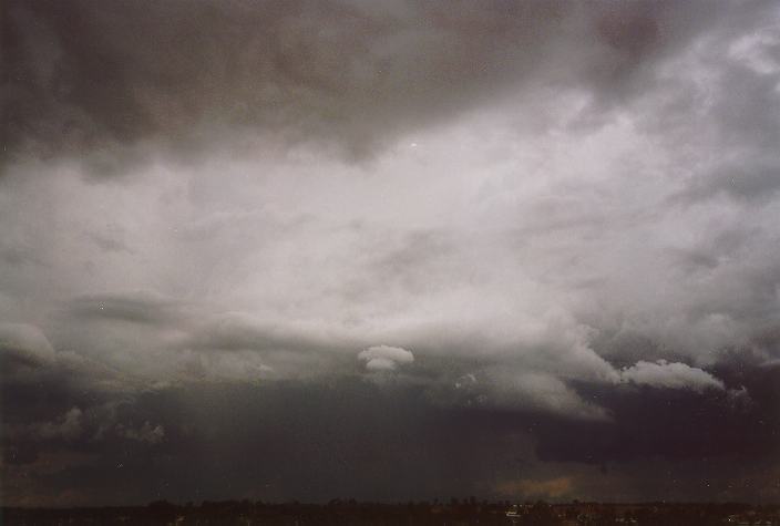
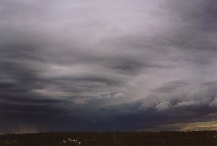
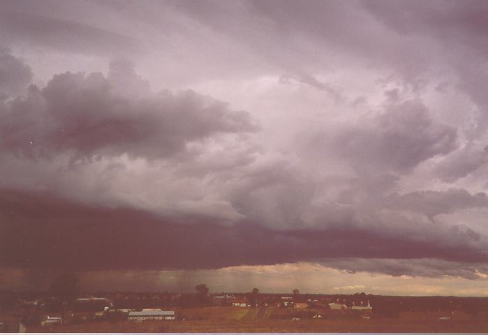
Photographs during the afternoon of the 11th April by Jimmy Deguara.
My guess for a possible haildrift was based on the slow movement of the storm. This was confirmed by a phone call from Don White about damage in Prospect as well as watching the evening news. I phoned contacts in Prospect who alerted me they had just experienced hail that covered the lawn and also received about 30 minutes of heavy rain. Thinking that the storms would dissipate and knowing they were not severe, I decided not to give chase. These storms certainly would have been easy to chase since I was situated only 10 minutes away.
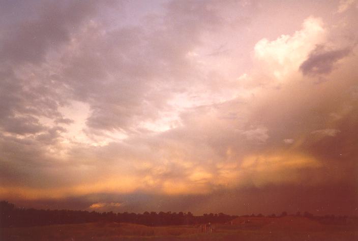
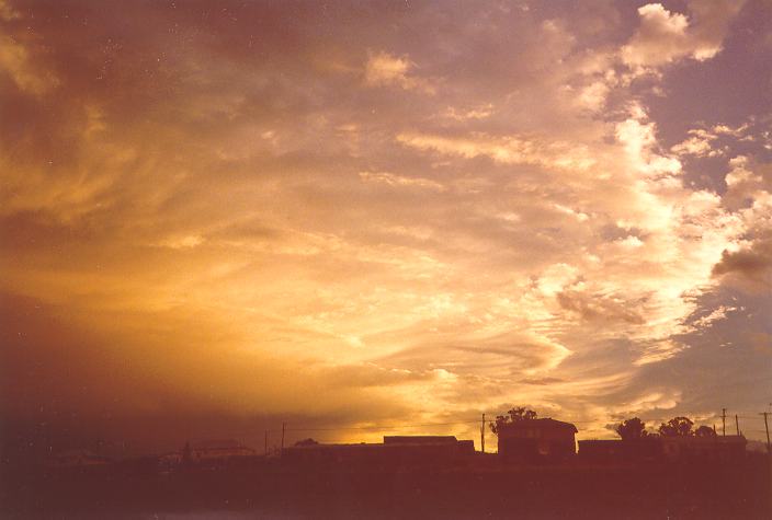
As the cells were developing and extending south a noticeable anvil began to spread south to southwest blending with the anvil of the Central Coast hailstorm (which produced hail at Mt White). During the evening, the anvil displayed spectacular features with the reflections of the setting sun. An invitation for further photographs.
It was the news on television that revealed the true extent of the storms. Haildrifts of up to 30cm in depth were reported in parts of Prospect. There were many accidents reported from drivers not used to the icy conditions. There were also reports of flash flooding. Schofields, Oakhurst and others nearby suburbs were left rain-less from this system. The most interesting feature of this storm was the north-south propagation rather than movement. It developed further to form part of the cloud mass of an east coast low. Further early morning development (on the 12th of April) (with thunderstorm activity) produced heavy falls mostly in the west and south-western suburbs.
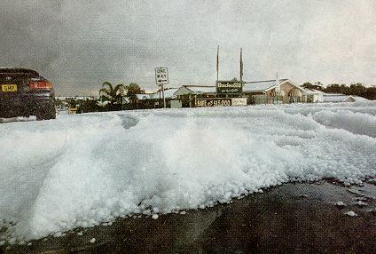
Photographs by Adam Olive of the Blacktown City Guardian
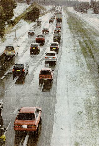
Left: Homeworld II was turned into a Winter wonderland. Right: Traffic slowed to a crawl on the Great Western Highway.
Metropolitan Rainfall for the 24 hours to 9 am on the 12th April.
| 12th | Suburb |
|---|---|
| 20 mm | Penrith AWS |
| 21 mm | Epping |
| 24 mm | Canterbury AWS |
| 25 mm | Oakhurst |
| 25 mm | Richmond Airport |
| 26 mm | Concord |
| 27 mm | Badgerys Creek AWS |
| 28 mm | Liverpool |
| 28 mm | Lucas Heights |
| 28 mm | Seven Hills |
| 30 mm | Oatley |
| 31 mm | Bankstown |
| 33 mm | Castle Hill |
| 34 mm | Homebush |
| 48 mm | Parramatta |
| 57 mm | Merrylands |
| 92 mm | Fivedock |
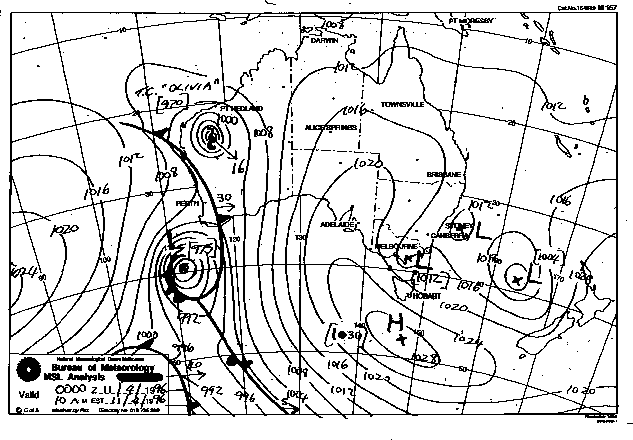
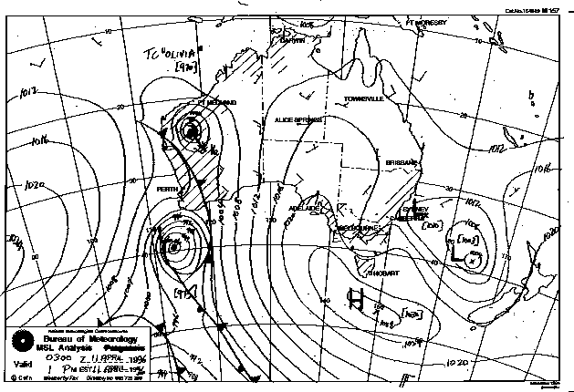
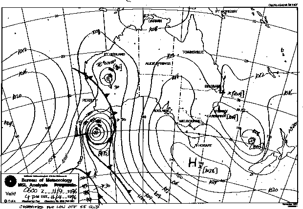
Synoptic Charts provided by the Bureau of Meteorology
|
Document: 9604-01.htm
Updated: 6th April, 2004 |
[Australian Severe Weather index] [Copyright Notice] [Email Contacts] [Search This Site] |