and Chasing
[Index][Archives]
Storm Chase 24th - 25th January 2001 - including Bowral to Lithgow Severe Storm Complex
storm chase report by Jimmy Deguara
| Storm News and Chasing [Index][Archives] |
Storm Chase 24th - 25th January 2001 - including Bowral to Lithgow Severe Storm Complex storm chase report by Jimmy Deguara |
I chose the area around the Oberon area hoping for activity to develop in that area but also as an experiment. I was aware of the strong cap that existed at around 500hPa, and in the case yesterday further down.
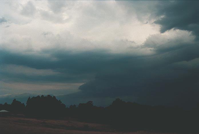
24th January 2001 provided us with some great structure pulse storms although more cells developed to the W and SW. I took fancy of a storm just east of our area in the unihabited areas. There is one dirt road that goes through the Wombeyan Caves area and this would have gone through the storm. But I didn't judge it as well worth the travels. Again I thought we would bust, but the predicted convergence right along the ranges by the models did help break the cap for some impressive structured cells but nothing severe. We had tiny hail, probably because of the elevation we were at ~1200m. It was incredible to note that the cumulus began to develop and then broke the cap just before 5pm near Oberon and then cells took off along the same convergence line and then other areas. I found that experience worth while. So this meant we needed two triggers: convergence and the elevation of the Oberon area to break the cap and so late!!!
Storms moved from the N as expected based on the model steering winds.
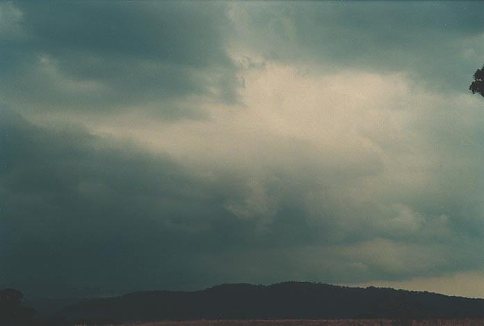
25th January 2001 I knew this day had less available moisture but didn't really seem too much different from the previous day but I suppose just that little difference meant the cap was not going to break. Well there was a trough line coming up the coast and this meant that it would break the cap if it came on time and it seemed it would arrive around 5pm or thereabouts...based on the models
I tell you what though, this day proved to be a patience tester and I know that some would have gone home on this day well before any activity would have taken off!!! The cap observed by the cumulus was strong in a few layers though so it meant that cumulus were trying to take off but wouldn't. It was not surprising that the storm took off along the trough line which acted as the trigger. However, I was wondering why the storm was drifting away to the E!!! There was supposed to be more developing along the line once some moisture would be pumped inland due to the enhancement of the SE wind change. This did happen as mentioned earlier once the trough neared.
What I did get wrong was the steering winds and I was wondering what the hell as was going on. I forgot or mistook the winds at 500hPa as being SW rather than NW. This was why the storms were moving E rather than NE or even NNE which is what I anticipated. I was expected multicell activity to cause drifting mostly along the ranges. But the flanking line observation/prediction and movement saved us as well as the 500hPa winds being rather light.
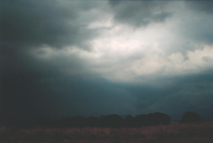
There was supposed to be (yet again) a convergence zone along the ranges which would team up with the trough too produce some severe weather around the ranges near Lithgow 150E degree longitude line. We remained around Oberon because of the steering winds error and also it is a good lookout (one for the ASWA lookout database - 360 degrees view near the mobile tower). But I knew that we would eventually make it to Lithgow. Once I noticed the error we were on the way to Lithgow anyway based on what was happening.
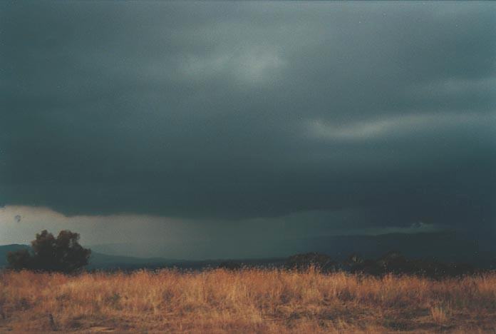
We did eventually run into some very strong winds and very heavy rainfall and patches of hail up to 2cm. There was some incredible lightning bolts (and deafening thunder) as well as a spectacular roll cloud attached to the gust front.
 What
topped off this chase was that earlier, we saw two dust devils at the Oberon Lookout
within one minute. No camera or video available but one went straight over us
and we experienced winds from all directions. Then it went towards the car and
dragged the dust and slammed all four doors which we left open.
What
topped off this chase was that earlier, we saw two dust devils at the Oberon Lookout
within one minute. No camera or video available but one went straight over us
and we experienced winds from all directions. Then it went towards the car and
dragged the dust and slammed all four doors which we left open.
I really enjoyed this chase and the motto is - don't give up on your plan. And yes I thought I was going to bust on this one. 5:00pm and nothing happening. We knew there was something along the flanking line and I knew it was supposed to develop along the flanking line but I was still sitting on the edge of my seat. It dissipated beyond Lithgow....
|
Document: 200101-05.html
Updated: 26th October, 2001 |
[Australian Severe Weather index] [Copyright Notice] [Email Contacts] [Search This Site] |