and Chasing
[Index][Archives]
Casino HP Supercell Disaster: Wednesday 17th January 2001
storm chase report by Dave Ellem
| Storm News and Chasing [Index][Archives] |
Casino HP Supercell Disaster: Wednesday 17th January 2001 storm chase report by Dave Ellem |
I think I made one of my best decisions this day. Thunderstorms had been on the cards a few days ahead and I was faced with a dilemma. Because I had done nothing all holidays Mum and Dad decided we'd go up the coast for the day. Fortunately in one sense, 2 days before the event, the forecast had dropped the chance of thunderstorms. So the problem was solved. Until on the night of the 16th. Thunderstorms reappeared in the forecast again. Arrgghh!! What to do. The next morning I got up early and had decided that I would go up the coast. But I just had to check the setup once more. Michael Bath was online and I told him what my dilemma was along with asking him what he thought was going to happen. Out of 10 he gave me a score of 9 for the setup. What to do!!!! After a little more convincing from Michael, I decided I would stay home. Mum and Dad weren't terribly impressed since they were going up for me and told me I'd see plenty of other storms in the holidays. But I watched them drive out feeling a little upset that I'd missed the trip. Those storms had better be good!!!
The sky was quite overcast. I was assured this would soon clear. And eventually it did. At about 11am I started chatting to Michael again and was told the LFTX was -9 in areas!!! He said the last time he had seen that was the day of the Evans Head Supercell in 1998 (a storm well remembered around this area). So I was feeling a little better. Anyway, we waited, and waited, and still nothing on radar. By this stage I was getting worried, thinking that if the setup was this good, there'd have to be something by now. I went to watch a documentary on supercells in the meantime, thinking that it would sure be nice to see one today. By 1.20pm local time, something began to appear on the Grafton local radar. Almost instantly a Severe thunderstorm Advice was issued by the BoM. As Michael said they'd been watching too.
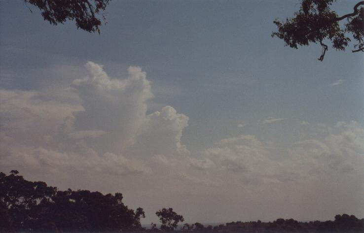
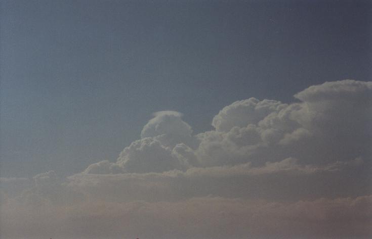
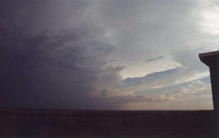
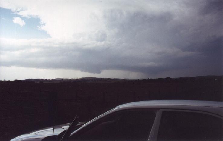
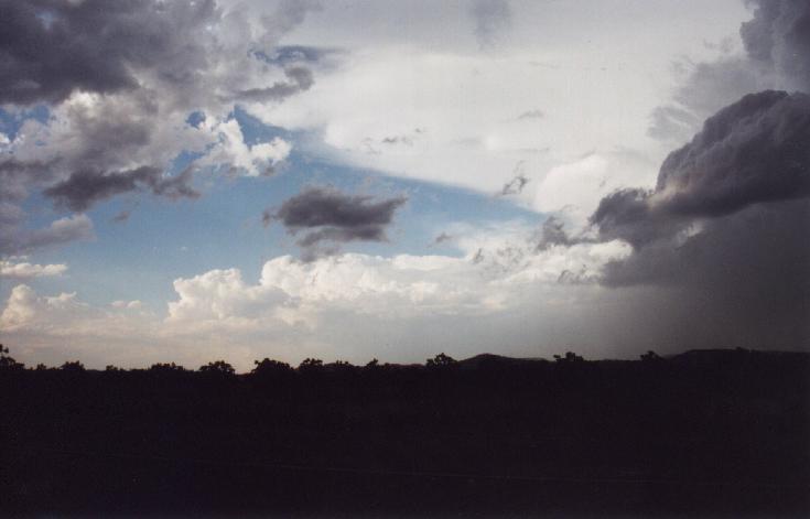
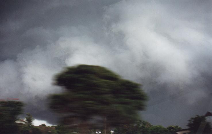
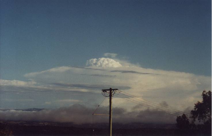
As time went on the cells on radar seemed to be just sitting around and not much else was happening. We didn't head out as these cells were too far away. I was getting REALLY worried at this stage that we'd miss out. This would not have been good. After an anxious 2 hour wait Michael called and decided we'd head out. He came around to pick me up and we headed off to a spot at Tregeagle. There was a nice looking cell to our WNW that was annoying to watch as we thought it would just keep heading up into Queensland (although good news for the QLD guys). Pileous kept forming on each new updraft and looked amazing. To our S was another cell that was still a fair way away but was looking quite strong. New updrafts were appearing in front of it. The sky above us was covered in Altocumulus and Altocumulus Castenellus. This was what we had wanted to see about 7 hours earlier.
A phonecall from Matthew Pearce got us both excited when we heard the cell to the south was quite strong and already showing red on radar. So we headed off to Parrots Nest near Lismore with a brief stop at Wyrallah for photos. I couldn't believe how quickly the sky had turned dark gray! When we arrived at Wyrallah (10mins drive) an anvil was beginning to spread towards us.
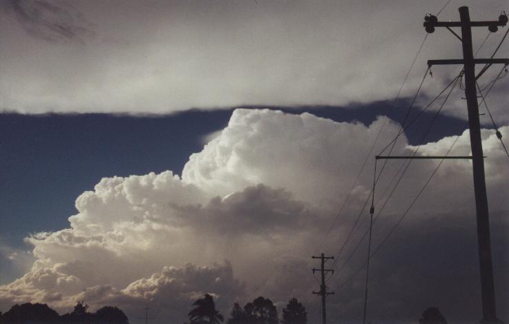
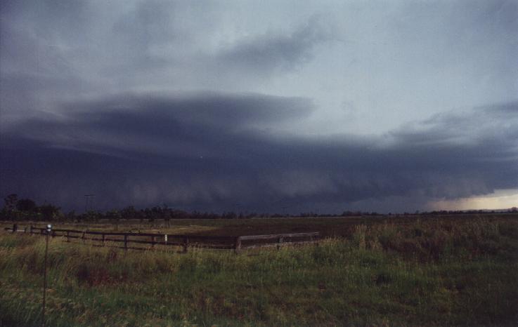
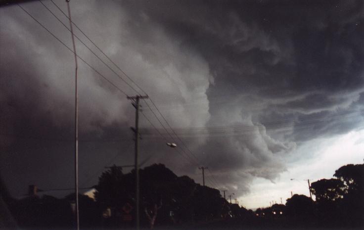
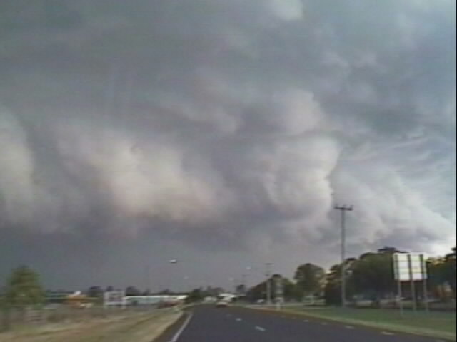
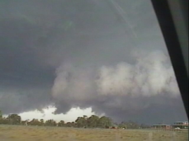
The scene from Parrots nest was amazing. A beautiful thick anvil had spread right over us. This storm was HUGE!! And to our NW, the other storm was gathering strength as well. More pileous formed on top of this one. However we noticed it seemed to be getting closer. This was really weird as all the other storms were heading NNE. We decided to get a little closer to the action and headed down to Michael's favorite spot, Fig Tree Lane as the scene to our NW was amazing!!! The storm had moved ESE and had a wall cloud!!! We sat and watched this thing grow and spread SE. It was just unbelievable. We got a call from Jonty Hall asking what we could see. He informed us that the storm to our NW was a splitting supercell! And also informed us of what was coming up behind us, as we sort of had our backs turned to it as we watched the cell to the NW. I couldn't believe it. This was my third chase ever and I was between two supercells!!!!!!!! After watching the cell to the NW explode toward us with a corkscrew updraft on it's SW flank, we looked behind us and decided it was time to move. The idea was to get to the western side of the cell and film it from there. We were soon to find out we'd left it too late.
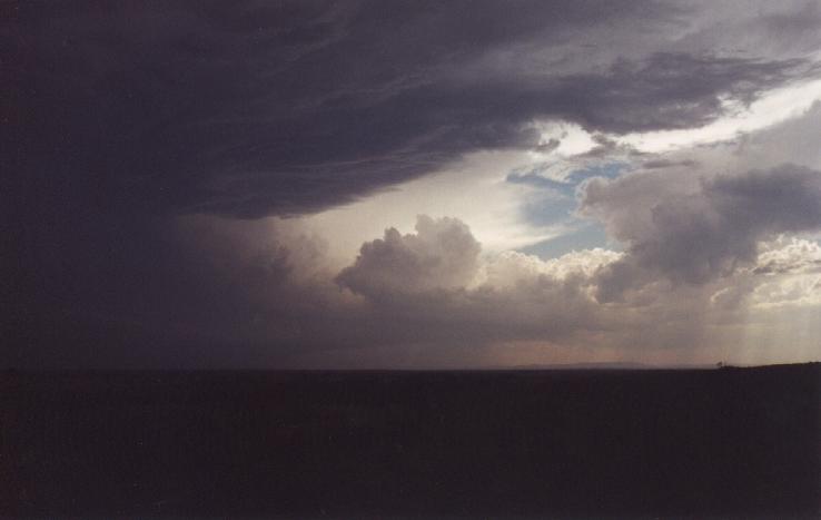


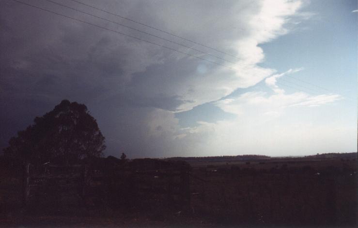
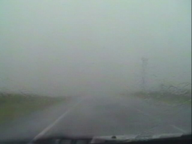
As we were racing through to casino we just had to pull over briefly to capture the guster that was coming up from the S!! It looked as though it was touching the ground in one spot. We both looked at it in amazement but then had to jump in the car and get through to Casino. The view from here on is not fully describable and no photo can do it justice. The guster raced toward us with incredible speed. A beaver tail looking inflow band was connected to the guster.
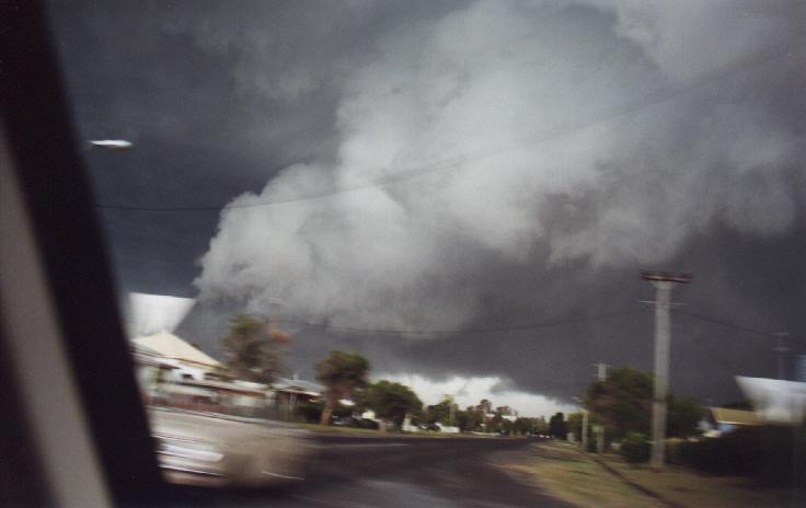
I was really getting scared because I knew most storms weren't supposed to look like this. The massive front stretched for ages and looked almost like the claws of a beast stretching out over the town of Casino. We knew just before we got into town we weren't going to escape it.
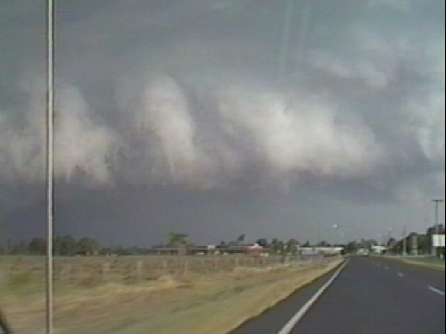
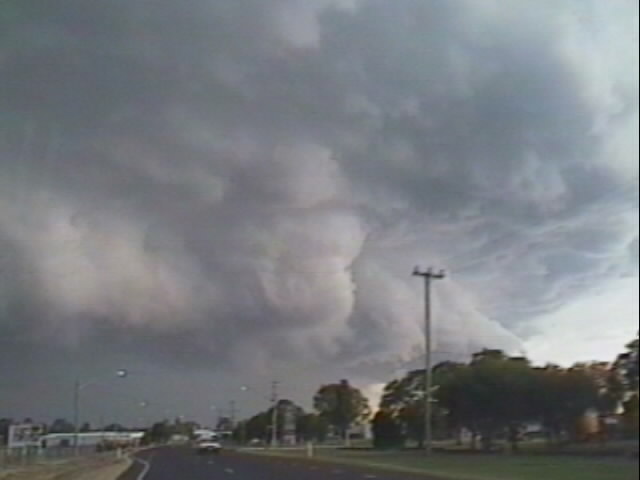
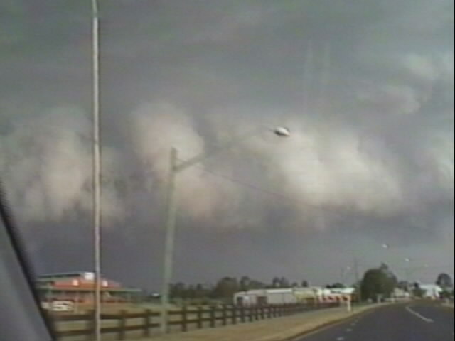

Video Stills Of The Guster As It Moved In From The South From 6pm till 6.05pm
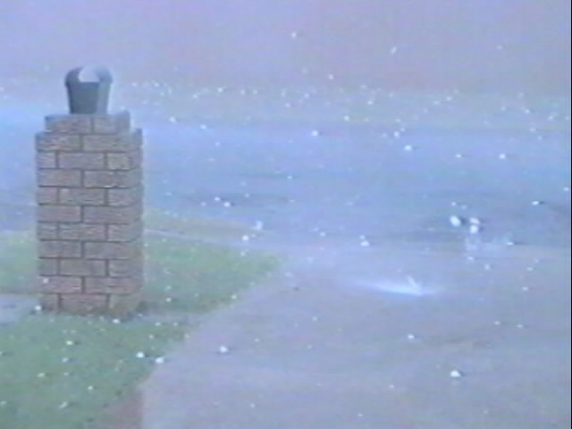
At 6.10pm dust and debris was kicked up as it hit. Large drops were falling and Michael decided we might get out of it if we kept heading out of Casino on the Summerland Way. It was not to be. Intense rain dropped visibility and the road was lined with gum trees that were losing their branches. We were dodging wind blown branches and then 'BANG'. The back of Michael's car got hammered by a branch which caused a substantial dent. We headed on trying to get out but visibility got that poor that we ended up pulling into a side road and watched the thing pass over us. Before we pulled off we were hit with 1-2cm hail in small amounts.
But when we stopped it slowed a bit and the wind and rain picked up. We were blasted with wind that really freaked me out. Because the visibility was so low I thought anything could be behind us and we wouldn't know (ie a funnel). Then the real hail started. Wind blown, golf ball sized hail began to pound the car. There wasn't so much at first but then the rain began to die down a little and the hail really began to fall. We just sat there for ages, waiting for the thing to pass and hoping the hail wouldn't smash a window. It kept up for a while and then we decided that if we headed back for town we'd get out of it sooner. Only a few hailstones were still falling at this strange but the rain!!! It got that heavy that we actually couldn't see in front of us at all!!!
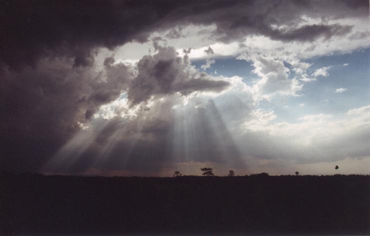
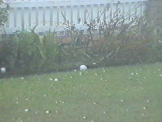
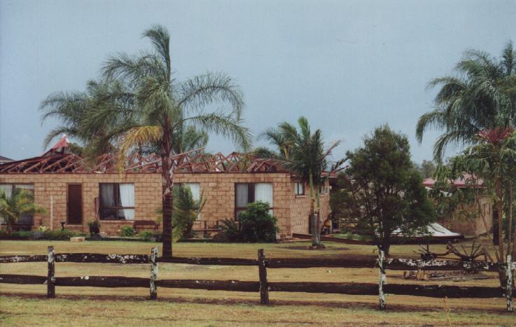
We pulled over where there wasn't any gum trees and then we got blasted with a gust that picked up the front of the car!! It was quite scary. By about 6.25pm the onslaught stopped. We couldn't believe what we'd just been in!!!! We headed into Casino and the town had been hammered. It turned out we got the gentle weather. Stones of up to 10cm were reported and there was 6cm stones lying everywhere. Windows were smashed, rooves were missing, trees and power lines were down. The town was a mess. We were so fortunate that we didn't stay in Casino otherwise we probably would've ended up with a smashed window. Michael's car still had plenty of small dents though. On the way out of town we saw one particualy damaged house that had powerlines down nearby. We headed back into Lismore for Maccas and a debrief. We sat there laughing in disbelief at what we'd just been in! As we ate more storms began to develop and by 9pm that night we were hit again by another storm although it didn't seem to be all that severe, there was just constant lightning. After watching this till about 11pm I went to bed and slept right through another storm that hit at around 6.30am. It dropped some 1cm hailstones. This continued on up to the Gold Coast and provided a spectacular photo opportunity at 7.30am. What a spectacular day it had been!! 2 Supercells and an unbelievable experience. I am so glad I stayed home. And I think Michael under estimated the day. Only a 9 out of 10?

| Document:
200101-07.html Updated: 26th October, 2001 |
[Australian Severe Weather index] [Copyright Notice] [Email Contacts] [Search This Site] |