and Chasing
[Index][Archives]
Supercell Outbreak - 8th February 2002 - including video footage.
report compiled by Jimmy Deguara
| Storm News and Chasing [Index][Archives] |
Supercell Outbreak - 8th February 2002 - including video footage. report compiled by Jimmy Deguara |
To see other photograph
structure of the day in Sydney by Judy Mayo, Admam Mayo, Mario Orazem and John
Grainger, click here and also the next page and also Jeff Brislane:
What a season this has been and yet another dynamic system was expected. Even from a couple of days out, the AVN model was suggesting that a curved strong jet was expected to develop with the right exit region and jet maxima heading through the central parts of the NSW coast by evening.
On the morning of the outbreak, I checked carefully satellite pictures and monitored the timing of the expected trough. What was needed was a lag in the timing of the surface wind change so that there would be sufficient moisture for convection to initiate. What I had anticipated was for a squall line system to approach from the west which was already active and moving through during the morning. Also a line of thunderstorms would develop just ahead of the wind change along the surface trough. These would have the best chances to develop into rotating supercells. If all these conditions came together, then a serious outbreak was to develop. The cap strength was weaker to the south which meant early convection such that storms would be widespread and cluttered. The cap strength increased further to the north though the maximum instability was centered around Wollongong to the Central Coast region. Cold upper air was also advancing across and with an impressive moisture profile, large hail was likely.
I awoke to thick fog (due to ample dew point moisture) that persisted late into the morning but cleared rapidly once the sun heated the atmosphere. It was mostly clear though some impressive thunderstorms persisted off the coast from overnight activity. I was quite aware that off the coast was the place to be with an impressive low level jet profile persisting and feeding into major thunderstorms which would intensify during the day with more heating. There had been an impressive lightning show during the night with this activity moving up parallel to the coast.
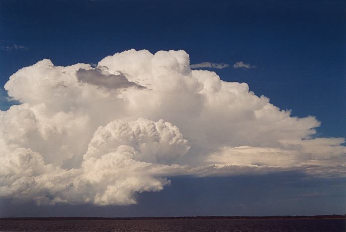
I had planned to watch for the first signs of activity before I headed out paying particular attention to the region just northwest of Gosford which was to be my target region. Once the fog cleared, it was evident that it was not going to muck around with large cumulus already developing over the ranges. Even though all looked impressive, taking into account that the cap was stronger to the north, it would supress convection for a little longer. Some cells aligned themselves northwest southeast well inland from the Central Coast. For me it was a matter of time to see whether these cells would break the cap and explode. Meanwhile, the line of storms to the south and southwest had rapidly approached and looked rather impressive.
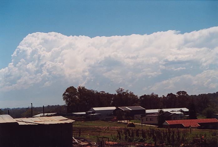
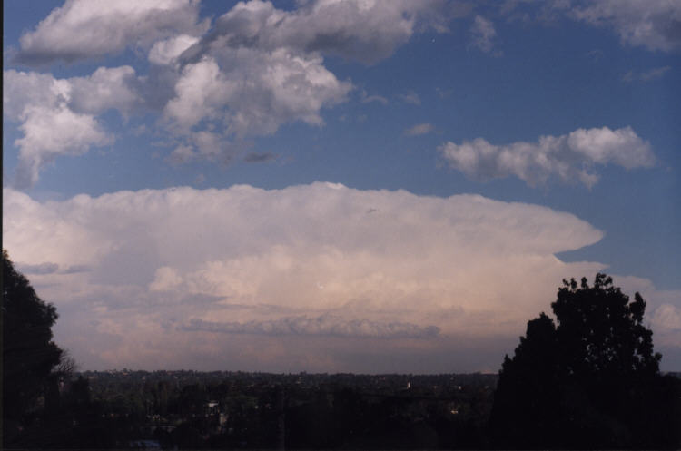
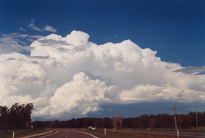
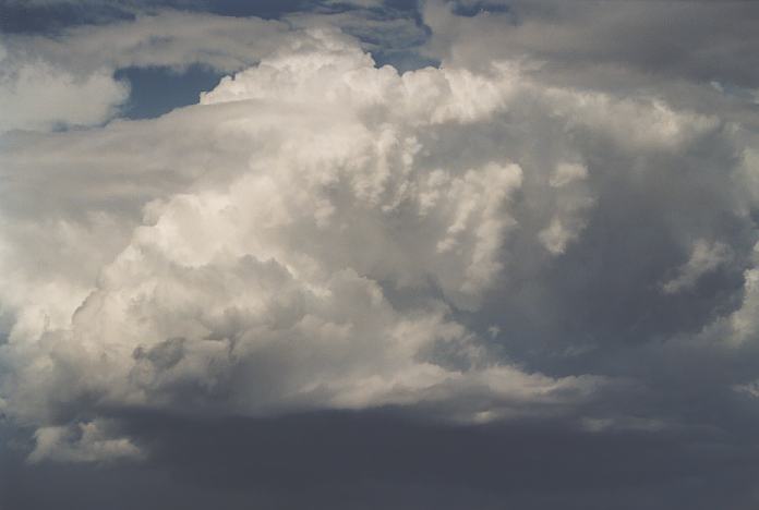
 About 1:00pm, I decided to head off towards the Central Coast. This was quite a bold decision knowing that you would leave the already impressive storms behind you and head for probable development to the north. I could get the odd glimpse of the cells to the south through the side vision mirror. Traffic was not helping but within an hour I was on the F3 freeway heading north towards Gosford. The cell had taken off and showed some interesting development. This was clearly a right mover with development on the southern flank. Once I crossed the Hawkesbury River, it was obvious that I was approaching the cell fast and theerefore it was also heading towards me rapidly. Taking the Calga Interchange turnoff, I parked about a few hundred metres up the road. The cell base was not that impressive but was rapidly becoming organised. The side anvil sent pulses east with each explosive updraught pulse. The storm was already becoming severe and the organisation suggested a hint of rotation.
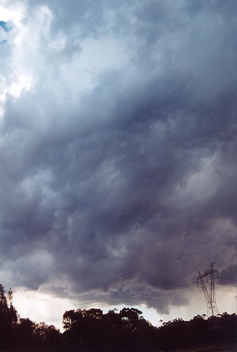
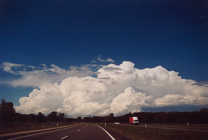
 By 2:00pm, it had begun to rain large drops despite the main core being further south from my location. After 5 or so minutes, hail began to fall with most hail between 1.5 to 2 cm though some larger stones to 2.5cm were falling and this was mainly outside of the core. The storm was moving rapidly southeast and there was absolutely no way of catching it!!!
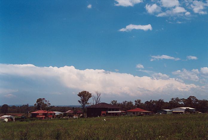
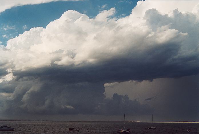
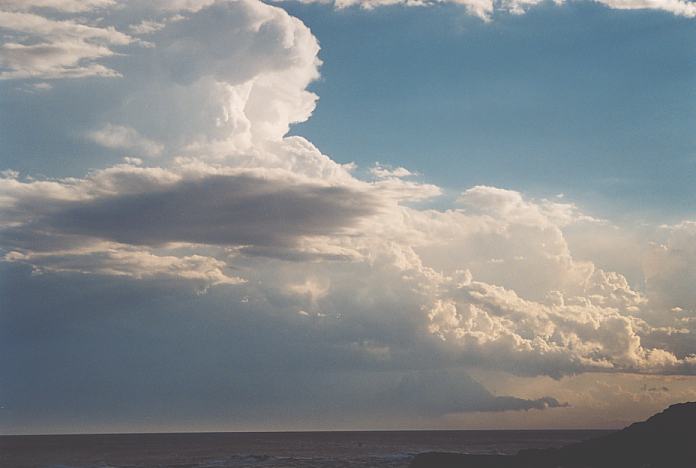
Quickly getting myself back onto the freeway, I headed for Gosford where the last few isolated stones were falling. There was a rapid change from hailstones to sunshine. But the storm was racing on. The chase of this storm was over. Some impressive structure developed as it passed over Avalon.
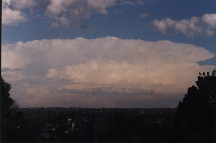
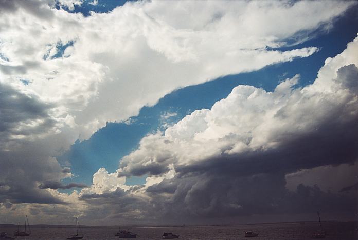
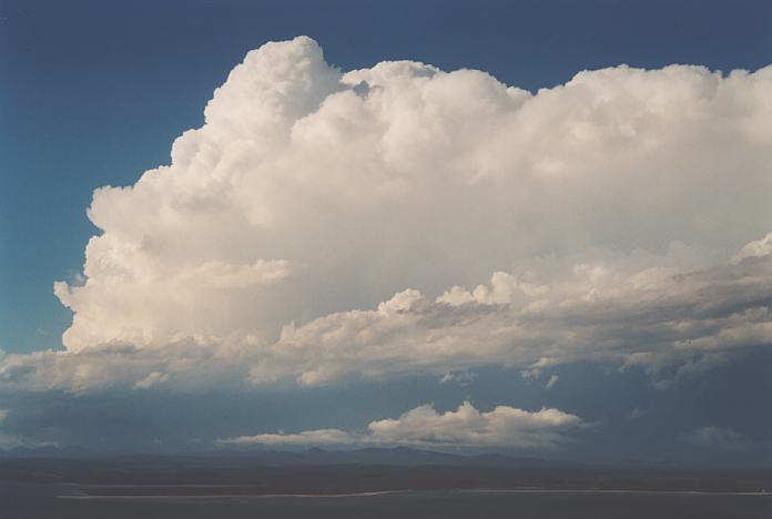
Back onto the freeway and again heading north to get a good vantage point for viewing this storm. 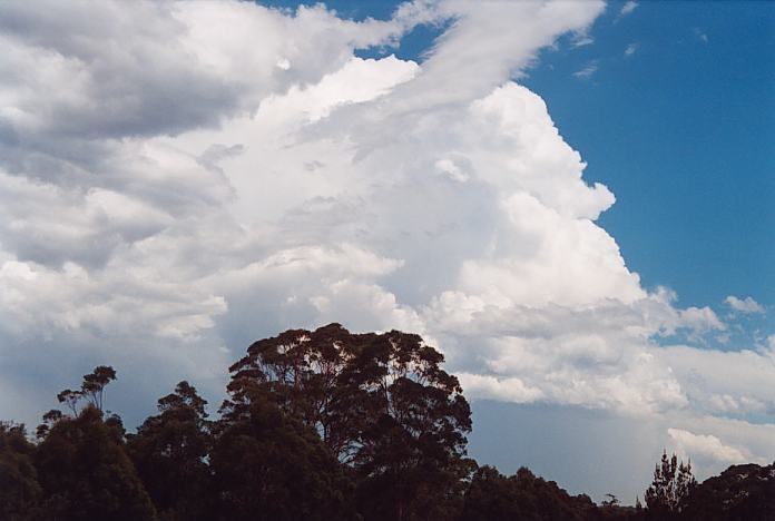 Stopping at Ourimbah about 2:40pm provided the best opportunity to photograph and film this storm's rear structure and make decisions for my next move. Further north, although not impressive was a cell that had made its way to the east and a clearing edge was visible (it was left mover of these split pair).
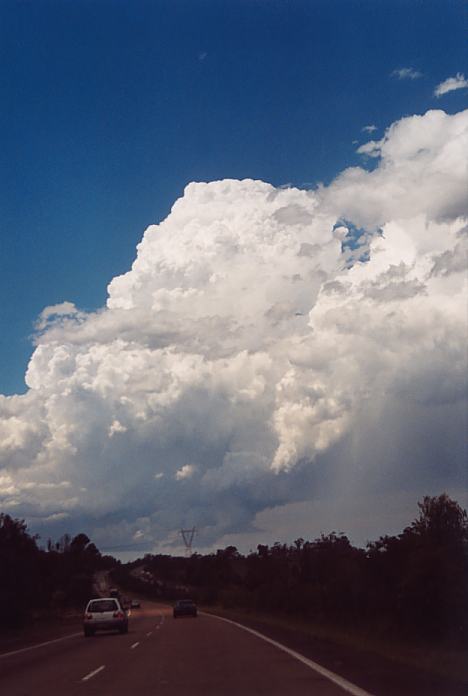
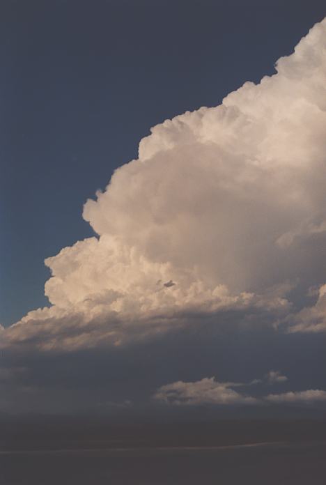
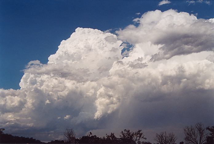 Despite giving chase, again the windshear strength were carrying storms rapidly southeast. I did enjoy some incredible crisp explosive vertical development and was almost passing out in excitement. There was an inflow band leading into the base of the storm though trees hid it from view and prevented any video opportunities. Thinking I would be able to get to the northern side near Newcastle was merely a joke: the storm had moved on too rapidly southeast. Further, the storm had rapidly collapsed within half an hour!!!
 Simultaneously,
a storm complex had exploded to the north near the Bulahdelah region. This line
looked impressive was the last opportunity to make something out of this outbreak.
Taking into account the direction of other storms on this day so far, storms were
heading southeast. This would put the target region near Nelson Bay. Knowing how
many trees existed in the area, any oppotunities to observe were taken. It was
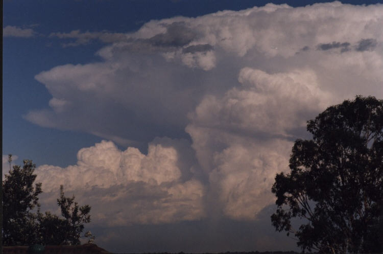
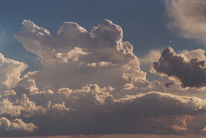
about 3:30pm and I stood in awe watching, photographing and video taping the whole
complex with one of the most impressive corkscrew updraught on one of the cells
to the north. There was definitely inflow into this system indicated by the tiered
base structure. It was also evident that there were a few supercells embedded.
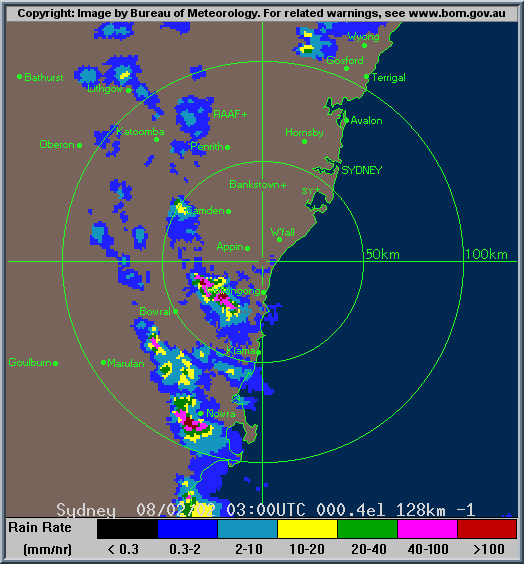
(Radar indicated three splitting cells in this complex despite being drier).
Simultaneously,
a storm complex had exploded to the north near the Bulahdelah region. This line
looked impressive was the last opportunity to make something out of this outbreak.
Taking into account the direction of other storms on this day so far, storms were
heading southeast. This would put the target region near Nelson Bay. Knowing how
many trees existed in the area, any oppotunities to observe were taken. It was
about 3:30pm and I stood in awe watching, photographing and video taping the whole
complex with one of the most impressive corkscrew updraught on one of the cells
to the north. There was definitely inflow into this system indicated by the tiered
base structure. It was also evident that there were a few supercells embedded.
(Radar indicated three splitting cells in this complex despite being drier).
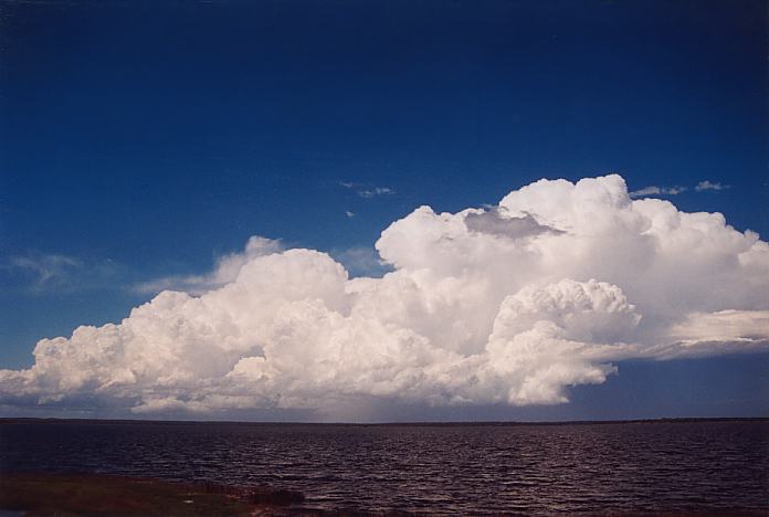
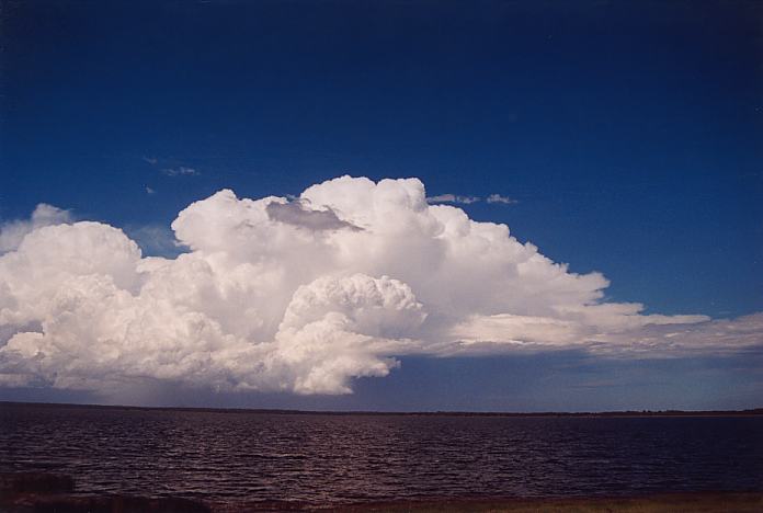
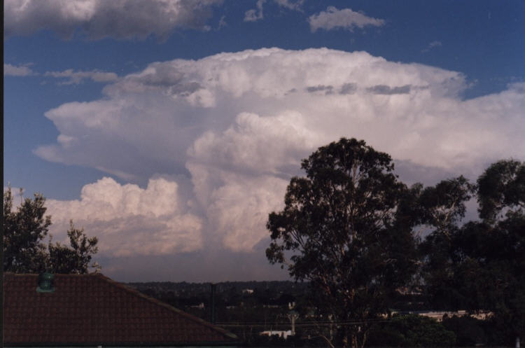
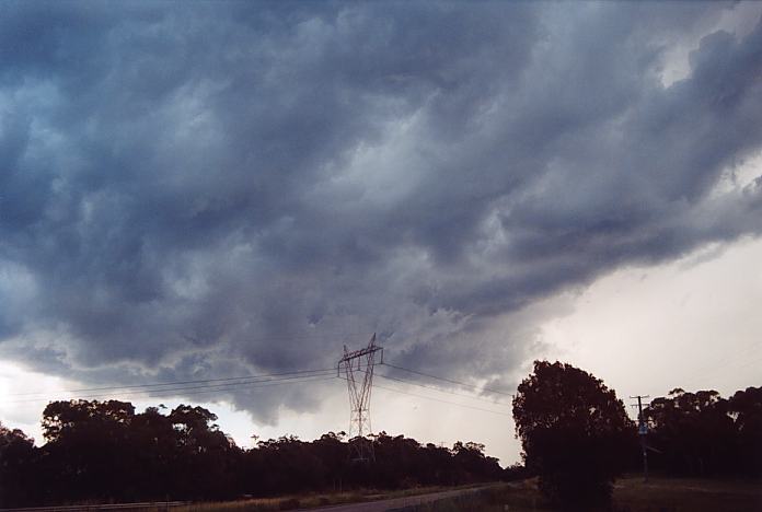
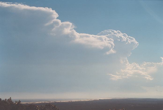
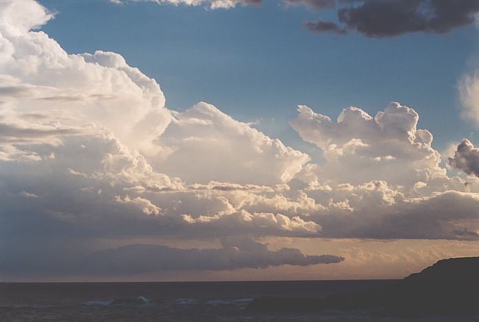
Heading east provided some opportunities to observe the incredible contrast and beautiful structure. However, this southern most storm in the complex had begun to weaken though revealing a twisting updraught throughout the process.
Here is some video footage of the complex to the north of Nelson Bay (right click if you want to save into your computer):
Supercell complex developing over the Mid North Coast. (2.78mb)
Supercell complex directed southeast from the Mid North Coast. (1.89mb)
Supercell complex with impressive corkscrew structure observed from near Raymond Terrace.(2.63mb)
Impressive contrast and structure including corkscrew. (2.99mb)
Twisting updraught, new growth and a lowering observed on the way to Port Stephens.(2.75mb)
After arriving at Port Stephens about 4pm, another cell to the north was backbuilding south. Well it was not surprising when considering the strong northeast sea breeze. This cell exploded but I had not taken footage (bloody phone calls) waiting for a better opportunity to view the massive explosive updraught. This may have been another split or collapse phase.
Noting that the northeast sea breeze was persisting and another cell was observed to the north, it was time to head for a better vantage point. Yes lost time and another phone call but eventually I made myself comfortable at a lookout overlooking the Port Stephens region about 5pm. This cell to the north was leaning but still explosive. Gradually, a wall cloud came into view. Since this was a right mover, the rotation was counterclockwise. This cell looked to be weakening. The collapse stage was again rapid with shear ripping the cell apart.
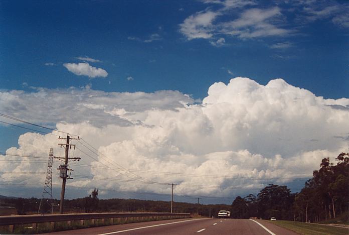
There were cells to the west with some reasonable anvils and structure. This was part of the line developing under the influence of the upper level trough. Unfortunately, I had mistakably expected the storm to head this way. This meant critical lost time and no chance to catch the storm (luckily Matt Smith's group were near this system).
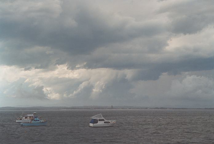
 Heading to the Anna Bay area by 6pm provided some opportunity to observe the crisp cells off the coast.
It was time though to head back. Knowing Matt Smith was around Newcastle and Anthony and Terry (on his maiden chase) had joined him, I made contact to meet up. We had much to talk about concerning the rotation fest we had observed.
This day was so ideal for supercell development though it was again disappointing low level windshear. It was interesting to note that cells were developing rapidly with impressive structure observed along the coast and then the cells would collapse rapidly off the coast. Yet the cell well off the coast had maintained itself for several hours as a left mover and gradually moved further off the coast.
If you (or someone you know) have any photographs or video of this storm or any other storm such as damage, the storm structure itself or hail, please feel free to contact Jimmy Deguara. Your contributions are very welcome. Please any photographs or video footage are important so don't discount anything.
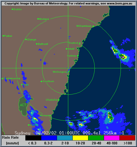
From Bureau of Meteorology.
|
Document: 200202-01.htm
Updated: 8th December, 2002 |
[Australian Severe Weather index] [Copyright Notice] [Email Contacts] [Search This Site] |