and Chasing
[Index][Archives]
Severe Summer Type Storms Lash NE NSW in Winter: Sunday 16th of June 2002
by Dave Ellem
| Storm News and Chasing [Index][Archives] |
Severe Summer Type Storms Lash NE NSW in Winter: Sunday 16th of June 2002 by Dave Ellem |
After a restless night under the feather doona I awoke at around 7.30am, quite hot, which I thought was unusual for June!! When I rolled out of bed I braced myself for the shock of the cold air that would grasp my warm body, and when I rolled out, I felt quite warm. Most excited I ran out to check the outdoor temp. It was 17.5C. I couldn't believe how warm it was. After realising just how warm today was going to get, I felt a little disappointed that such rare heat in winter would be wasted on a day with no chance of storms! WRONG!! When I read the forecast and saw the chance of thunderstorms, and was filled with that immense joy that storm chasers get on a surprise potential storm day. I quickly plotted the LFTX on AVN and was a little disappointed to see only 0 to -2 LIs for the Northern Rivers region. I had a quick chat with Anthony Cornelius and he said that the downs was the place to be as far as instability went, with LIs around -2 to -4. The surface trough in the morning was SW of the border ranges. He then mentioned the phenomenal shear! Although directional shear was not great (winds mainly from the NW throughout the atmosphere), the jetstream was reaching 50-60 knots at 700mb!!!!! At these speeds there was potential for severe wind damage and even tornadic activity. By 300mb the wind was approaching 110 knots!! 500 temps were around -14C and humidity was quite high throughout the atmosphere, indicating a reduced potential for large hail. At 8am there was some very small congestus on the ranges to the NW, but the sky was clear everywhere else, but had 'that moisture haze'.
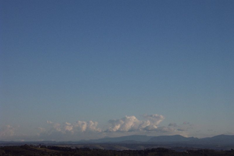

By about 11am I was getting a little worried at the lack of development with no clouds overhead. However about 30mins later I noticed some weak development on the ranges to the NW. We had friends around for pumpkin soup (a badly timed winter dish for this day!), so I wasn't keeping the closest eye on things as I feared my parents would not be impressed with me constantly ducking out! At around 2pm anvils were stretching out from the NW and blocking the sun. It was all looking rather weak though, and Michael Bath was a little concerned the strong shear would rip any developing storm apart. I told him I was going to try the 'positive outlook' on today rather than the critical outlook I usually have. I went for a bike ride with my friend (first one in like 2 years - bike ride that is...) and she surprisingly noticed the storm activity and was quite interested. I was most surprised, as I didn't think she was that interested, but I explained the setup to her.
We got back about 2.15pm. I was getting quite interested in radar, and continued taking some snapshots of the distant development. At around 2.40pm I checked radar and saw that two cells in the pink were heading towards Casino, and wondered, 'why am I not out there'. After receiving harassment from Anthony about not being out there I decided to head out! My friend volunteered to come along without me even asking!! I decided to call my other friend who had said in the morning she would love to come storm chasing if there were some storms in the afternoon. So we all met up and were on our way to Casino by about 2.55pm! Heading in I was a little worried on where to go. I had never been on a proper storm chase without Michael before, and so missed his guidance. It looked like the first storm had already passed Casino and I was tossing up weather just watching from Lismore and waiting for a cell that had developed further east than the rest to come through the Lismore area. It looked weaker however, so I thought I'd take the chance and head to Parrots Nest, half way between Lismore and Casino. When we arrived we could see the back end of the first cell. It had a rainfoot at the back and I explained to my new storm chasers that it was a sign of microbursts meaning strong winds.
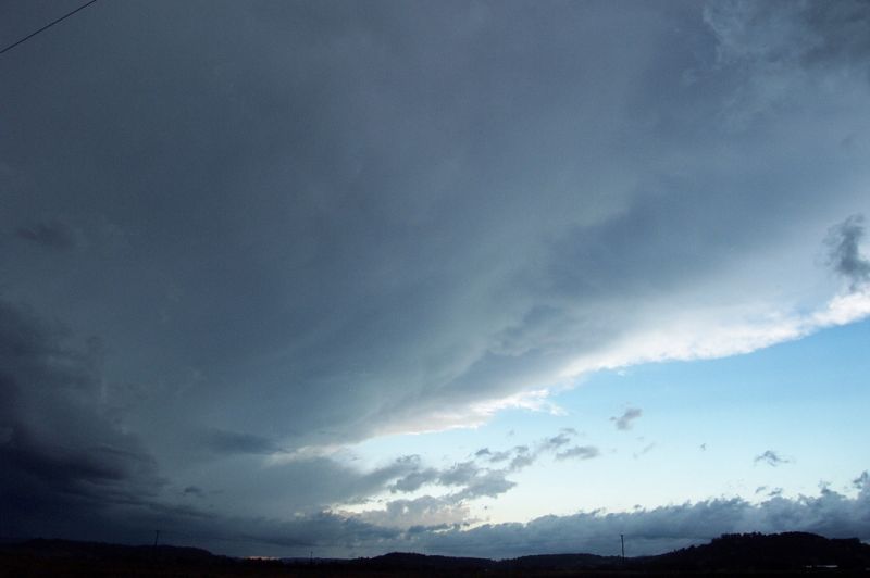
There was another storm looking quite dark to the NW. I thought that the base of this cell (what I thought to be the base), was rather circular looking. At the time I used the word 'meso', but that comment was probably unfounded now when I think back, and also, my lack of understanding. What did make me wonder though was a small lowering towards the back/side of the cell.
I gave Michael a call at his home at around 3.20pm, and he said that a cell was in the pink and heading for Casino and an STA had been issued for the Northern Rivers for severe winds.
NSW Severe
Thunderstorm Advice
BUREAU OF METEOROLOGY
NEW SOUTH WALES REGIONAL OFFICE
Issued at 1516 on Sunday the 16th of June 2002
The Bureau of Meteorology in Sydney has issued a Severe Thunderstorm Advice
for people in the following weather forecast districts:
Northern Tablelands and Northern Rivers north of about Emmaville to Yamba
This advice is valid until 9 pm and it should not be used after this time.
Thunderstorms are forecast within the advice area this afternoon. Some of
these are expected to be severe, with damaging winds.
He told me to wait a second till
he loaded the latest image. I was shocked to here him say 'big blob of red, get
into Casino now'!! We dove into the car and headed towards Casino, and as we
did, a sus lowering developed in the region I had previously noticed the smaller
lowering. It was rapidly developing, and went all the way to the ground! I
couldn't believe it!! None of us could!! We kept speeding towards Casino, and as
we did this thing just grew and grew!! I was sure it was a funnel, and a massive
one at that.

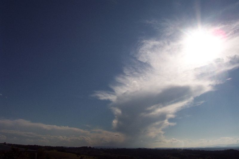
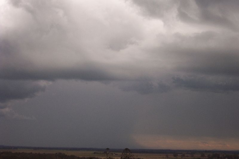
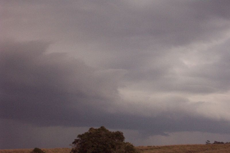
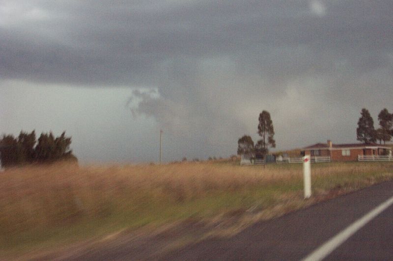
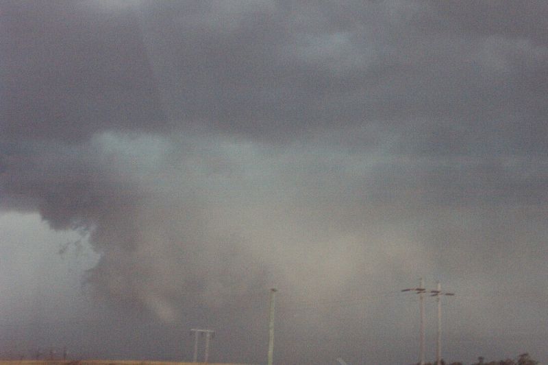
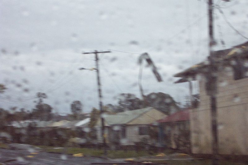
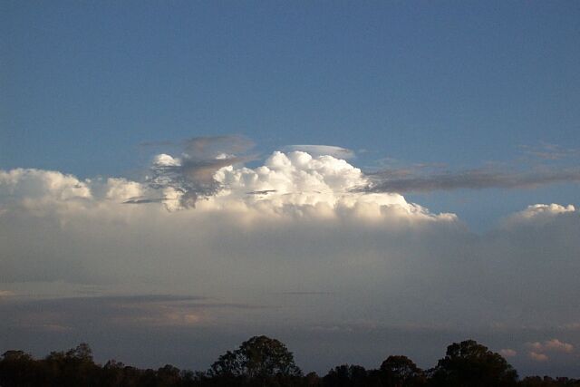
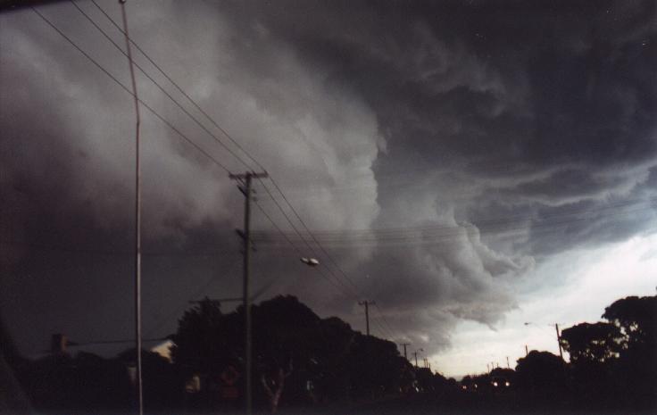
These photos of the 'funnel shaped cloud' rapidly developing into a guster were taken around 3.25pm
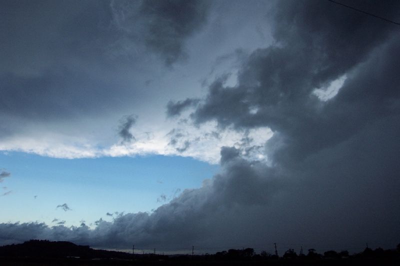
I gave Michael a call and let him know what was going on. But it just kept growing larger and larger, and took on a guster appearance. It looked like January 17th guster all over again, but viewed more side on. The guster had passed us by the time we got close to Casino. We entered the storm from it's side, and watched with excitement as a wall of water came rushing towards us (or us to it). There was intense rain, with very strong gusts coming from the SE, blowing the car all over the place. It was so exciting!!! This continued for a while, but by the time we reached Casino, it was pretty much over.

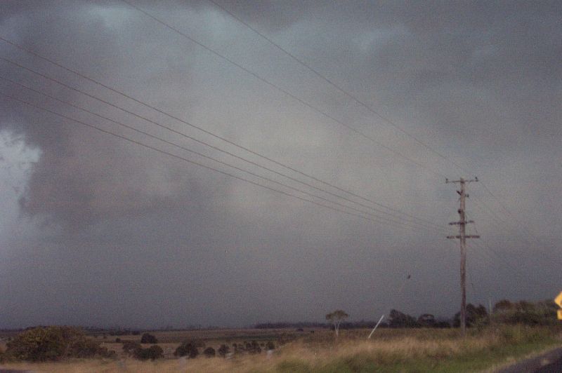
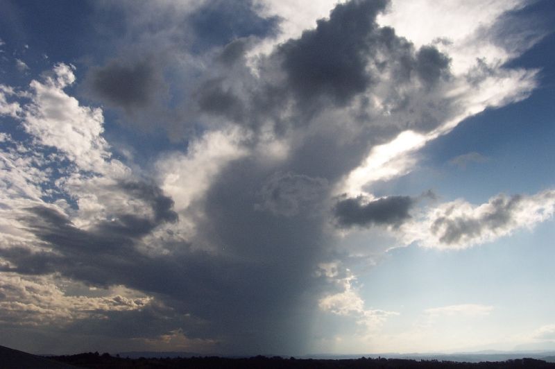
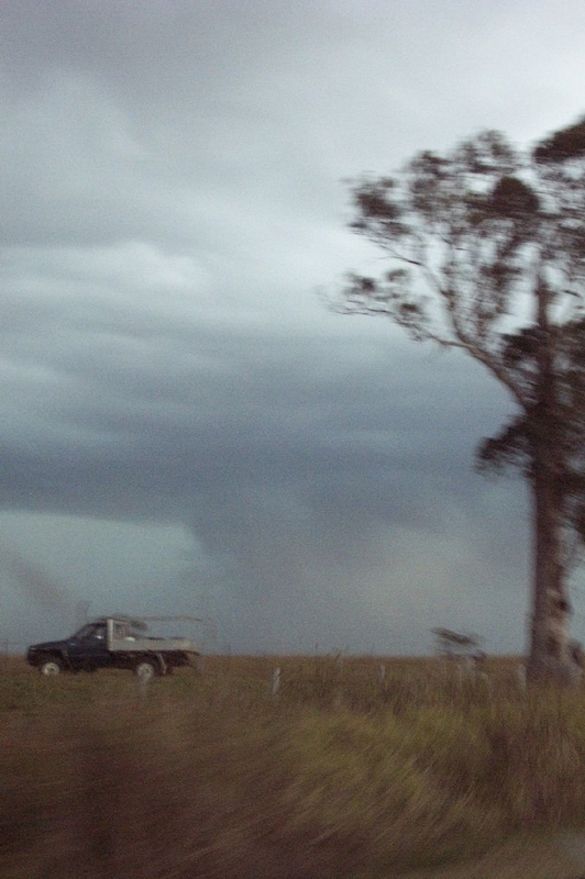
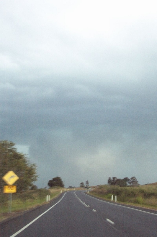
These photos of the guster were taken around 3.30pm
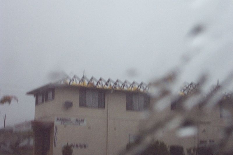
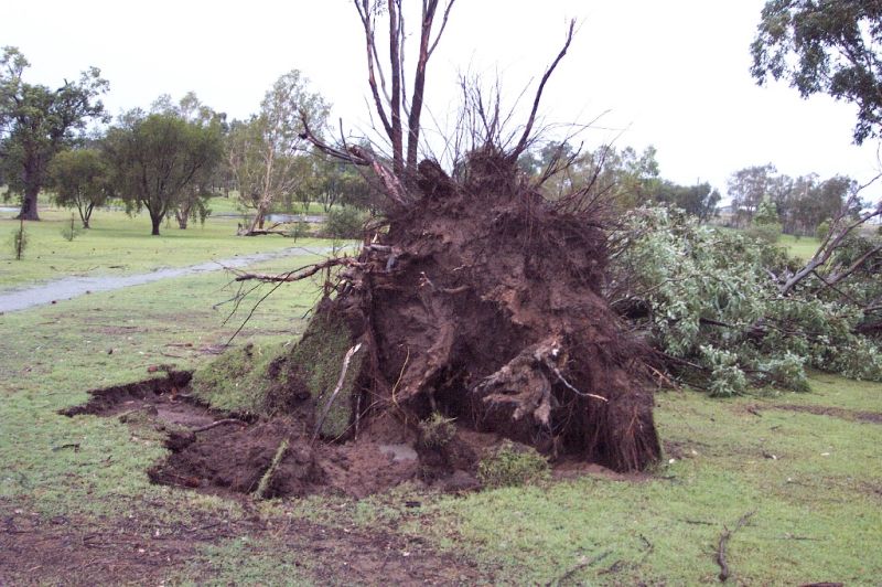
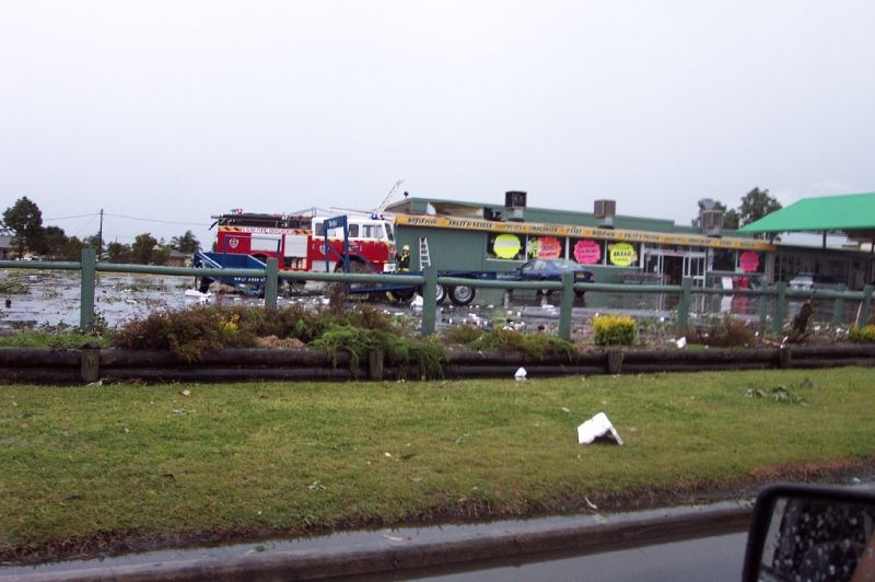
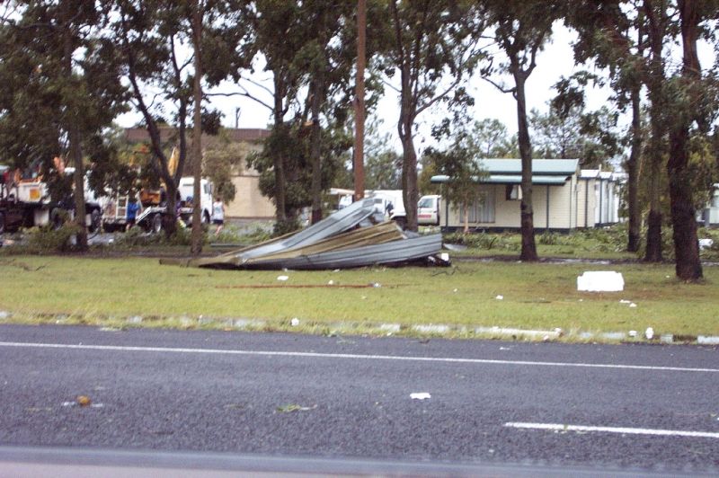
We got into Casino around 4pm. There were large branches down, then a little further trees down, then a little further, rooves wrapped around trees and debris scattered everywhere!!! We followed a fire truck to a butchery, and it's entire roof was gone. We were astonished!! It's roof was in powerlines and peoples yards up to 500m away!! It was interesting to note that damage was very localised to two areas of Casino. The very eastern part of Casino and the central NW part of Casino. Other places looked barely touched.
We were on the phone to Michael again and were informed another cell was heading for Lismore. We headed back towards Lismore, but the storms were just roaring through, and there was no way we could catch it. We got to Lismore around 4.30pm and were treated by a great view of the back of the cell currently affecting the Alstonville Plateau. Another storm was developing to the NW, and had it's anvil stretched overhead with a bit of mammatus. We stayed in Lismore waiting for it to arrive, and watched a small guster roll over the area.

Lightning was fairly frequent, and the rain pretty heavy. It was about 5pm and I decided we may as well head towards home and enjoy the weather for longer. It was great fun driving in the torrential rain! The sky was now almost constantly alight, and when we reached Lismore Heights, we were getting some small hail, but not much. This continued on the way home towards Wollongbar and there was one big flang (the closest I've ever witnessed) that flashed right near the car, making the ground shake (even though we were in the car!!). When we got home it was just pouring. Not sure of rain rates as my parents had turned the PC off. This continued for a little while till about 5.40pm. In the next 3 hours, another 2 bands of thundery rain came through, with some booming CG's. Out to sea in cloud CC lightning was constant with a few CG's. I went to bed at around 9.20pm, very contented, and very awake!! It sure was hard to believe that today was the 16th of June, and not the 16th of January!!
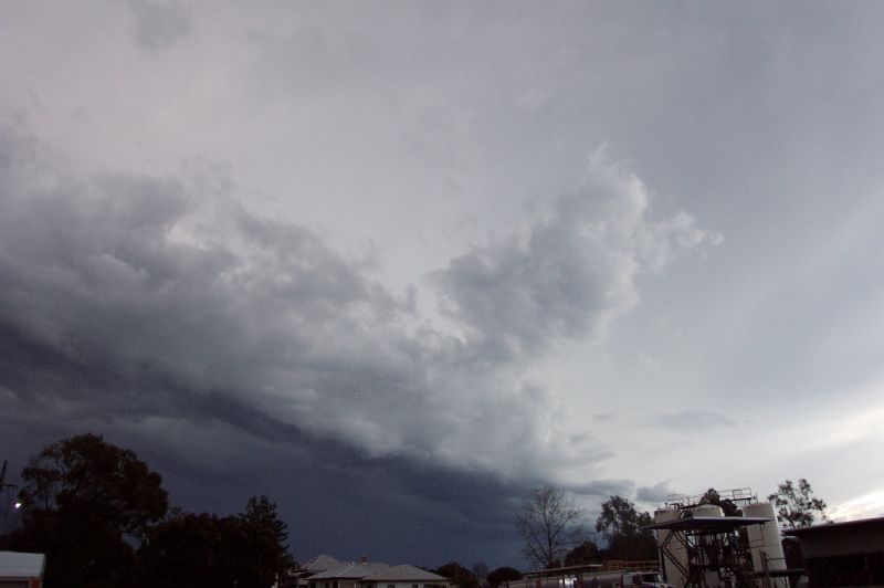
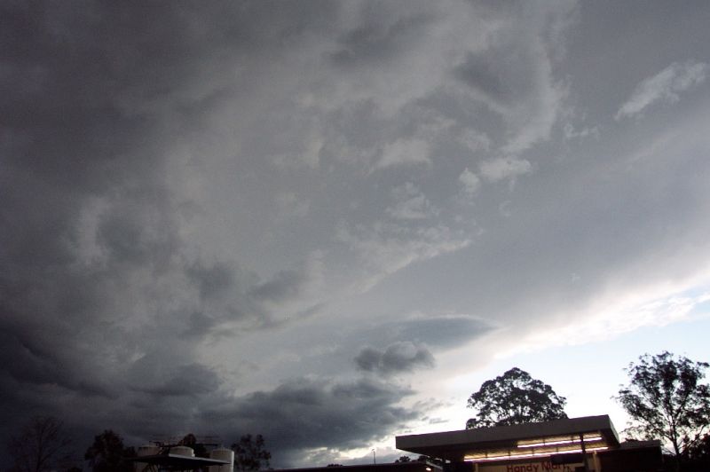
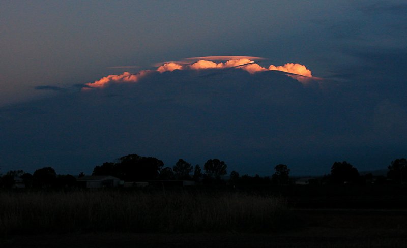
The following pictures were taken of the cell that hit Casino around sunset from SE QLD. Note the beautifully sunlit pileus caps on the updrafts of the cell, which often indicates strong updrafts. Photos by Dale and Filski.
The following observations are by Stuart Macdonald:
It
has been a while between storms apart from the thundery weather we had a couple
of weekends ago. Today the 16th of June didn't feel like winter at all.
The day was very warm not quite hot but not like winter. There has been
talk of another el nino starting up and today felt like that at first. I
started noticing something happening around noon. There was some cumulus
and they seem to develop quickly which made me think that the atmosphere was
changing. There was some faint lightning static on the radio which I had
on the AM band and where there are no other signals. I checked the
lightning tracker and there was some lightning inland south of Grafton. The
radar didn't seem to indicate any rain so the lightning may have been further
south. However by 2pm cells were seen to the south west right round to the
north west. I went for a walk up the road and I noticed that the cell to
the north west was moving east. It seemed to be joining with the cells to
it's south. The cells were moving quickly and building up. Before I
ventured out to check these out I checked the lightning tracker and not much
difference there but the radar indicated storms to
the northwest near the Queensland border moving southeast. However while
outside I felt these storms were moving more east southeast. During the
afternoon cells seemed to fill in and the sky was looking impressive from the
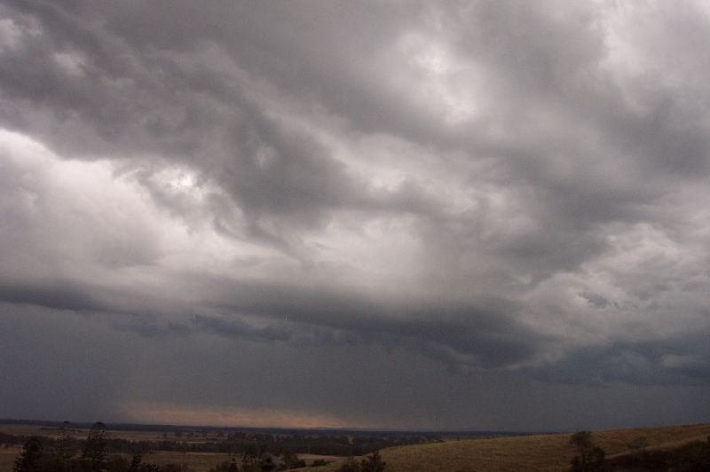
south through to the west. It was around 5pm when a shelf cloud moved
overhead. It had the usual characteristics with it's yellow tinged front and
rounded edges to it's inky blue underside. I was a bit disappointed that
the rain band wasn't filled in as much although the cloud was quite deep.
There wasn't a great deal of electrical activity with this one. There was
the gust front with heavy rain and freshening winds from the wet but I wouldn't
class it as a severe storm despite it's threatening look. The storm moved away
quickly leaving some clear patches of sky to the north west to be replaced by
another storm behind it. It looked like these two storms seemed to be
linked by their upper cloud for the anvil from the second storm was in the same
direction as the first. The second storm had a smaller shelf cloud and
this time more electrical activity. It lasted for about half an hour and
produced a good lightning show as it passed over. I saw one CG which is
what it looked like before the storm hit. During the evening there has
been further storms and these seemed to have developed closer to the coast.
Radar
Provided by the Bureau Of Meteorology
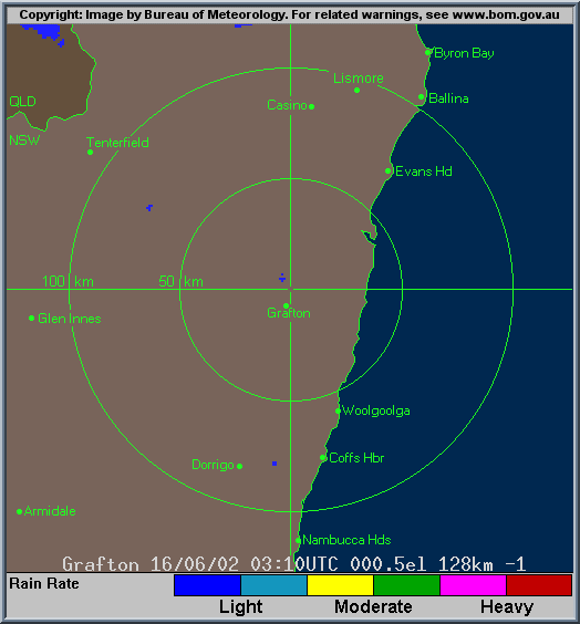
Grafton Local (128km) Radar Loop from 0310z till 1040z (1.10pm till 8.40pm local time)
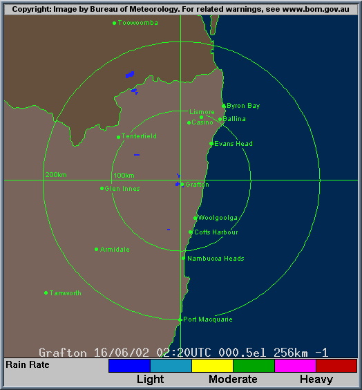
Grafton Medium (256km) Radar Loop from 0220z till 1040z (12.20pm till 8.40pm local time)
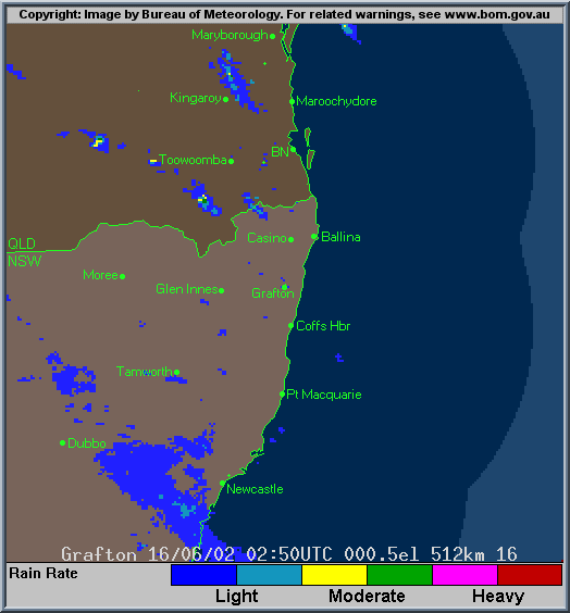
Grafton Broad (512km) Radar Loop from 0250z till 1040z (12.50pm till 8.40pm local time)
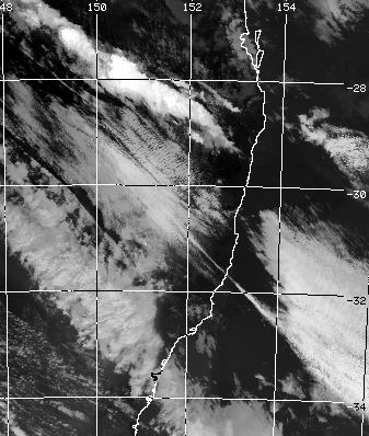
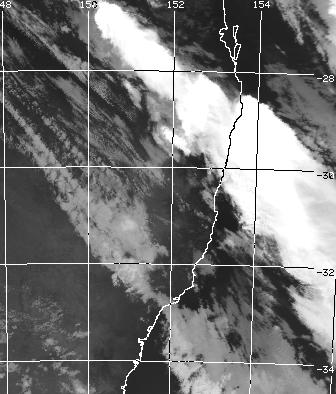
Satellite Photo
Images provided by CSIRO Marine Research
Image taken 0347z (1.47pm local time) Image taken 0715z (5.15pm local time)
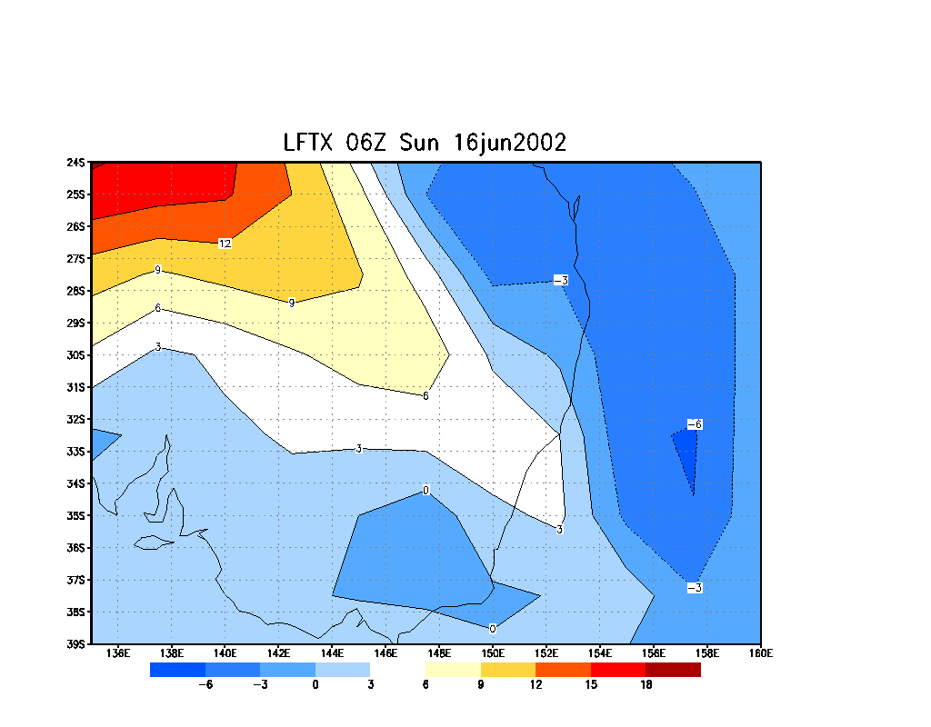
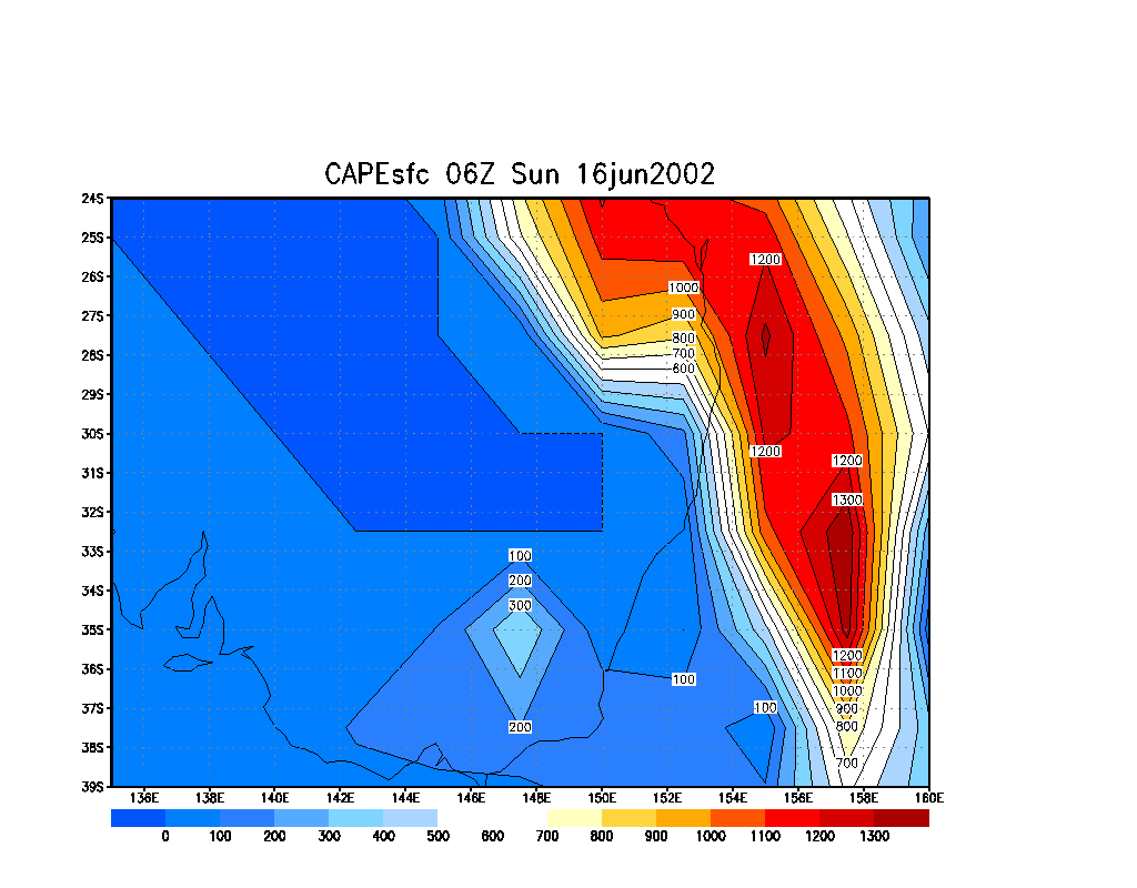
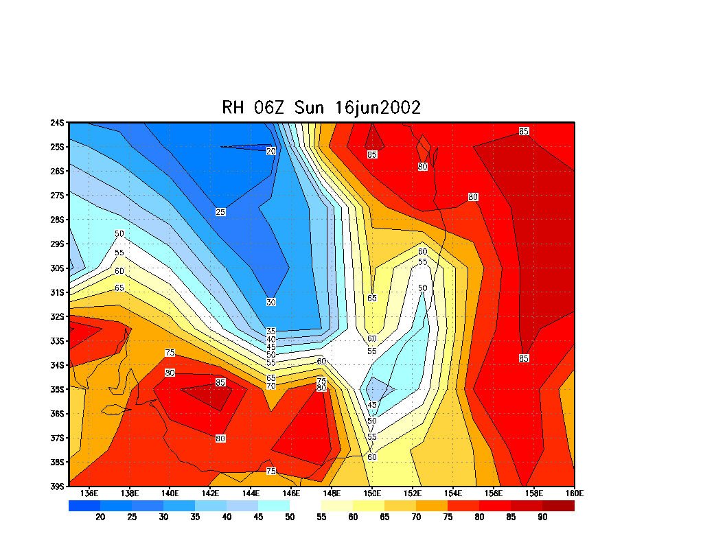
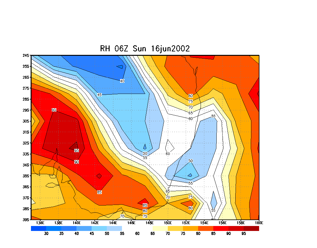
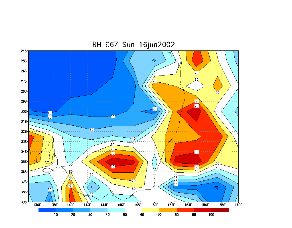
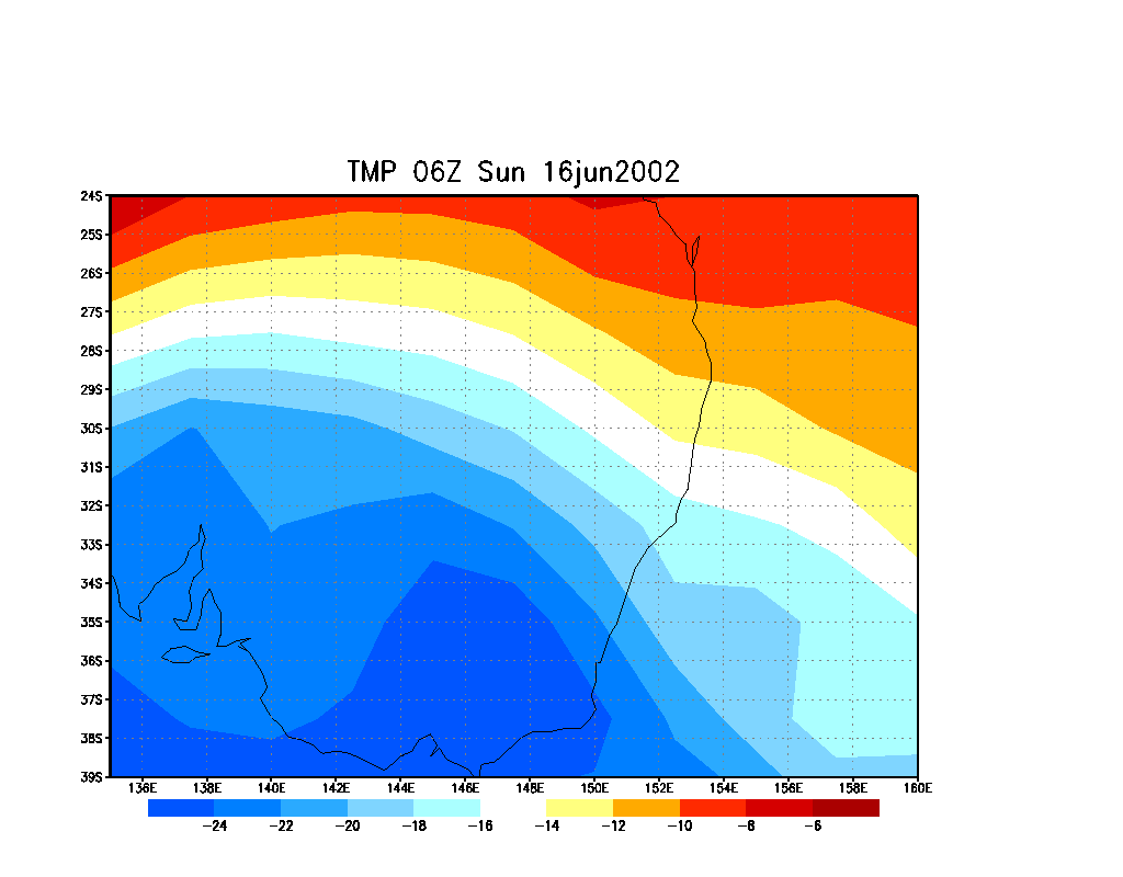
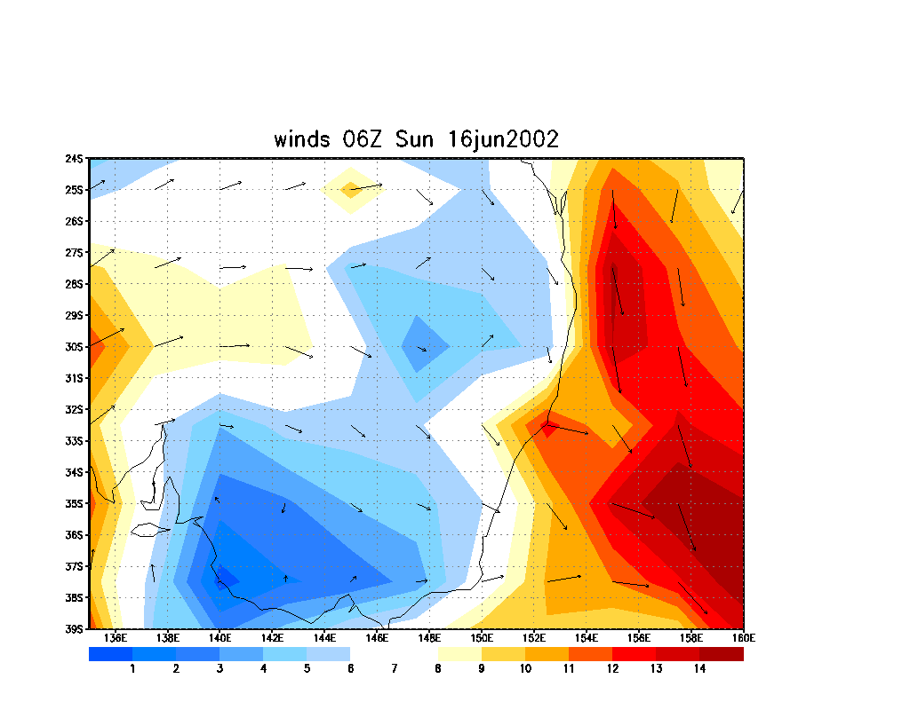
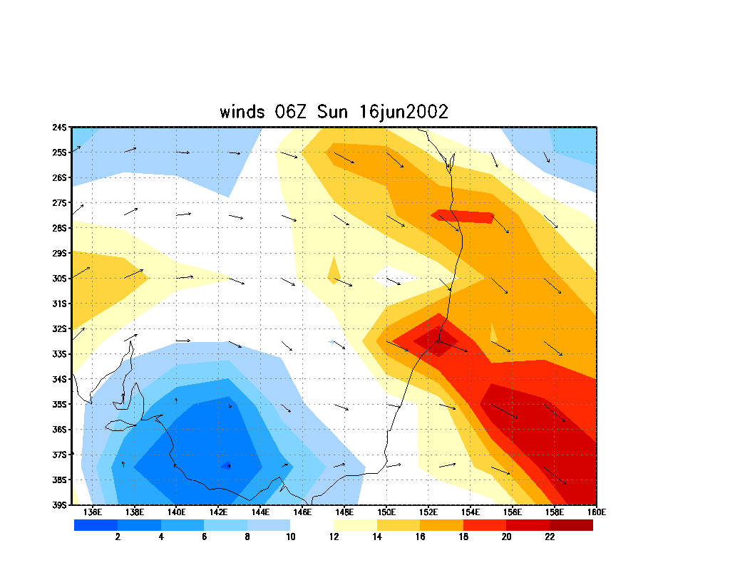
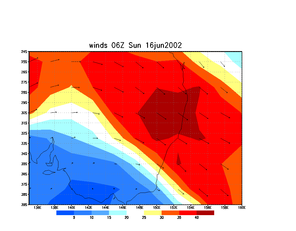
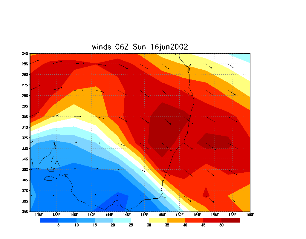
AVN Model Data
From NOAA 16/06/02 06z data run
Please note that winds are in metres per second
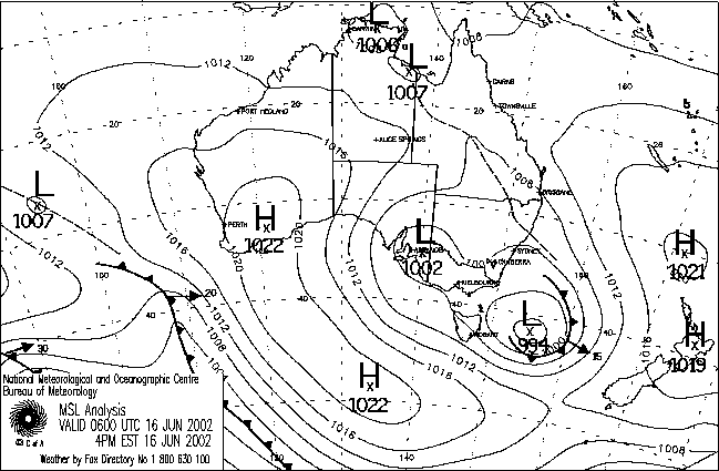
MSL Analysis Chart
MSL 06z chart provided by the Bureau Of Meteorology
|
Document: 200206-01.html
Updated: 3rd October, 2002 |
[Australian Severe Weather index] [Copyright Notice] [Email Contacts] [Search This Site] |