and Chasing
[Index][Archives]
Supercell outbreak with Niangala tornado reported - 13th October 2002
report compiled by Jimmy Deguara
| Storm News and Chasing [Index][Archives] |
Supercell outbreak with Niangala tornado reported - 13th October 2002 report compiled by Jimmy Deguara |
This event was primed to be an excellent dryline situation. There was an excellent wind shear profile with turning in the lower layers of the atmosphere. The dryline setup was not dissimilar to the profiles observed in the United States according to the models - except for the lower layers as usual not having the strongest turning or backing. Having said this it was the best dry line profile I had observed on the models to date. Rain from the previous day storm activity would provide surface moisture. Two target areas were chosen: the region to the northwest of the Gloucester region and along the dry line near Dunedoo. The profiles would change to maximise wind shear during the latter hours on the northern tablelands and upper Hunter. This included a favourable moisture profile.
As the early afternoon emerged, cumulus fields developed to the west. Some developed into larger cumulus. Unfortunately, the winds had turned from the north to northwest and gradually the air began to dry out. The cumulus fields were unhealthy and we knew we were in trouble. Should we head north to Coolah and north from there or head east to some similar looking cumulus fields to the south and southeast? Because it was a Sunday and we were closer to the southern cumulus, we headed east to Merriwa in order to catch this action - not impressive but something. Dry air can easily cause 'bust chases' in Australia!!
As we headed towards Merriwa, we were basically parallel to the storms as they moved reasonably rapidly east. Then we had to move southeast towards the Denman to Jerrys Plains area. We were now moving towards the activity. Outside of Denman we stopped. This was an area where good contrast existed for more photographic opportunities. There was some activity to the north and some to the south. "Umm what is that to the south?" Then as I walked towards David, he pointed out what seemed to be a wall cloud with upmotion. Yes - we were looking at the same feature and noticed simultaneously.
Almost immediately, we headed south to be a little closer to the suspicous lowering. At the same time, I got a call from Rhett Blanch at Cessnock suggesting he had observed the same thing as well as hailstones. You beauty!! The wall cloud basically lost most of its structure but remained as a circular rain free base. The setting sun had illuminated the side shear anvil and some cumulus to the north. "David - look at the overshoot of the storm to the north". After some more video footage and photographs, we called it quits and headed home south along the Putty Road.
All in all, we made the best situation out of a day which I thought was ultimately disappointing. It hurt more to note we missed an F2 tornado in the region near Niangala. I suppose a small consolation prize was that I had the opportunity later on to observe the damage path twice and assess the damage as maximum F2 rating. Observation and report below. At 3pm, cloud build-up giving the impression that a storm was brewing after such a warm day.
About 6pm, frequent lightning observed and a little wind - in fact it looked like hail weather. So Graeme decided a short time after to make sure the sheds etc were secured. (He had no idea what was going to happen; well he didn't think anything out of the ordinary that he could recall).
At 6:15pm, he heard a little noise - westerly winds were blowing. Whilst generally completed closing the sheds, he was walking back to the house and he was bombarded by dust and small debri from the field as the wind got stronger. Before he knew it, he was either airborne or somehow transferred 20 to 30 yards from where he had been. There was some debri in the air and falling around and away from him. It all lasted about 20 to 30 seconds. He quickly went into the house to make sure everyone in there was ok and making sure the broken windows and glass were attended to. It was 6:25pm when the first phone calls were made. At this time the storm was heading further upwind and probably affecting other properties.
Graeme does recall that NE of there, hail was reported. Further up the road, a double brick home was destroyed with furniture displaced up to 1km away. This house was about 8km distant from his residence. Then the Sugarloaf hill region, (about 10km from his residence) showed a widening of the path to about 200 yards wide. At this point, an observer David Muller?? observed two funnel like clouds almost like they were dancing around each other.
Graeme found that his shed and a few windows of the house sustained the main damage. It seems that it was where the tornado started in his view.
It seems from these observations and the atmospheric conditions on the day that this tornado was spawned by a classic supercell and it was fairly dry around the tornado itself. This meant it was able to sustain itself for a reasonable time. In other words, I doubt from the observations that it was rainwrapped and I do believe that there was little or no condensation at ground level. Yes this is the worst type scenario making it hard to pick up and particularly dangerous.
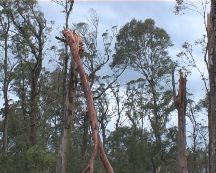
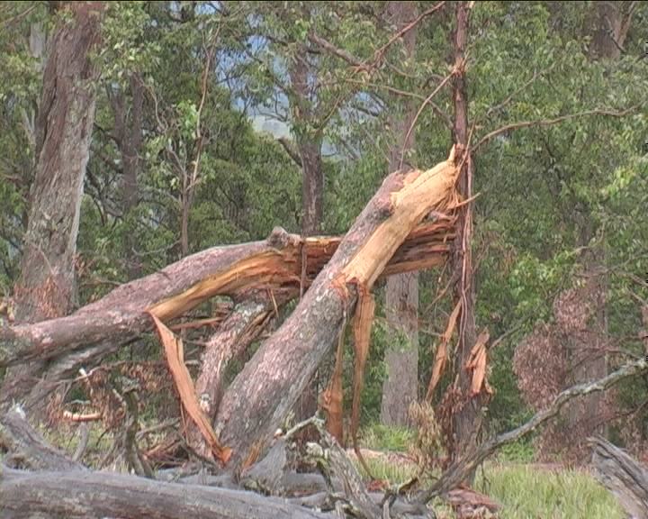
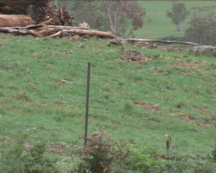
Having done the study myself, it seems the tornadic damage was consistent with an F2. What I would have looked for was more carnage if it were an F3. A fair few trees were uprooted with a few snapped. The forest region was also not full thick forest but moderate (lots of daylight shining through). As to the house, the walls of the house and the internal damage was not consistent with F3 but again it depends on the strength of the house. What I mean internal damage allowed for walls to remain intact whereas I would have anticipated western section of the house to be crushed and the eastern side to remain less damaged for F3 status. I would not say the house was that strong considering the roof was lifted right off. The walls broke at the weakest point and based on wind flow dynamics would have aided in those brick walls to be collpased. Had the corner on the western side caved in then I would have definitely suggested an F3 rating. I also believe through the footage I viewed that the path width was more consistently 100 metres wide. One important observation that I almost overlooked was the fence: it remained almost unaffected though leaning over slightly despite being in the path of the tornado on the highest part of the hill where the forest damage begins adjacent to open paddocks. Of course, this is only my assessment of the damage and I would welcome feedback.
The following are some video stills of the damage to the medium density forest (note the stills of the fence line within the damage path at the entry into the forest - just slightly leaning over).
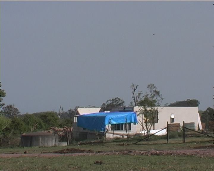
The following are video stills of the house particularly badly damaged by the tornado (I did not venture into the property).
Check the excellent online article of the Northern Daily Leader - Tamworth
If you (or someone you know) have any photographs or video of this firestorm or any other type of severe storm such as damage, the storm structure itself or hail, please feel free to contact Jimmy Deguara. Your contributions are very welcome. Please any photographs or video footage are important so don't discount anything.
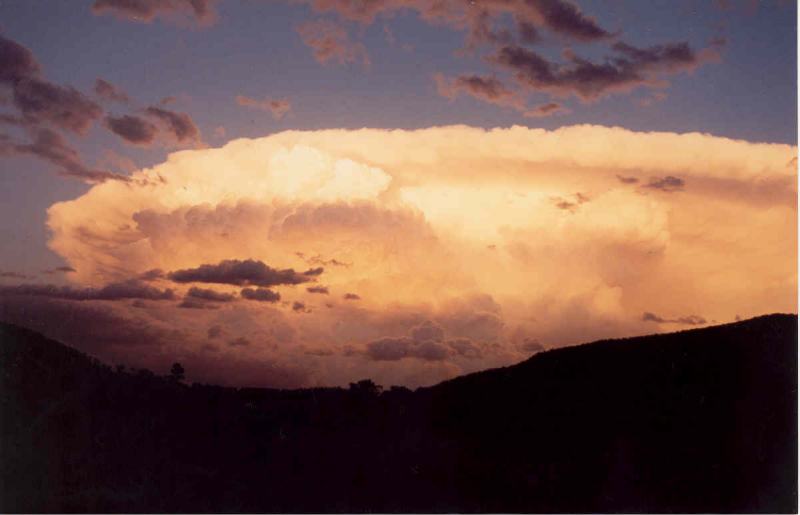
 Photographs courtesy of Geoff Norris - taken 60km West of Tamworth.
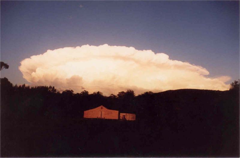
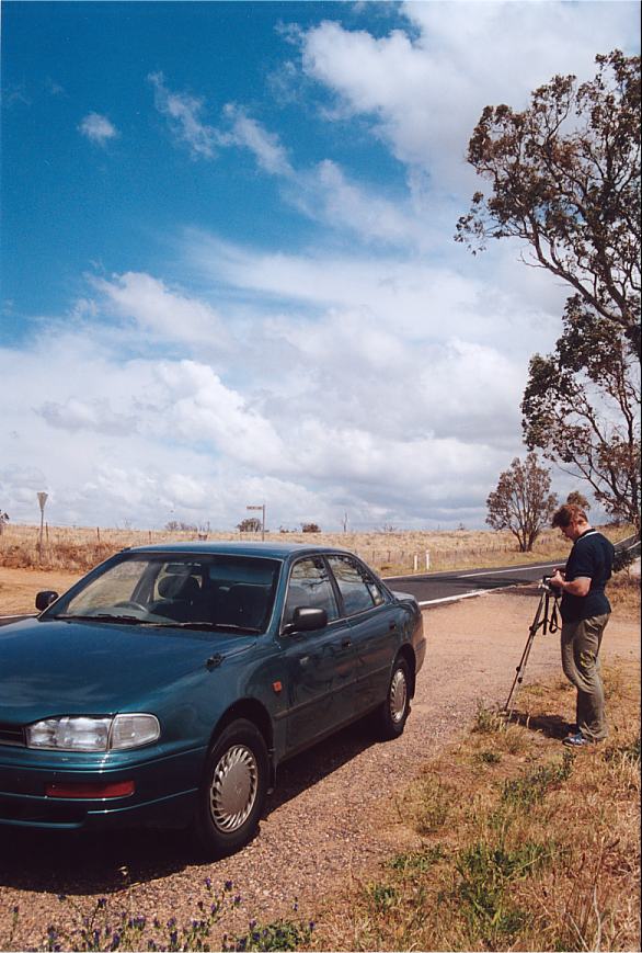
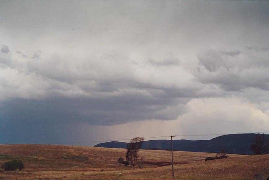
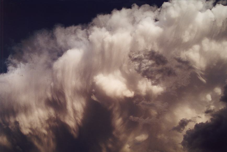
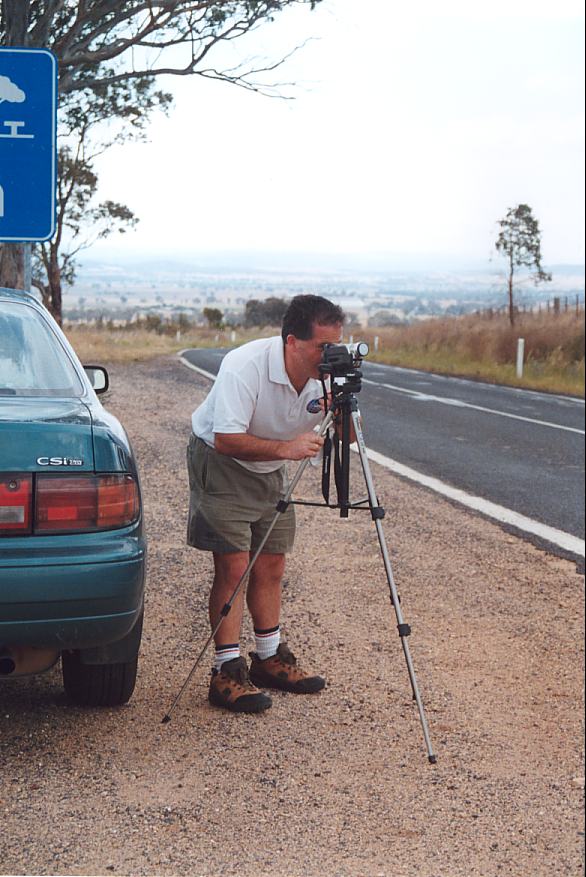 Because we wanted to play the dry line, we chose and positioned the region around Dunedoo. We were there by about midday after eating lunch at MacDonalds Mudgee. At first the winds in the lower layers were quite favourable and there was ample moisture with low clouds. An advice out for the Southern Tablelands to Illawarra area certainly added to our motivation.
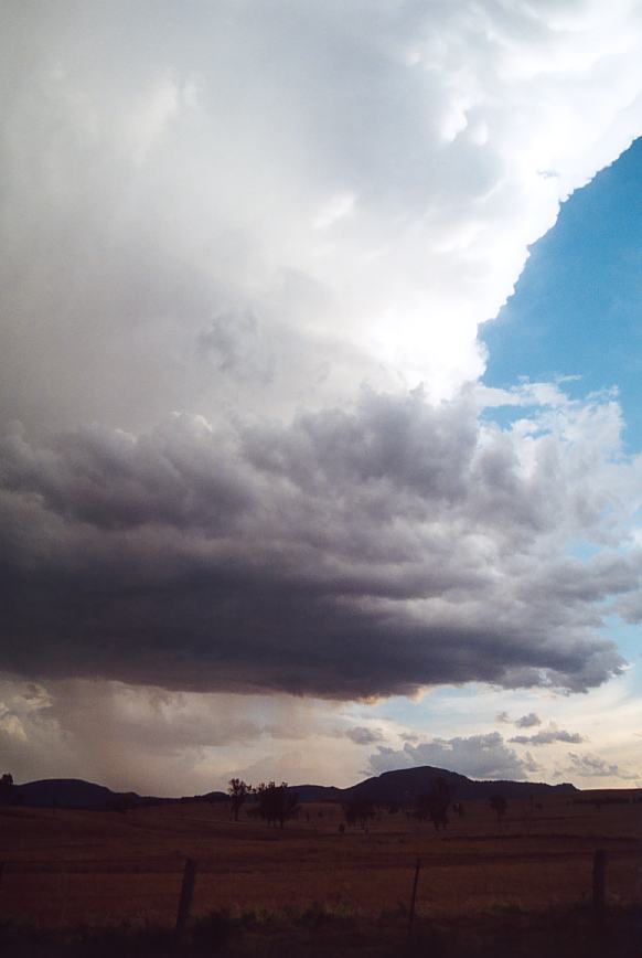
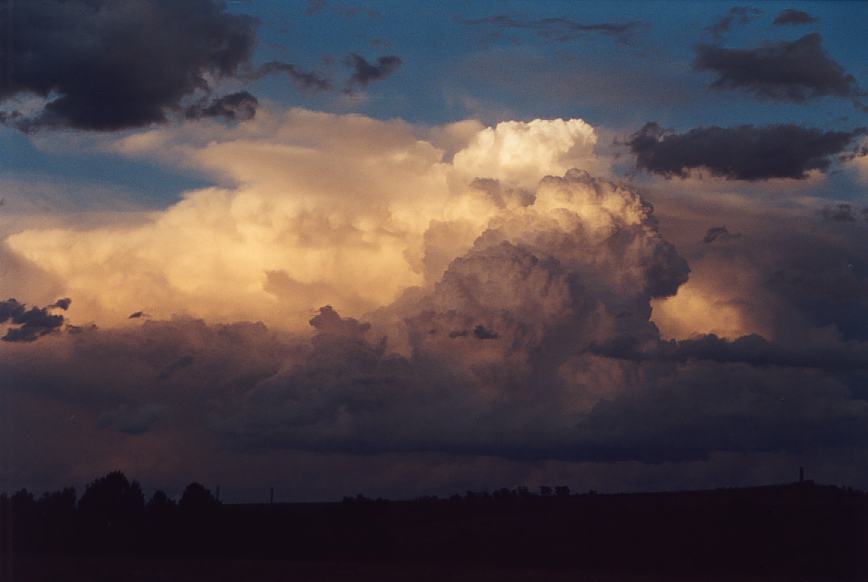
Wall cloud some time after the upmotion activity had occurred.
Because we wanted to play the dry line, we chose and positioned the region around Dunedoo. We were there by about midday after eating lunch at MacDonalds Mudgee. At first the winds in the lower layers were quite favourable and there was ample moisture with low clouds. An advice out for the Southern Tablelands to Illawarra area certainly added to our motivation.
Wall cloud some time after the upmotion activity had occurred.
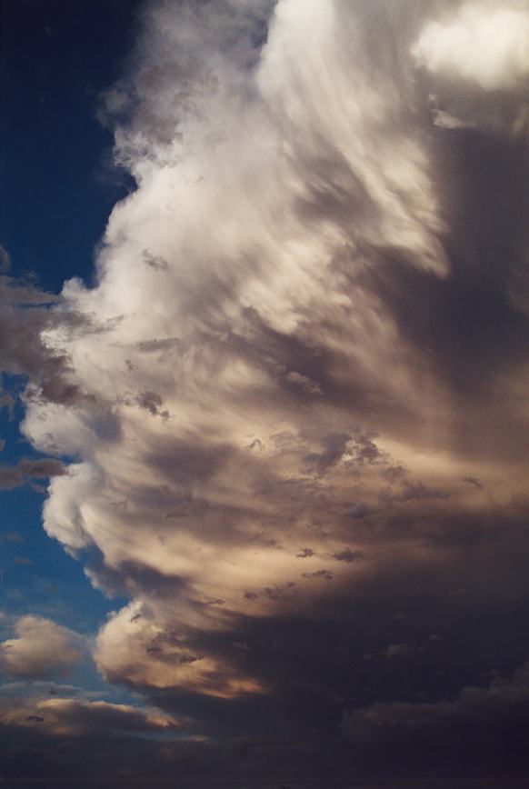
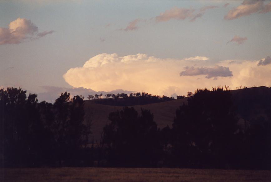 Impressive - but little did we know that we had missed a tornadic supercell in the region target area number 1. This hurt but that's chasing.
The tornado report from Graeme Brazel


Document: 200210-01.htm
Updated: 10th January, 2003
[Australian Severe Weather index]
[Copyright Notice]
[Email Contacts]
[Search This Site]