and Chasing
[Index][Archives]
Damaging Squall Line and Wollongbar Gustnado: Tuesday 10th December 2002
by Michael Bath
| Storm News and Chasing [Index][Archives] |
Damaging Squall Line and Wollongbar Gustnado: Tuesday 10th December 2002 by Michael Bath |
The previous evening, extensive storm activity developed in the west of the State and Southern Queensland. These brought some high storm rainfall totals, particularly to parts of Southeast Queensland. Mid level cloud persisted during the morning with some light showers clearing towards the southeast.
Very warm humid and mostly sunny conditions prevailed from mid morning. Some scattered cumulus developed locally, while storms and rain slipped towards the SE in the far SW of the Northern Rivers district and throughout the Northern Tablelands and Northwest Slopes and Plains. Broad scale radar revealed an extensive line of thunderstorm activity rapidly developing and spreading towards the east. It was apparent quite early that a squall line was likely to spread through much of NE NSW and SE Queensland, with isolated cells developing ahead of the main line.
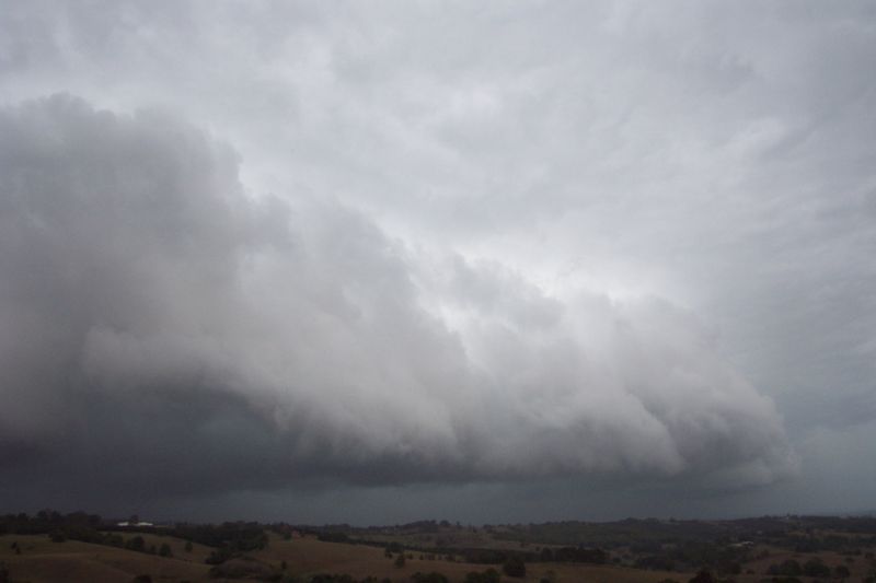
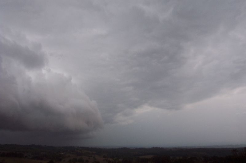
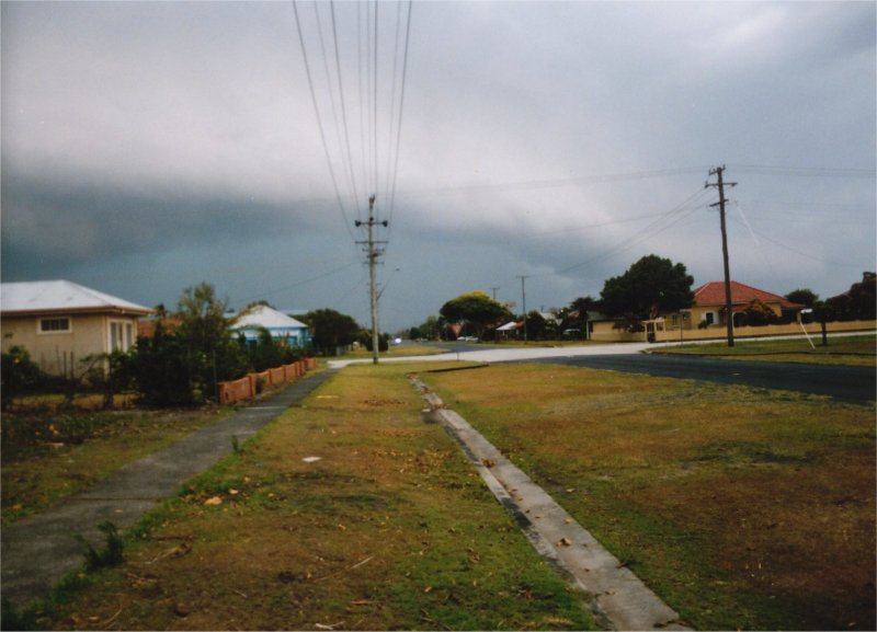
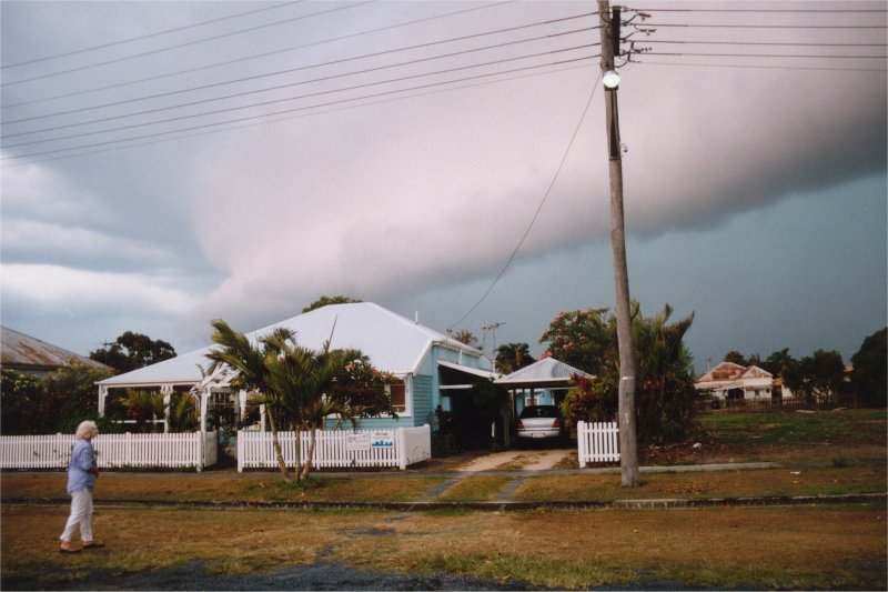
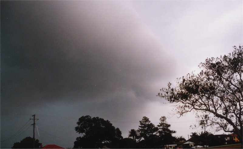
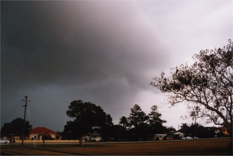
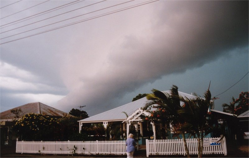
From mid afternoon the storms were visible to the W and NW through the haze and local cumulus. The contrast was poor and radar was the main guide as to what was happening. By 4pm it was quite dark to the west and some small cells has developed locally. One in particular passed just south of Lismore with a distinct lowering and hail shaft, soon confirmed by a report of small hail from Coraki. Meanwhile, the main squall line had become established. Visually, it did not look like much from McLeans Ridges at first, and judging by radar, it appeared the northern edge of the line may pass to the south of the Alstonville Plateau area. There was however a rapid and unexpected intensification around the eastern parts of Lismore.
Some video captures from McLeans Ridges looking W and WNW
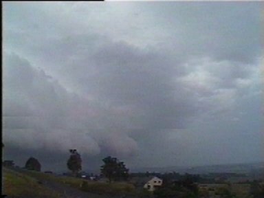
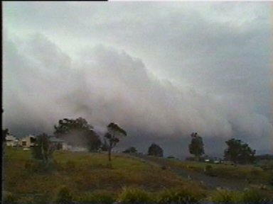
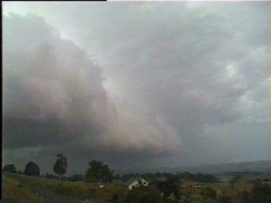
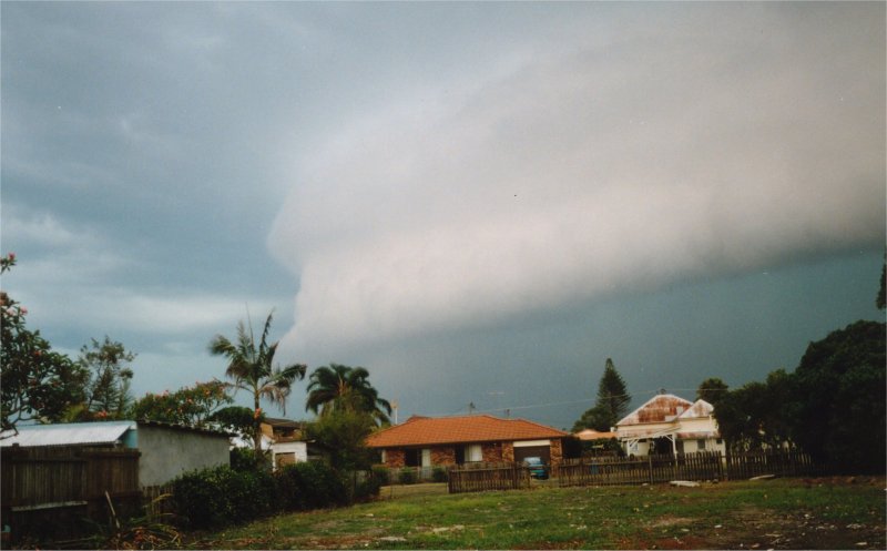
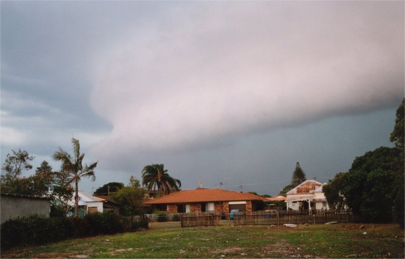
From about 4.45pm a fast moving gustfront formed, with the northern edge wrapping around towards the NW in a curved shape - much like you may expect on a supercell gustfront. The leading edge was very close to the ground and moving quite fast towards the ENE. Deep rumbles of thunder were heard, but lightning was largely obscured by the intense precipitation. Power was cut at 4.50pm. There was serious concern as the leading edge of the storm powered in, an incredible roaring sound could be heard, something I have not observed before. Trees started to bend over towards the NE with small braches soon snapping off, and leaves spreading through the air. Intense rain hit in bursts almost horizontally. It passed quite quickly but rain persisted for about 20 minutes. I estimate local winds reached 80 to 90 km/h.
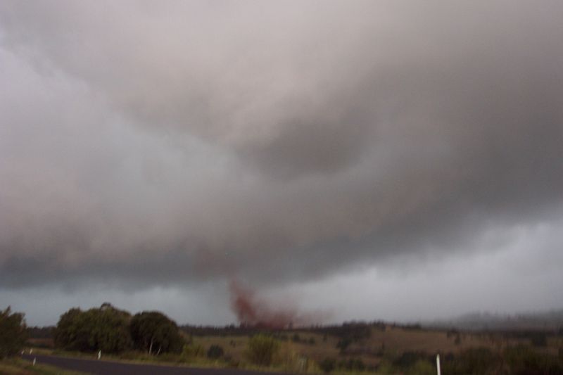
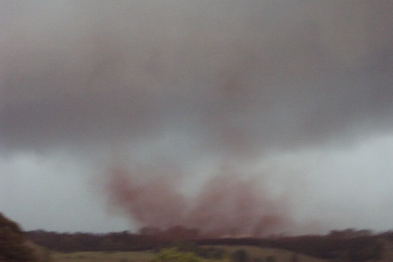
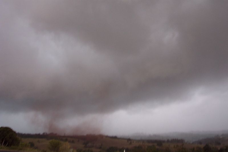
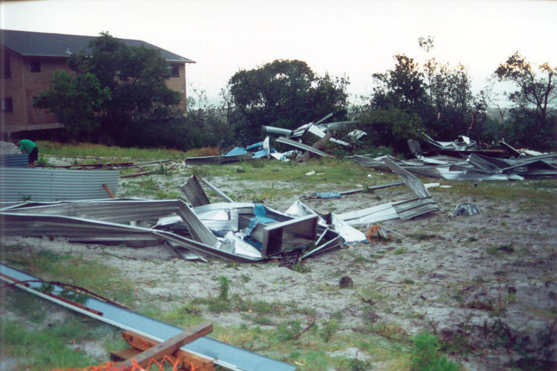
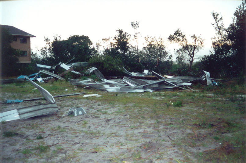
Meanwhile, Dave Ellem 3km to my SE had just observed a tornado in the Wollongbar TAFE grounds .....
"I couldn't get over how fast this storm was moving towards us, and the roar was incredible. The rain now looked to be less than 1km away, and with the gustfront flying towards our place I decided I had better run back up the street to my house. The power had already gone at our house before the storm hit! As I was running I saw something fly up out of the corner of my eye to the WNW. I turned around and dirt was being sucked up and rapidly rotated in a tornado formation. Within seconds the dust and debris had taken the form of a fully fledged tornado!! I screamed out to Dad to come and look, whilst a person walking not to far away heard me scream "tornado" turned around, saw the funnel of dust, and starting running towards his home in our street! I started clicking the button on the camera really quick, but with the low light and my shivering with fear and excitement, the photos turned out blurry. The event was very brief. Probably 20 seconds after it started the formation fell apart and the dust and debris just got blown past the front of our house. Then the winds hit!!!! Just about everything you can imagine went flying past the house! Braches, leaves, dust; it was all being blown past at around 80 to 90km/hr!! Heavy rain also started being blown past, and soon reached a rainfall rate of 150mm/hr. The heavy rain and winds gradually decreased in intensity and after about 30mins only some drizzle remained. What an event!"
Photos by Dave Ellem from Wollongbar

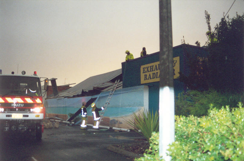
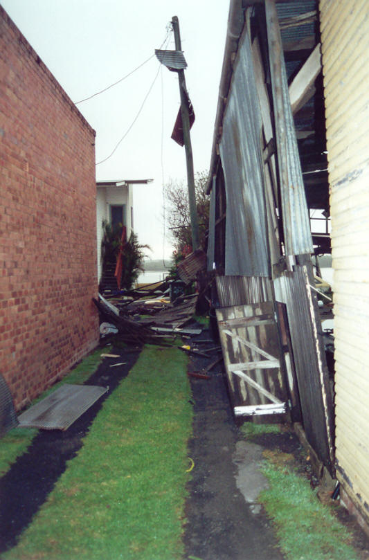
Reports soon arrived of the storm's arrival in Ballina where significant damage
occurred. John Graham from Ballina reports ....
"What a ripper
of a storm this afternoon here ... thought we'd missed it as a shelf cloud moved
to the south of us, so I went inside to check the radar (pink & yellow heading
towards here), when my nephew shouted to come outside. I went outside to be greeted
by another shelf cloud (which was a pinky/tan colour) and a nasty green tinge
behind it. I turned to Brendan (my son), and told him to get my camera, looked
around at the storm & told him instead to get the car keys as the car was
outside...it was coming towards
here *that* fast ... got the shed door down when the wind hit and the power went
out ... got sandblasted when I went from the shed to the house. The highest gust
here at my place was 88km/h, it bent my CB antenna and the mast to my scanner
antenna."
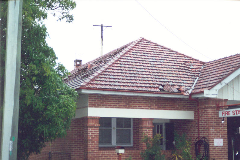
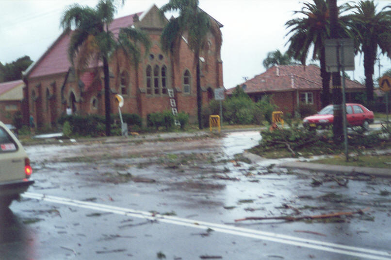
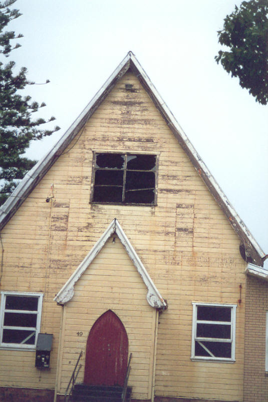
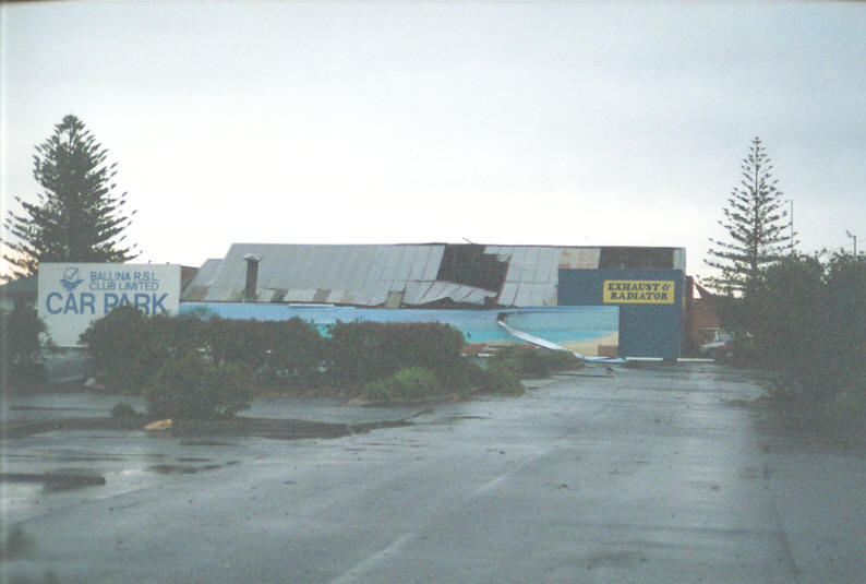
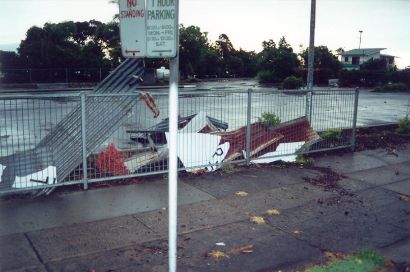
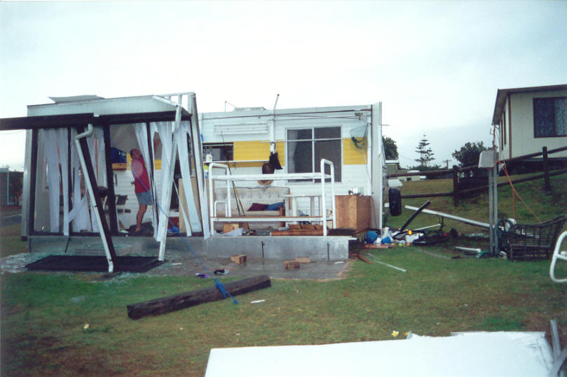
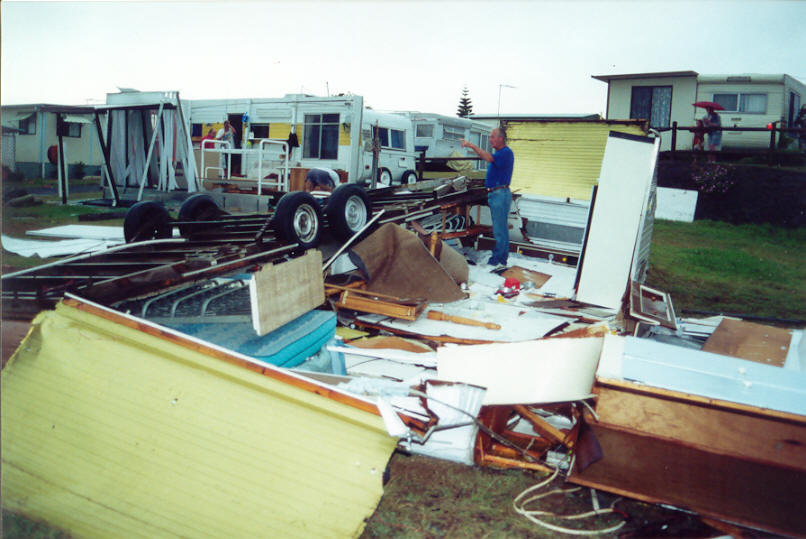
"After it had finished I went out to look at the damage around town. Shaws Bay Caravan Park ... old kiosk windows blown in, 1 van overturned, 1 annex destroyed. East Ballina ... house lost roof, landed in vacant block next door. River Street ... 2 businesses lost roofs, landed in RSL carpark. Fire Station lost some tiles in 2 places. Flats on the corner of Swift and Martin Streets lost the roof. Trees were down everywhere. Photos taken in Ballina by John Graham:


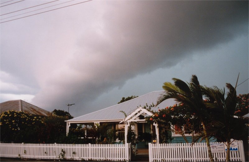
Stuart Macdonald reports from Alstonville:
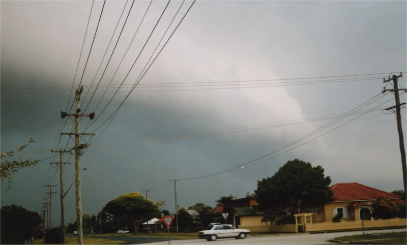
Yesterday December 10 was interesting with the storm that hit Alstonville just before 5pm. The day started off with some cumulus building to the W and on my way to work there was an interesting formation to the W around 8am, however the radar didn't reveal anything exciting and soon the cloud broke up. We were left with scattered cumulus. During the morning the radar did reveal some small activity well west of Casino but again nothing became of it. However during the early afternoon the radar showed activity quickly developing near Grafton. By mid afternoon the leading edge of a storm was visible to the SW and extending to the S. This moved across quickly. While I didn't study this intently at first it was obvious by the lightning static on the radio that there was quite a bit of lightning in this line of storms. It was starting to thunder to the SW by 4:30 and scudding stratocumulus started to move in - a sure sign that this storm might mean business. Soon to the SW there was the shelf cloud which extended to the S and gave the appearance that the storm may pass but the cloud extended more W. I had seen darker shelf clouds before but like storms of it's kind it moved in quickly. Behind the shelf cloud the sky was light green. The gust front hit from the W. While we didn't experience any damage here where I work our phone system was affected by a lightning spike. There was damage experienced in other areas. Around 5pm was the time when the storm hit with driving rain and strong wind gusts. We had 45mm of rain during the storm and another 2mm just as the storm was moving away. A welcome relief but the rain fell too heavy and for too short a time but it certainly cleared the air.
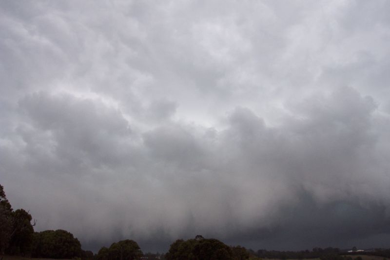
John Bath of Ballina took these photos of the shelf cloud structure as it raced into town. The sequence was taken over a matter of minutes.
If you (or someone you know) have any photographs or video of this event, please feel free to contact Michael Bath. Your contributions are very welcome.
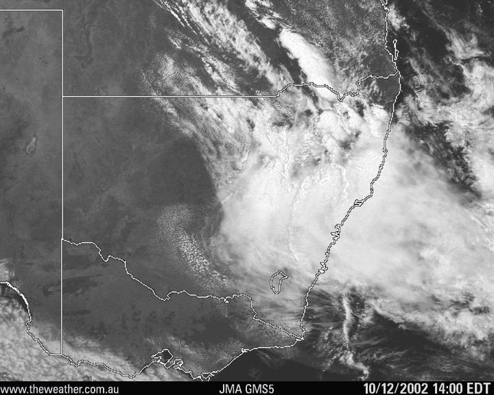
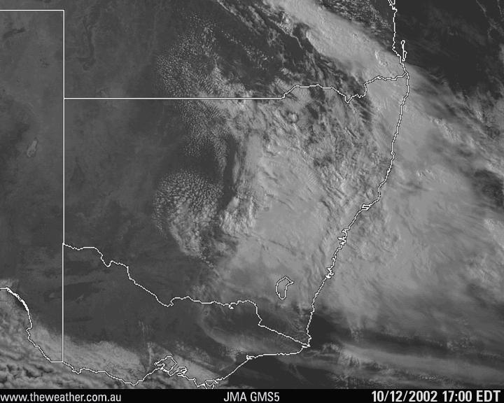
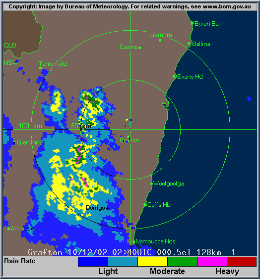
From Bureau of Meteorology.
These GMS-5 visible images from TWC Weatherzone:
From Bureau of Meteorology.
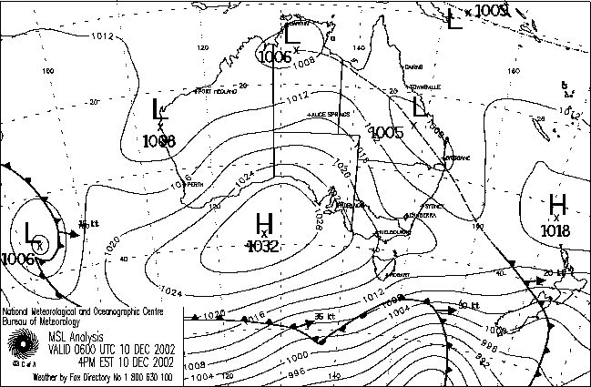
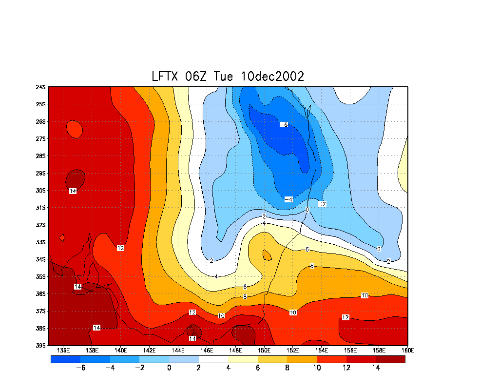
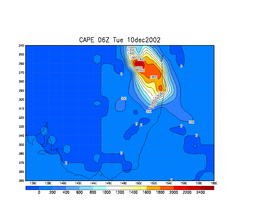
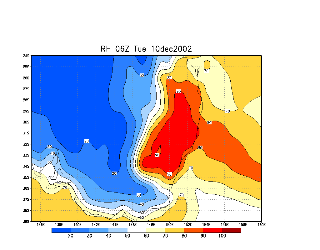
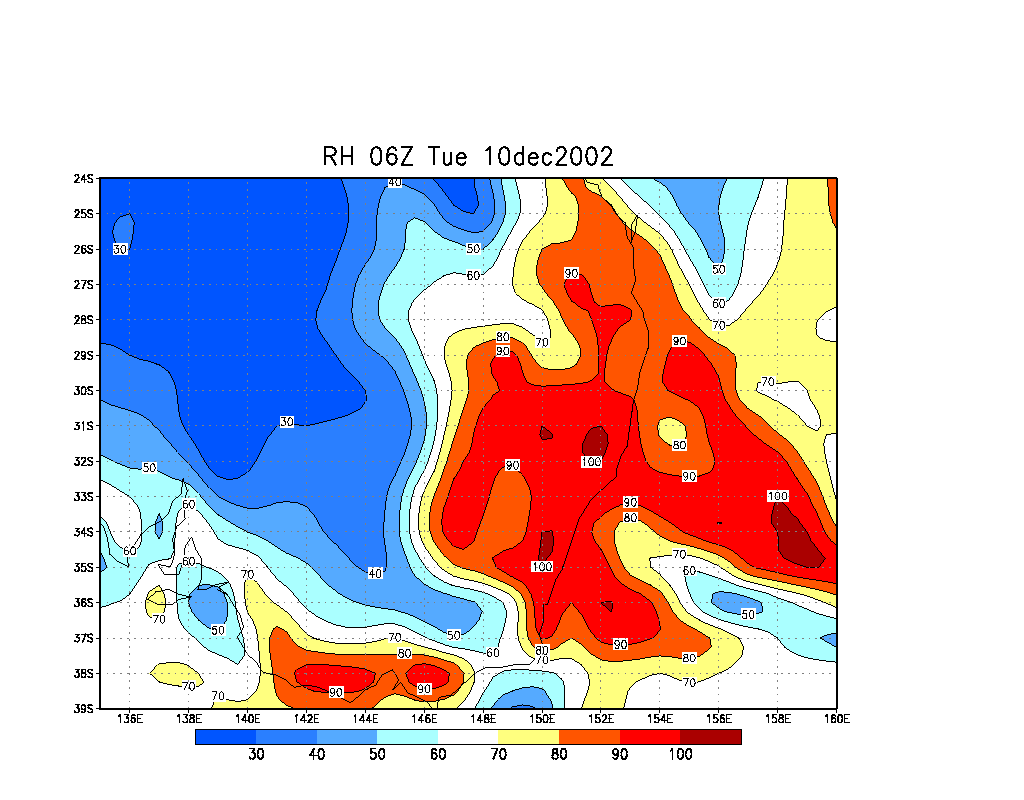
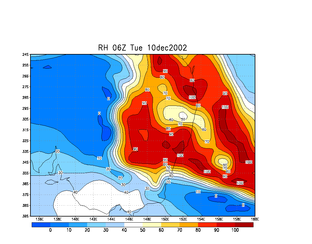
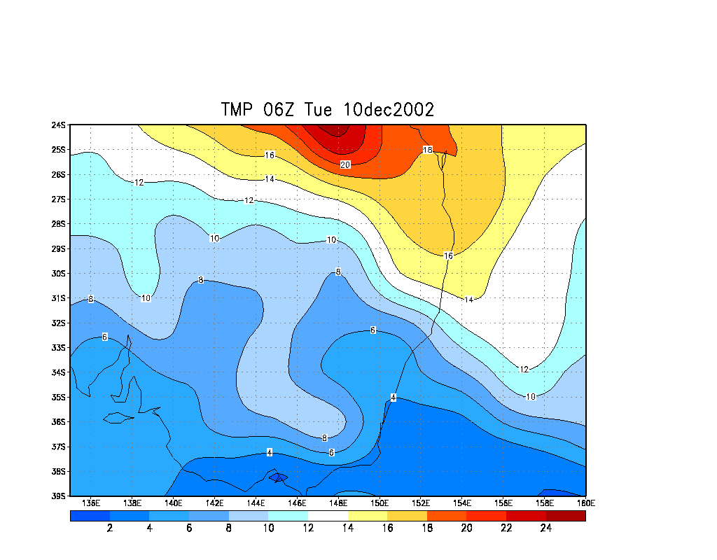
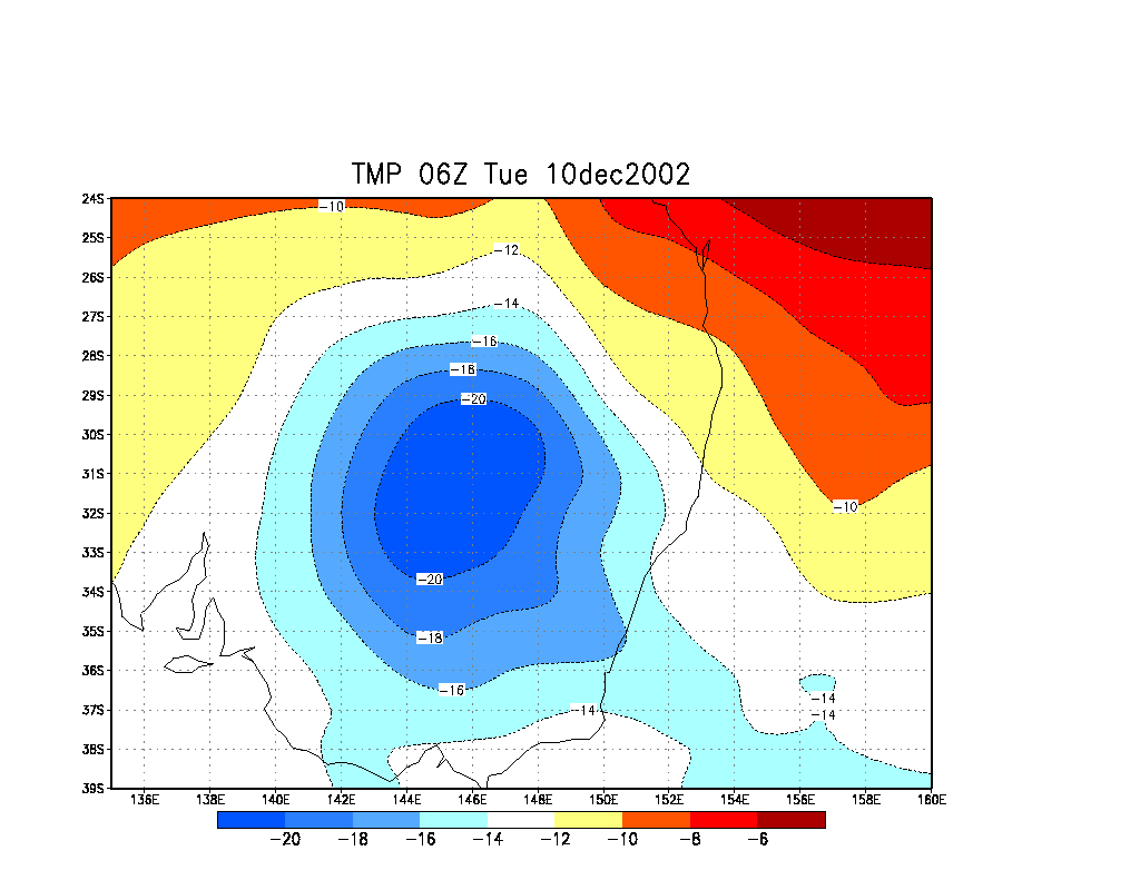
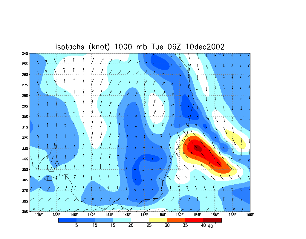
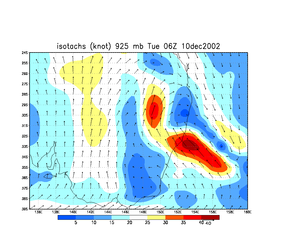
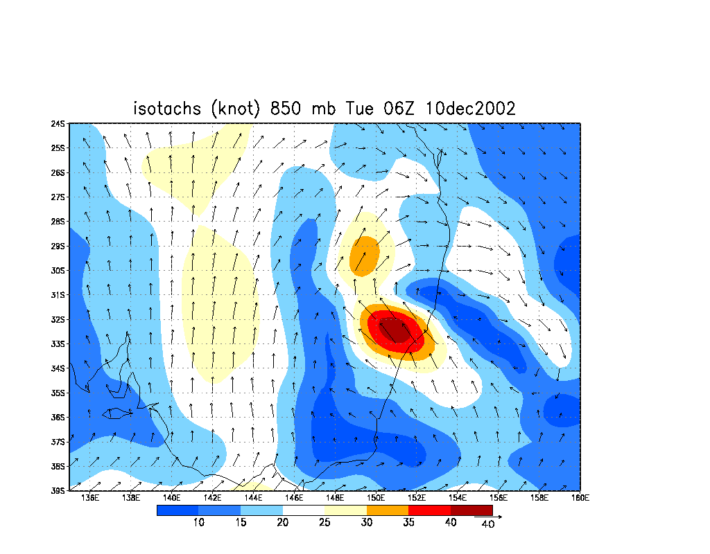
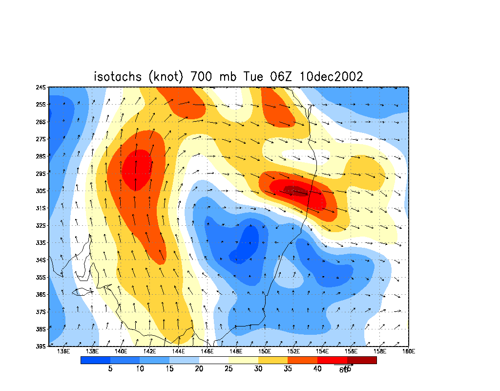
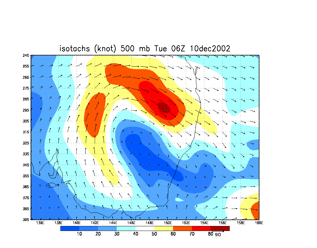
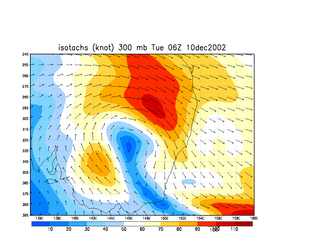
From NOAA 10/12/2002 06z analysis run
|
Document: 200212-02.html
Updated: 30th December, 2002 |
[Australian Severe Weather index] [Copyright Notice] [Email Contacts] [Search This Site] |