and Chasing
[Index][Archives]
Monster Supercell Outbreak - Hail and violent winds - an MCS - North West Plains - 23rd December 2002 - Special Report
report compiled by Jimmy Deguara
| Storm News and Chasing [Index][Archives] |
Monster Supercell Outbreak - Hail and violent winds - an MCS - North West Plains - 23rd December 2002 - Special Report report compiled by Jimmy Deguara |
Check these pages for all stills of this chase.
In the 10 years to date that I have been chasing, there have been a few storms and storm chases that stand out. Usually, it is either the extremity of being in the storm or the shear structure and organisation or perhaps the unusual nature of the storm that normally stands out. The storm chase on the 23rd December 2002 set new limits. The supercell complex that developed on this day is one of the most incredible in terms of unusual behaviour, organised structure, energy, and sustained winds. It turned out to be a long-lived system providing for an action packed several hour storm chase. It also developed into a major text book MCS (Mesoscale convective system). This event exhibited the behviours of storms observed in the United States Tornado Alley region in terms of an organised outflow dominated supercell complex. The only common severe weather feature not observed on the day was a tornado. This report is designed to give some insight as to what happened in greater detail and why such a system developed and became so strong and sustained itself for such a long period of time.
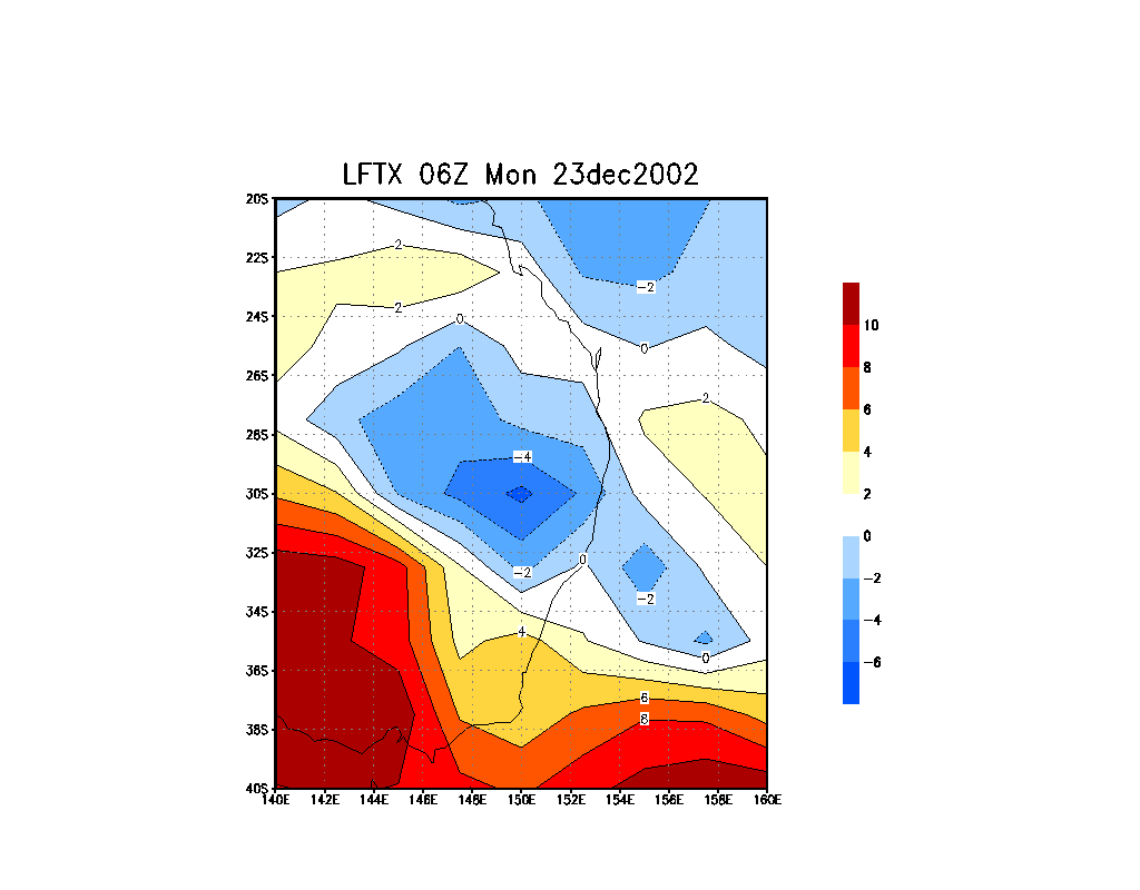
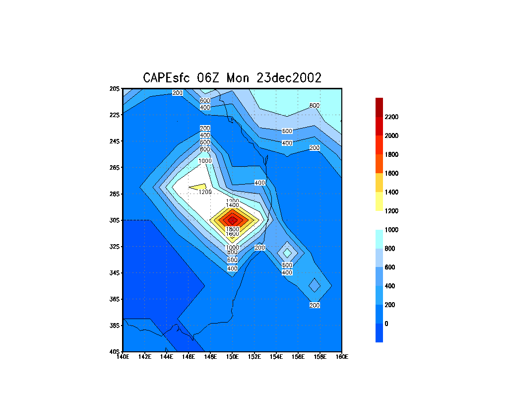
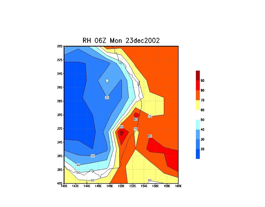
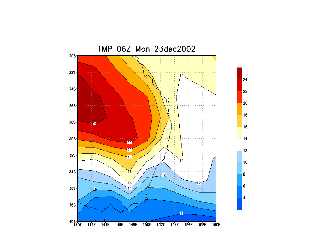
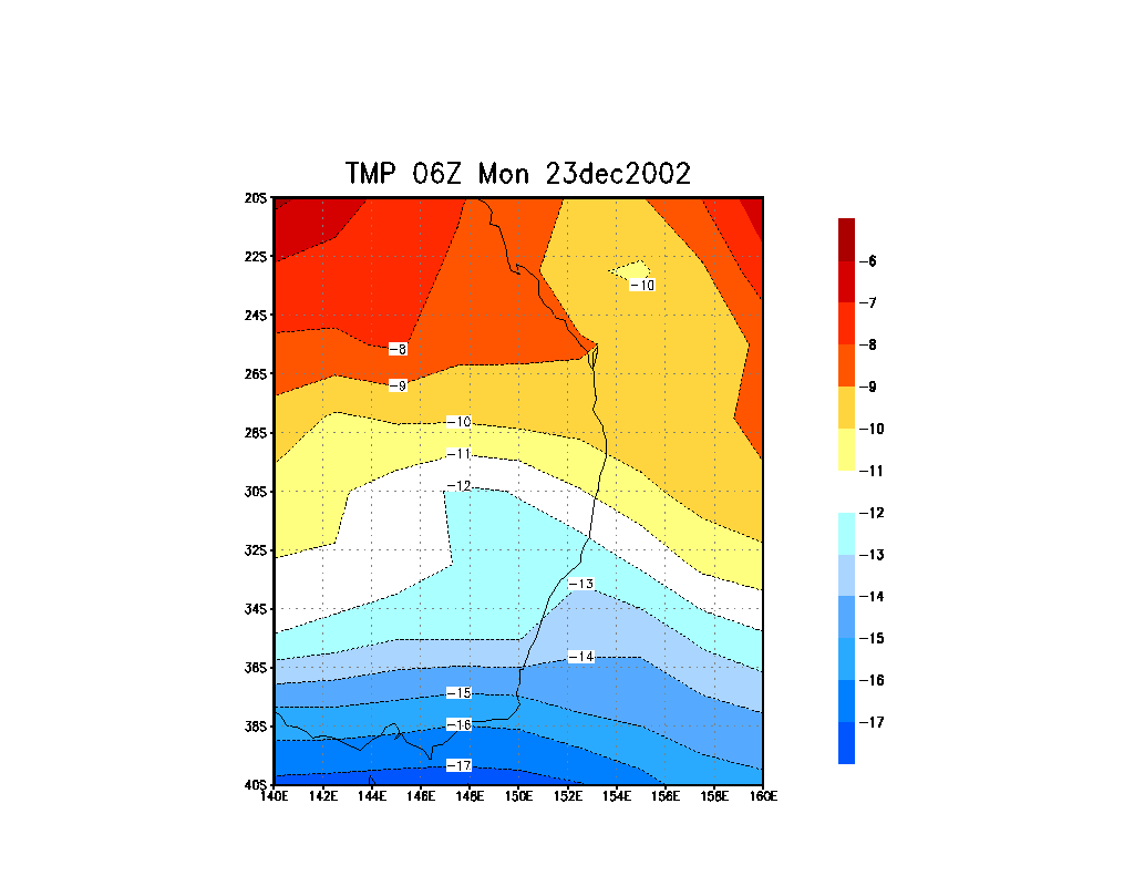
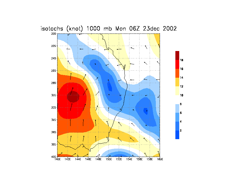
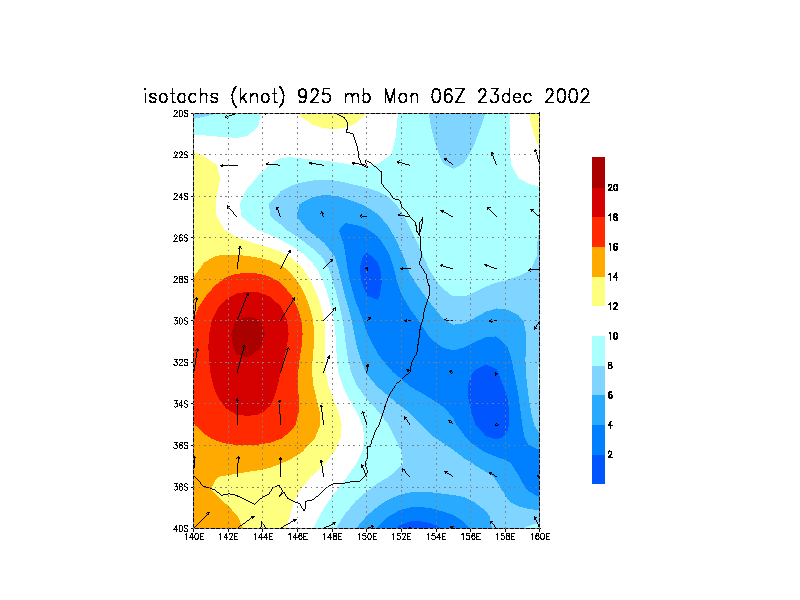
The build up to the event was consistent in the AVN models suggesting that widespread severe storms would develop anywhere from the Central West Plains to the North West Plains. There was a convergence line expected to set up aligned mostly north south but a slightly negative tilt to it. One of the most important feature was the moisture moving inland due to a deep moisture airmass return. This was brought about by the southeast change from a cold front moving up the coast the previous day. There was a reasonable wind shear profile sufficient for supercells combined with the very unstable atmosphere. Unstable? AVN model data predicted a core of Surface Lifted Index of -8 and a CAPE of 3000 though later models downgraded this somewhat. Capping was not a problem and would allow for storms to develop within the early to mid afternoon period. There was a subtropical jet south of the target area. There was ample midlevel moisture to support a large complex (something I am normally not happy with) but understandable under these specific conditions. The temperature profile was sufficient to hold down development to early or mid afternoon period (which meant we had to be in the target area early).
We had chased the previous nights (22nd December) activity from in Sydney (42 degrees Celcius in the western suburbs) at Maroota where the first cell shot through the strong cap gradually moving north creating a spectacular lightning display in the Hunter Valley region. A large anvil shield did develop as expected with many cells embedded within the complex. We stayed the night at Singleton.
The next morning, the chasers were up and off. After memorising the models with Nick Moir's support (thanks Nick - Library was closed), we targeted the region nearer Coonabarabran. This was a great drive along the Golden Highway west of Muswellbrook and over the open ranges around Merriwa and then towards Dunedoo. This trip was easy and with perfect timing. Low cloud was flowing over the mountains but broke around the western side - even within the Hunter itself.
Arriving at Dunedoo about 12:30pm, we noticed a line of cloud developing. We were curious in fact cautious of the dry line. We hate dry air and know what it is capable of doing to chases. We headed to Mendooran, southeast of Coonabarabran. You had to see the confused and worried look on my face when I noted the wind had changed direction. David noted the air was drier using his usual sixth sense hygrometer!! Deeply concerned about the cumulus rapidly developing to the east and the one to our south not being well organised, we decided not to panic and have lunch at Coonabarabran since Mendooran seemed closed shop food wise. By the time we made it to Coonabarabran, the line of cumulus extended overhead. This remained here only to develop further during our lunch break.
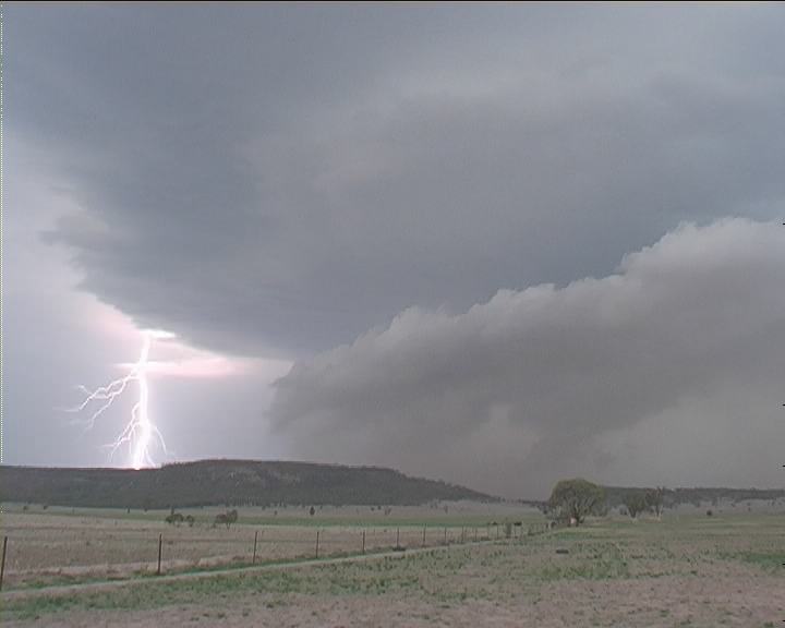
As he filmed the outside scene with myself narrating, I shouted "Quick David, there's dust!!" Strong outflow had developed from the storm at this stage about 5km out of the storm. At about 3:35pm, this dust continuously extended further ahead of the storm. Other storms were now developing further to the north. With substantial energy available, we hoped the sky would not totally fill out with numerous storms. We had to remain incontrol and within view. Chases are often lost or won from this angle. Well in between storm, another storm developed and dominated dropping wet microbursts on both sides - a nice toe on the southern side (3:54pm)!! By 4:10pm, we were in the storm, and hit hail again probably up to 2cm or so "on the edge" (David loved that comment). Persistent heavy rain made driving conditions hazardous and David suggested the hazard lights were a good idea. Winds were nothing to worry about though. Occasional lightning observed in the core several kilometres east. The rain and darkness set an eerie scene. As we approached the region with persistent lightning, winds increased in bursts. Lightning increased. Cars were parked on the sides of the road, nothing unusual when it came to hailstorms. Then I saw light through the driving rain. Several hundred metres, and we were out of the intense winds. Safe!!
I shouted in excitement. This was classic!! Scary but I must admit awesome. I found it intriguing that the violent weather was now immediately behind us but surprisingly not catching up. Ahhhh. The outflow from these bursts could be observed in the fields to the north of the core. More raised dust. David commented on stopping for a shot of the beautiful HP structure but trees ruined our chances. What amazed me that in the time we would have been in the storm perhaps 20 minutes, the gap on the southern side had closed joining the first storm. We had passed into the second major updraught. It was even more amazing that the anvil plume now large was so crisp on the eastern edges. Another updraught was now rapidly developing on the northern side in this region of organisation where the dust plume was being whipped up. The rain shafts were angled though the storm organised further meaning to us the storm still had access to inflow. It was actually sucking this inflow from way out of the storm above the outflow. We could note this by the behaviour of scud developing below the base like a shelf cloud formation and the outflow dust being lifted back in.
After a fuel stop at Gunnedah, we were off in a flash wanting to remain ahead of the storm and not again enter the same sort of conditions encountered within the core. Lightning now was strobing in the new core. It dropped more rain shafts yet was still able to maintain structure. We began to realise this system was an organised complex and would remain long lived. Outflow was so strong now that dust was being whipped up 10 to 15 kilometres from the storm on the right hand (eastern) side of the road. A gustnado developed as I admired the structure of the storm to the east. It maintained a thick anvil structure. We were headed for Boggabri.
Hills blocked our view for some time until finally arriving at a clearing about 5:30pm. Here we parked and filmed for the next 20 minutes. The lowering was still there even from 10 minutes back. Setting up the tripod quickly, I tried to capture this incredibly dynamic activity. Both David and I were in awe at the unusual nature of this wall cloud. It seemed to be rotating with visible upmotion though the rotation was anti-cyclonic (counterclockwise) yet David noted the base of the storm cloud was clearly visibly moving in toward the storm into the updraught region and seemed to be clockwise (cyclonic) in nature. Wierd. (Later thorough analysis has suggested otherwise - more below). Bolts were occasional though increasing in intensity. This wall cloud gradually ventured east towards us with the storm. Dense dust was being whipped up under the rain free base region but not rapidly moving outwards. The dust was remaining under the base and rising as well!! It was chaotic. There was so much happening it was difficult to get a grip of what really was going on within the storm. It was like a vicious struggle of airflow within this volatile region. And yet the whole time from when we got out of the core near Gunnedah, we were in constant fresh to strong outflow.
What we began realising was the break down stage of the wall cloud. This happened in real time revealing dynamic changed in behaviour. No need for time lapse to observe it either. Dust moved outwards almost in phase with an arcus cloud type of feature (is if it were trapped). It's movement was in towards the right hand side. The break down cycle then revealed one of the most frequent, powerful lightning bolt display I had ever encountered. It was incredible. I monitored the video camera's view but was able to use my own Pentax camera to grab photographs of the long pulsating lightning bolts. And these bolts were thick. There was so much energy being dispersed that even 3 intense bolts would flash in one go at times though one would dominate and pulse.
The core was slowly moving east and the dust slowly approaching us. Yes it was not over yet. The bolts were frequently either dropping from the rain free base, through the dust cloud and diminishing wall cloud, or the rain core. It was one of the most incredible spectacles we had ever experienced. Which way do we go when it got too close. A quick check on the compass and I knew finally that we were safe to go north as we were facing northwest. Dust began to move outwards. It would be silly to remain here with dust getting into the equipment. Visibility of the storm would have been close to zero.
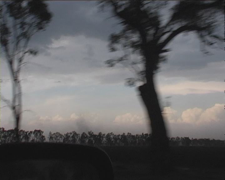
Now what made it interesting was that the winds were quite strong with outflow from the storms. We were up on an embankment as the road was elevated from the fields - probably 2 metres. We could see tumble weeds being moved around but we never thought much of them. One crossed the road and got caught in a fence on the other side. It was David though that was to realise the so-called 'uncomfortable' nature of tumble weeds. One had creeped up the embankment and stopped at the car. With window open, spikes and bits and pieces entered inside. I kicked it out of the way along the car and gradually it was on its way. Same wall cloud as in previous stills
Heading east about 6:45pm revealed a "cow catcher" type formation so atypical of well organised HP (Higher Precipitation) supercells and also the massive rounded updraught and lowered base to our south. Absolutely impressive. It deserved some more video footage.
With Mt Kaputar hills in our sight, decision time. Do we head north-northeast (in case another updraught develops) or keeping heading northeast... Heading north-northeast was the fateful decision. Our storm chase was practically over. Just like that. What's going on over those hills. The vision of the beautiful HP Supercell interacting with those hills entered my mind. Do we turn back. "It's most likely too late.." David suggested considering we may have had to face the powerful winds of the core. We simply had gone too far. We were disappointed but we were tired. We had chased consistently on the go for over 4 hours. It was getting late. The nearest town was Moree. Finally surrended, we headed back to Moree and booked in for the night. Lightning across the near horizon suggested another section of the storm line was approaching. We needed food and wanted some more action. So we settled for MacDonalds. The wait in the drive thru was so long one could have eaten inside quicker and at least avoided the exhaust fumes!!! Besides, there was a storm on its way. In the motel, we watched in awe as our footage revealed the incredible structures produced by the storms. We began to pick features we had not noticed in its true entirety. The motion - the differential flow seemed to indicate cyclonic rotation yet the wall cloud was anticyclonic, something we had never experienced and not fully understood to this point. And how many wall clouds were there just in our sight!!! And the lightning, those bolts were powerful and some strobed for 2 seconds, behaviour comparable to lightning bolts we experienced in the Tornado Alley 27th May 2001 monster HP supercell chase. What about the outflow wind dominance and the long lived nature of this event. We may have been tired but we continued to watch video into the early hours of the morning. These sort of chases are not forgotten and produce adrenalin that lasts for months. It was definitely the Storm Chase of the Year.
We returned home on Christmas Day after spending the 24th December trying to determine whether to chase the coast (decided against it), or chase the same region (outflow boundary was a concern). We ended up getting a few pretty pictures from a half hearted chase. Ideally we should have chased well to the north which is where storm exploded. On second thoughts, it was too far to travel and we had to be back in Sydney regardless. Besides, we were content with the successes of the 23rd December 2002 chase.
In this section, updates of the analysis of this event will be posted since we have not to this point concluded what most likely happened.
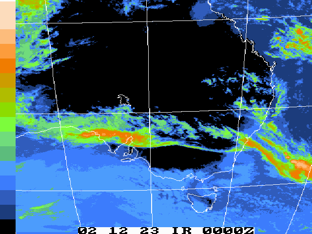
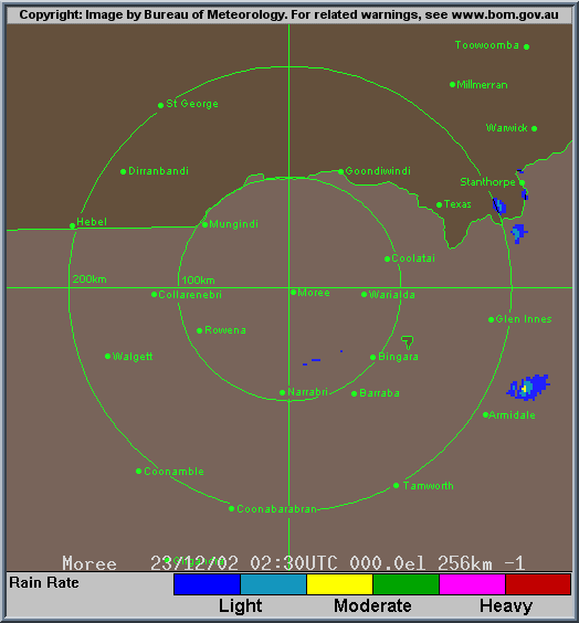
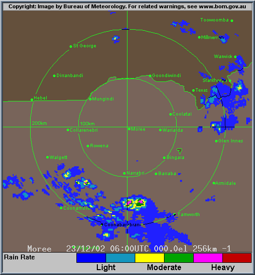
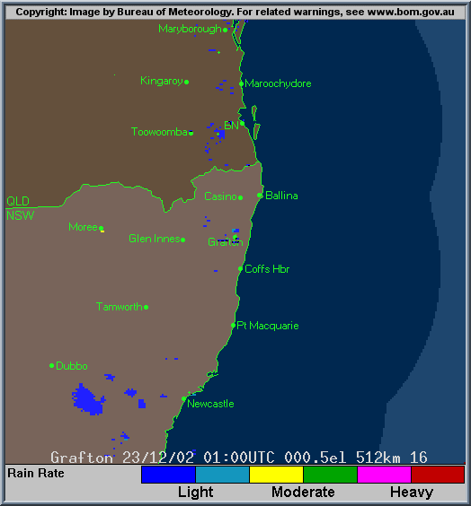
It seems once you spend ample time looking intensively at the video evidence, radar, satellite and conditions observed on this day, it is still difficult to determine what was going on. We have sought other's opinions to gain a better understanding and check if what we had observed has been documented or observed elsewhere and how common. What cannot be assumed from evidence we have had is we cannot conclusively verify the existence of mesocyclones (we suspect up to five are possible) until we have sufficient evidence to do so. We probably will never be able to verify this. Unfortunately at the time of greatest activity on our chase, it seems the storm was too far away from the radar and also offline for some time. The radar does show weakening of the cells into a messy rain region past the Narrabri area but prior to this you can observe that there seems to be change in the direction of cells to a northward direction. There seems to be at least 3 major cores being picked up from this distance of about 150 to 200 km from the radar.
Conditions on the day were sufficient for supercells since there was major convergence, moderate but increasing windshear and also a very unstable atmosphere. The deep moisture profile combined with these conditions therefore would have favoured HP supercells which is most likely what we have experienced here. The storms were very severe as encountered by passing through the core, the updrupt changes in behaviour, the longer lived nature of each of the upraughts and the organised nature of the complex. Hailsize on the edge of the core was large ( estimated up to 4cm) though not giant (5cm and over). Cloud tops and the severe lightning behaviour of the complex indicated a deep atmosphere.
If you (or someone you know) have any photographs or video of this event or any other type of severe storm such as damage, the storm structure itself or hail, please feel free to contact Jimmy Deguara. Your contributions are very welcome. Please any photographs or video footage are important so don't discount anything.
From Bureau
of Meteorology.
From Bureau
of Meteorology.
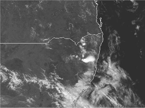
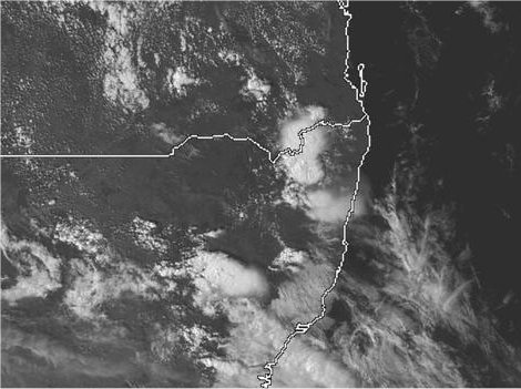
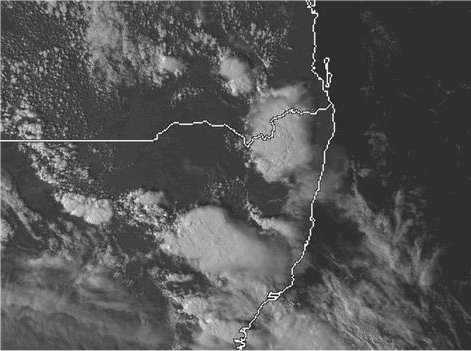
High Resolution satellite pictures - note the large anvil shield that explodes and overshoots that exist within this plume (Courtesy of The Weather Company)
From Bureau
of Meteorology.
From NOAA
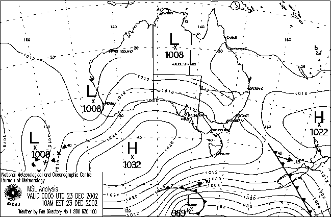
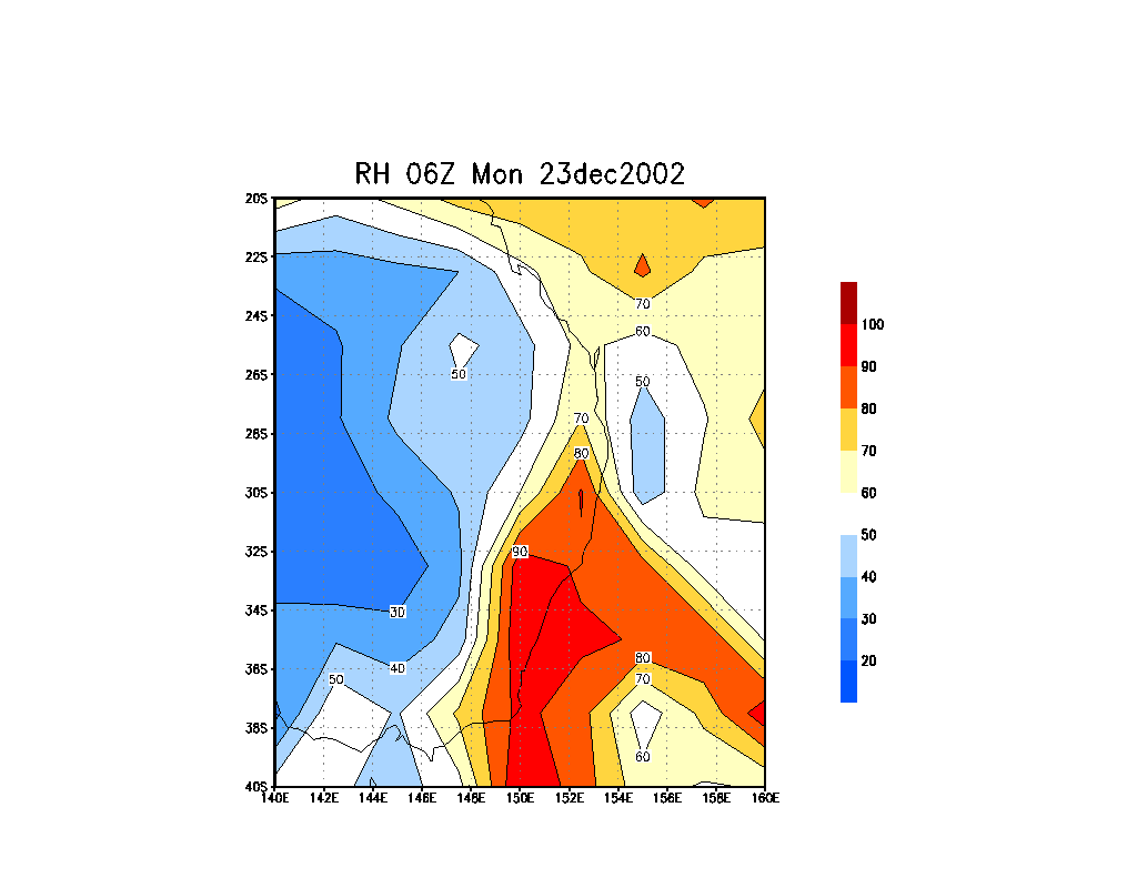
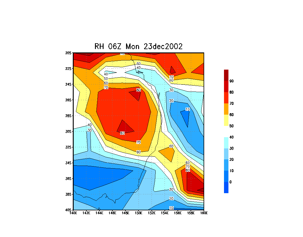
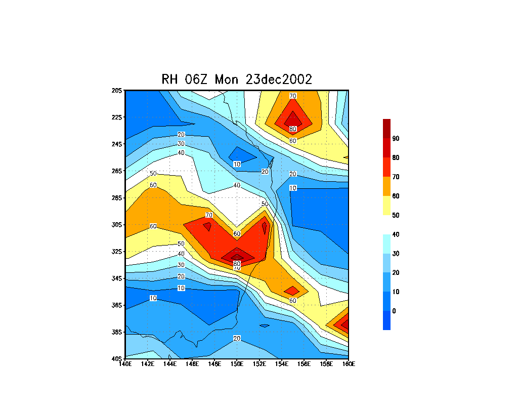
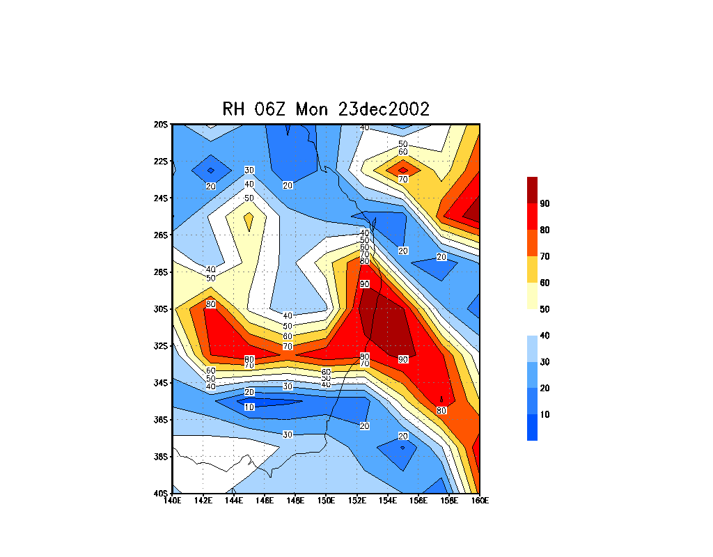
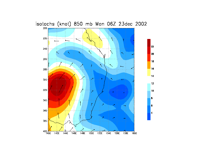
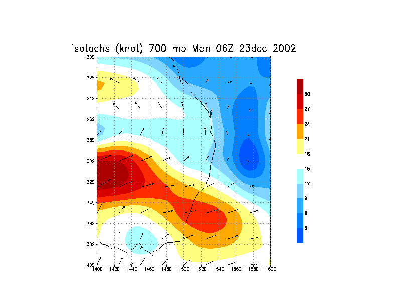
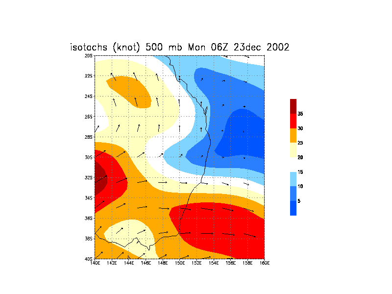
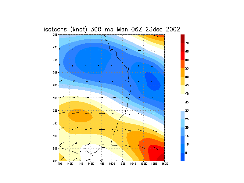
23/12/2002 06z analysis run
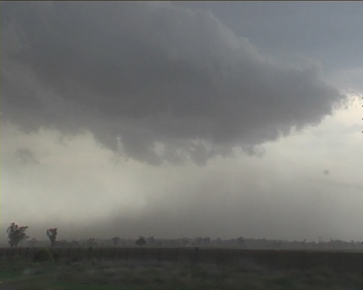
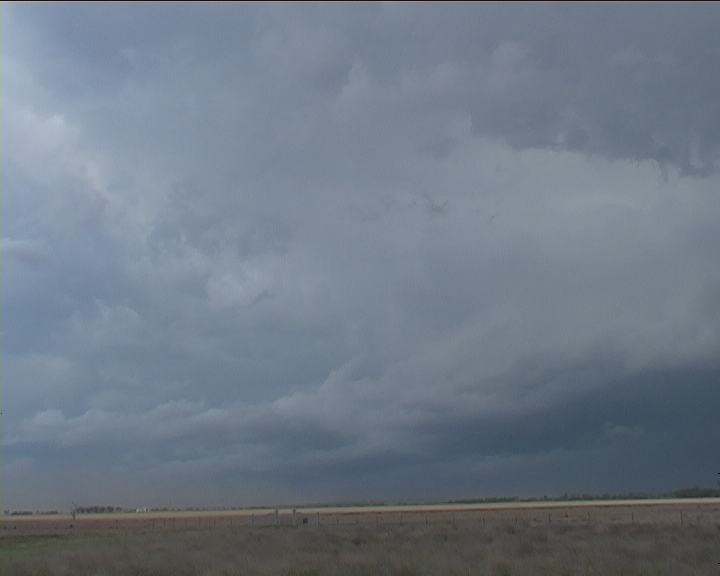
 Finishing lunch just after 2pm, we wasted little time and headed out towards Premer. Not the best organisation of cells except for one partially hidden cell further east. This seemed the most mature. Well hidden until one powerful updraught on its western side simply exploded upwards. That's our storm. I shot some video of this major updraught. Time was 2:45pm.
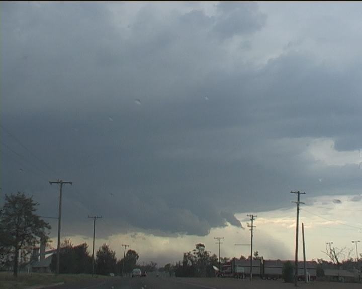
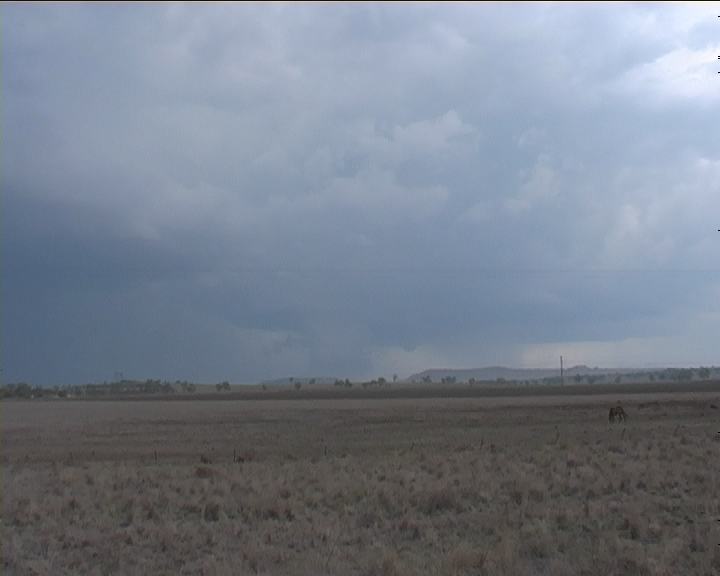
 On a hillside further along our route, we stopped for video opportunities. There appeared to be a lowering (wall cloud) although it was not clear to be confirmed from this angle. The rain basically covered our view. I was hoping that we would not have to drive into the main core to go north. What luck!! The core was on the eastern side of the road north to Mullaley. The direction of storm development was expected to be generally north to north-northeast. As we edged the core within a few kilometres of the turnoff, strong winds spat a few stray hailstones onto the car within the heavy rain probably about 1.5cm range based on the sound onto the car. You could see the green in the base now just to our east!!! The storm was intensifying.
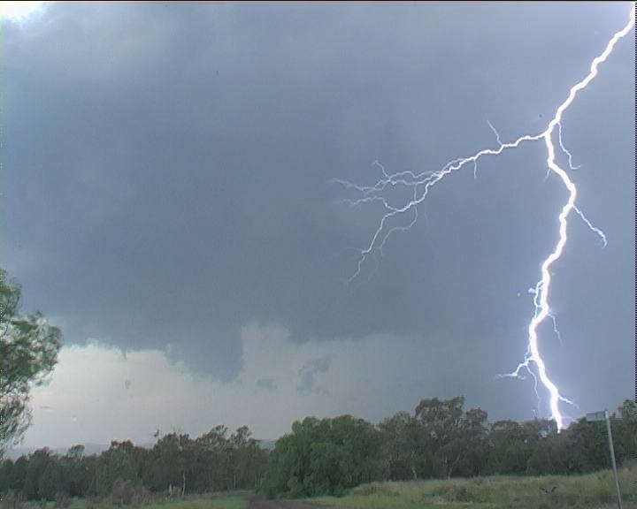
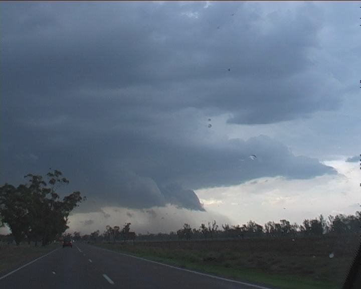
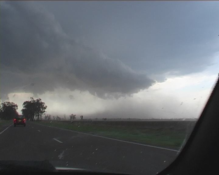
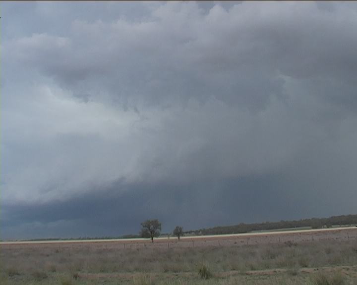
 Finally, we made it to a clearing and stopped about 3:25pm. The wall cloud could now clearly be seen with slight rotation. A small funnel protuded from the base though nothing out of the ordinary to be any serious threat. Outflow hit and we were again off further north.
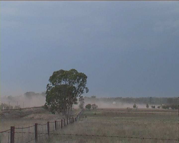
Quite spectacular but this time the dust remained sustained in the outflow domination. I have yet to observe a continuous dust plume coming from the storm all the way out. We panned footage to reflect this feature. And it persisted indefinitely.
Finally, we made it to a clearing and stopped about 3:25pm. The wall cloud could now clearly be seen with slight rotation. A small funnel protuded from the base though nothing out of the ordinary to be any serious threat. Outflow hit and we were again off further north.
Quite spectacular but this time the dust remained sustained in the outflow domination. I have yet to observe a continuous dust plume coming from the storm all the way out. We panned footage to reflect this feature. And it persisted indefinitely.
 They were easily observed moving rapidly outwards. Lightning activity was becoming more persistent and some bolts were pulsing. This storm was intensifying rather rapidly and now hail shafts!! Finally it was decided the only way to get to the other side was to head onto the road to Gunnedah. This meant passing through the core.
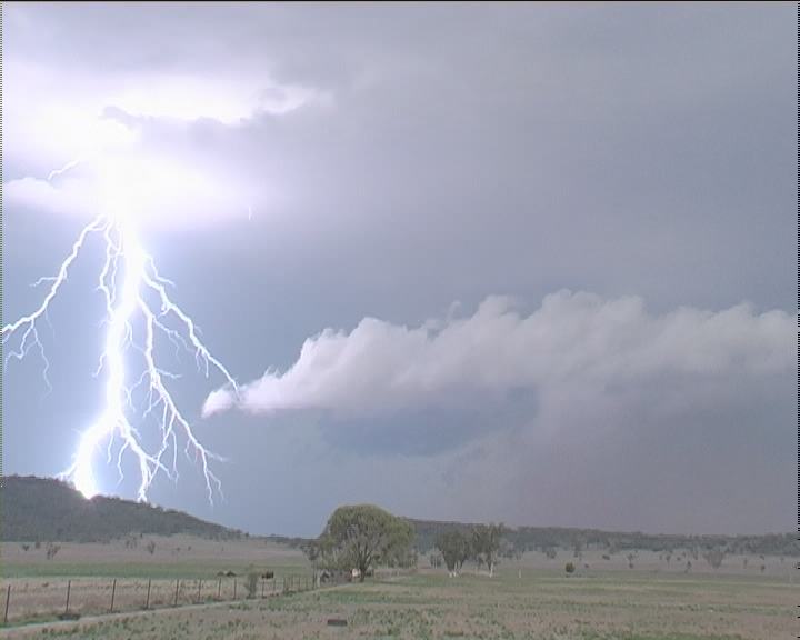
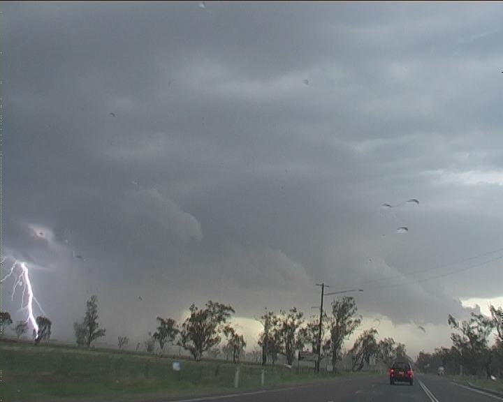
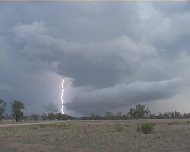
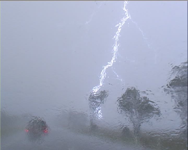 Then a bright flash!!! A lightning bolt down the road followed by loud clap of thunder as we approached. Then aqua-planing. Suddenly bursts of rain and winds hammered our vehicle. "HP Mate" I commented. Large hailstones thumped the bodywork and windows. "Ohh Shee. That's big bolts" I commented as a bolt peirced the countryside to my right. Then a loud thunder. It was whiteout conditions - it reminded me of the 16th February event only this time the rain was driven horizontally. But those 'pink' lightning bolt flashes were incredible and this reminded me of tornadic thunderstorm behaviour in 1984. Within the heavy rain, violent winds and with windows closed, you still could hear thunderous bangs outside. These bolts were powerful!! They lit up the fields creating that eerie backdrop. I concentrated on driving. We were now getting increasingly concerned. This was not the intensity suggested by the severe storm earlier. Each burst produced stronger winds and bursts of large hailstones. It was obvious the stones were large enough that damage was a certainty. It was even more of a concern that hailstones were pounding the side panels and windows. I could notice David commenting for a blanket or towel. Occasional hailstones of about 4cm driven with these now violent winds were testing the threshold of the windows now increased in frwquency. All I could think of was "HP"!!! (High Precipitation supercell - time 4:15pm). We were right next to the core and I was now worried about possible tornadic activity as winds were increasing dramatically beyond the strong winds further back.
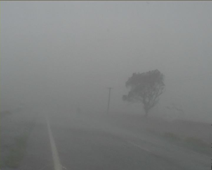
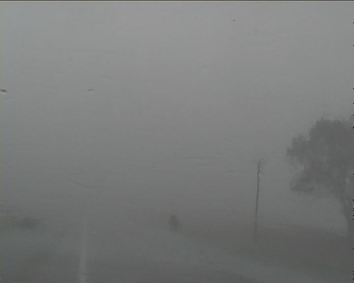
 "Wooow, what was that!!" The powerlines had sparked (probably because of debri or shorting out by contacting each other in the intense winds) - the 'sparks' drifted in the wind momentarily. Lightning bolts were frequently strobing in the fields to the right. Trees were constantly bent over. I was also checking for debri; concerned our vehicle could get hit. "What's that", I shouted. A gush of wind driven rain pounded the vehicle - visibility zero. "This is the core!", David commented. "Get ready to duck.... get ready to duck". It was not that often that I did but this time I had to stop - zero visibility. Large hailstones were now prefusly pounding the vehicle. After stopping briefly, we moved on. "What's that". Another powerful burst. We had approached this brownish low streaming layer. This time muddy water was being splattered onto the side windows and on my side of the windscreen - something I had never observed before (recorded on video). This was downright incredible!!!

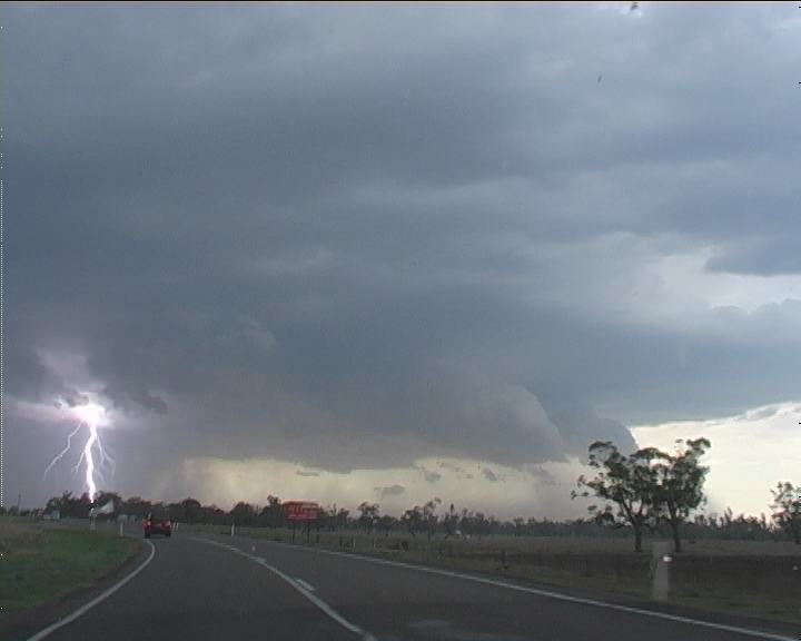
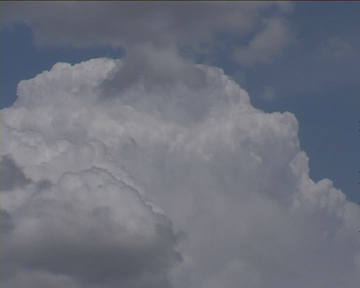
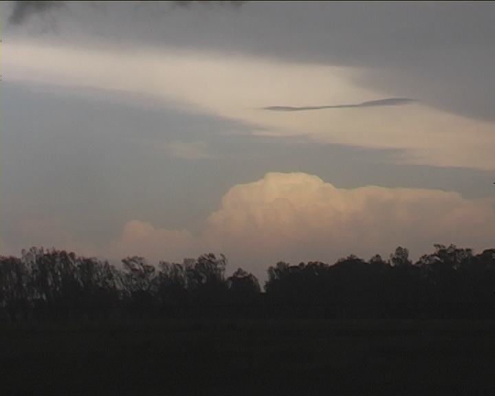
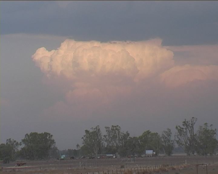
 And that nice storm to the east or northeast over the southern Northern Tablelands made for an excellent comparison. It was powerful yet it looked so minute on the scale of this storm. This was turning into a massive complex. High CAPE was being utilised. The storms were outflow dominant though organising on the northern side.
 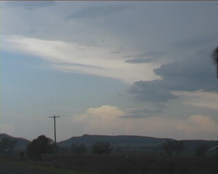 There must be inflow I thought with such quickly developing structure and rapid organisation. We both knew one thing, like yesterday, the storm was now tapping a deep atmosphere simply by the nature of the thick, powerful pulsating bolts and the clearly crisp massive anvil. This was a sign of strong updraughts in the storms.
 Arriving at Boggabri 5:10pm, I felt I had to get some time lapse of this 'eastern' storm. Setting up my tripod, wrong fitting on the video camera. Upon return with the correct fitting, the tripod was on the ground blown over by the constant outflow winds from the storm.
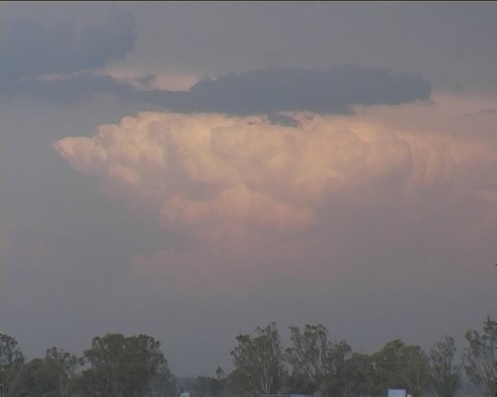
 Time lapse was attempted though it was near impossble to keep the camera still. Nevertheless, I was glad I got some footage of the varying stages of the changes in development of this powerful cell in the southern Northern Tablelands.
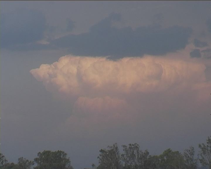
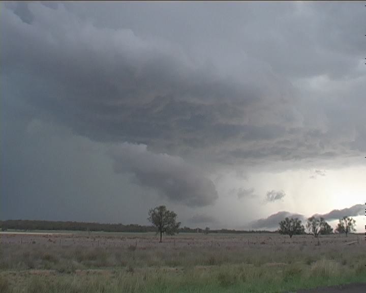
 Retrieving the tripod ready to walk across the road, David and I noticed a lowering on our storm. Wow!! It had organised and revealed itself within this 5 minutes we had stopped. So we headed for a clearing.
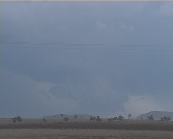
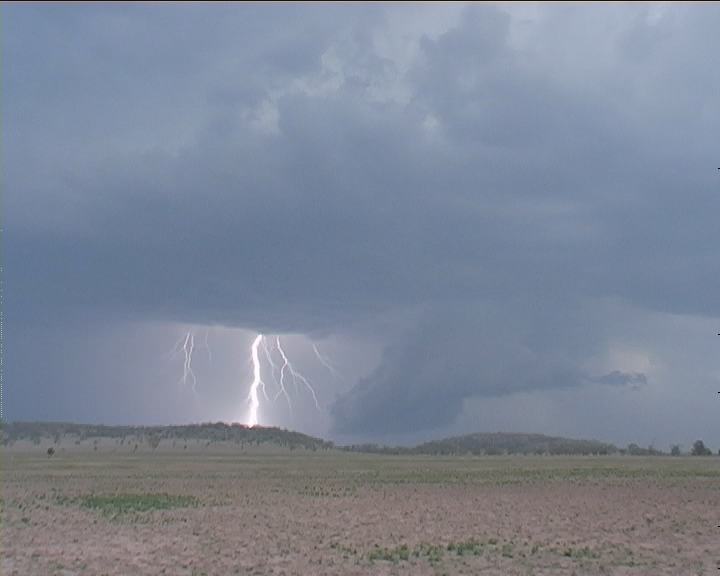
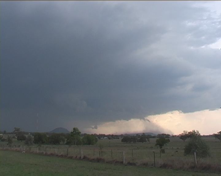
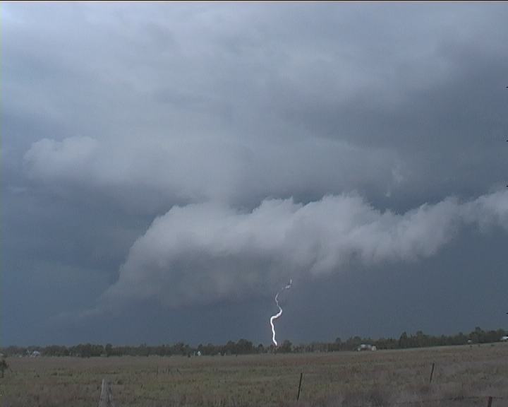
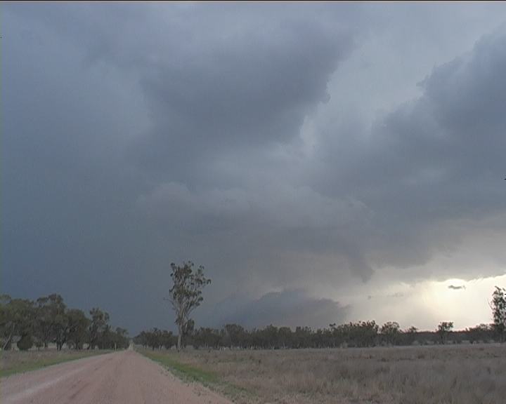
 A major rain free base with a large lowering (developing wall cloud) was in the centre of this region. This lowering almost was on the ground - time about 5:20pm. The storm was some distance away perhaps 15 to 20 kilometres distance. After this brief stop, we headed north again.
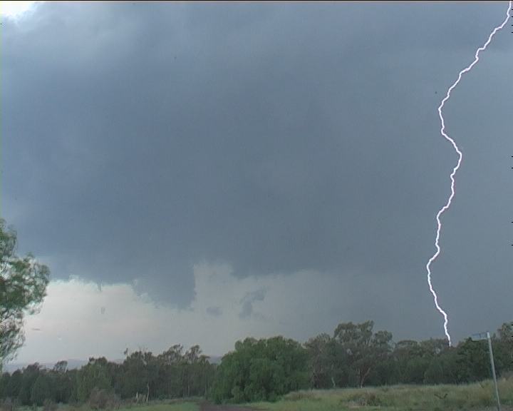
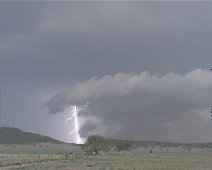
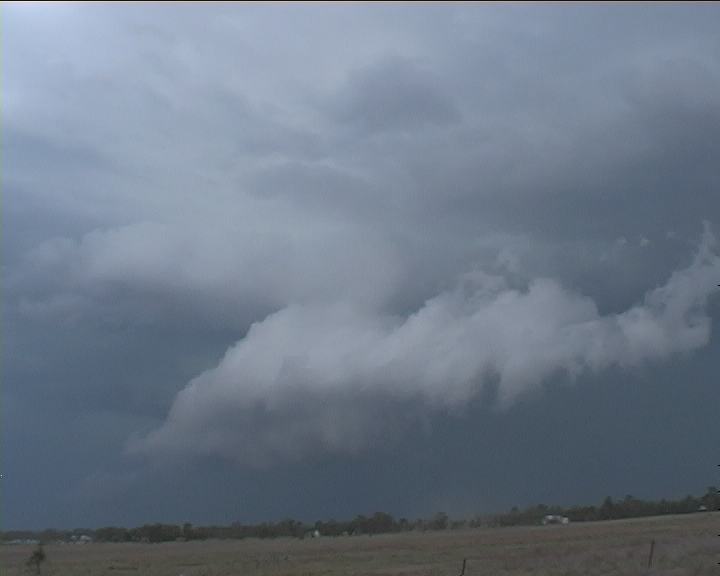
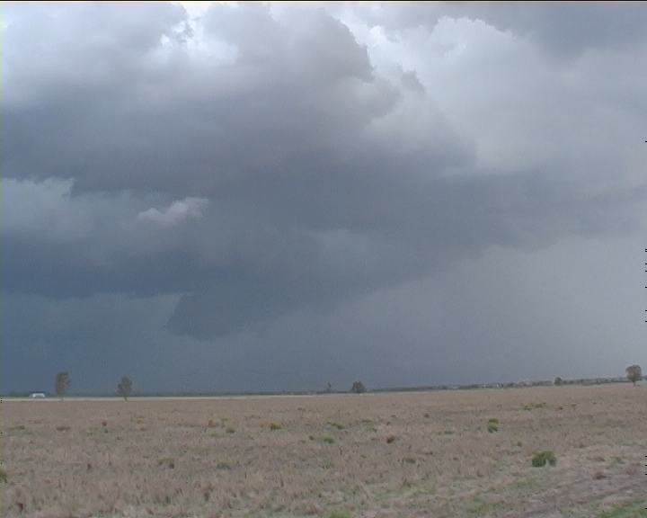
Wall cloud going through dynamic changes
A major rain free base with a large lowering (developing wall cloud) was in the centre of this region. This lowering almost was on the ground - time about 5:20pm. The storm was some distance away perhaps 15 to 20 kilometres distance. After this brief stop, we headed north again.
Wall cloud going through dynamic changes
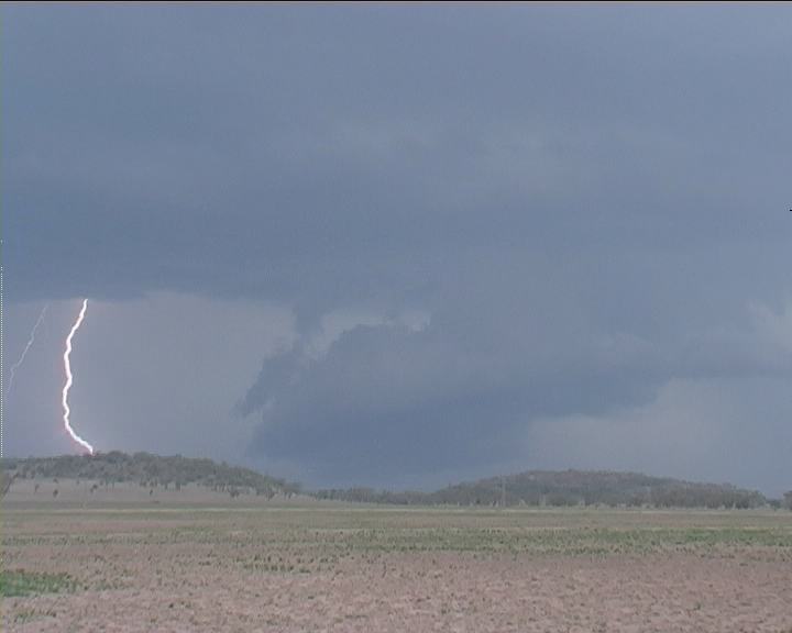
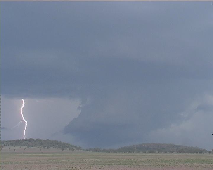
 Wall cloud going through dynamic changes
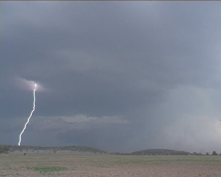
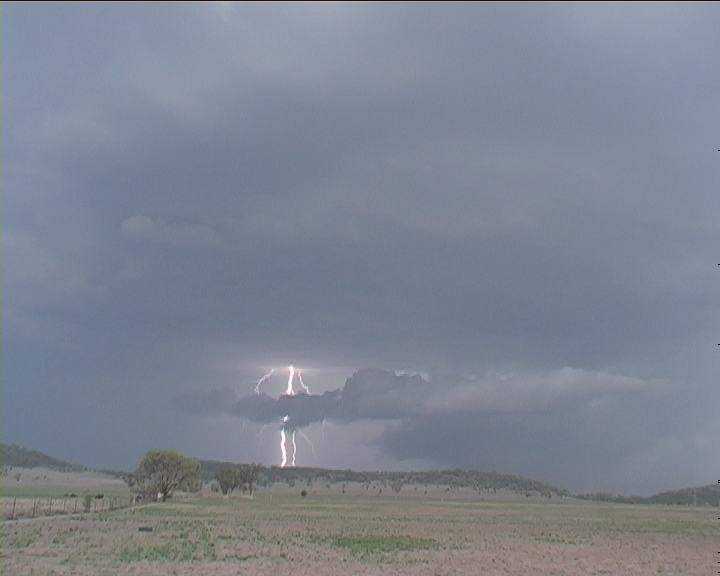
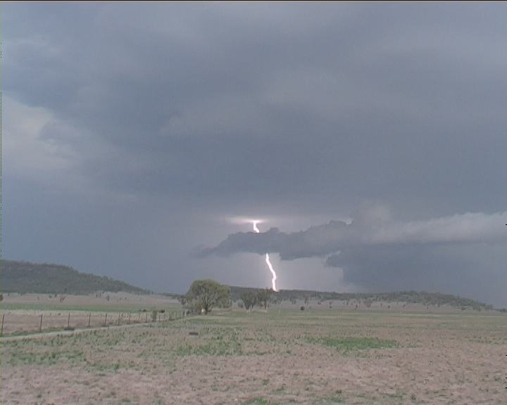
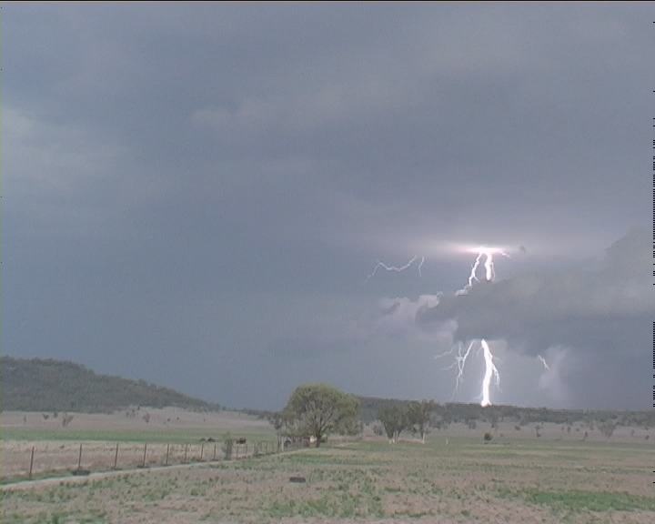
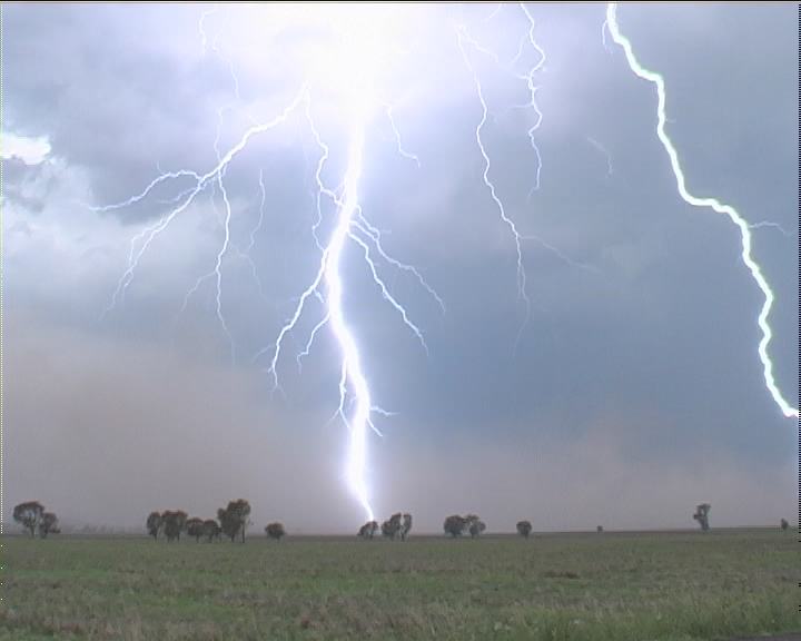
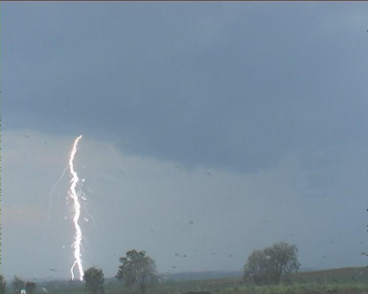
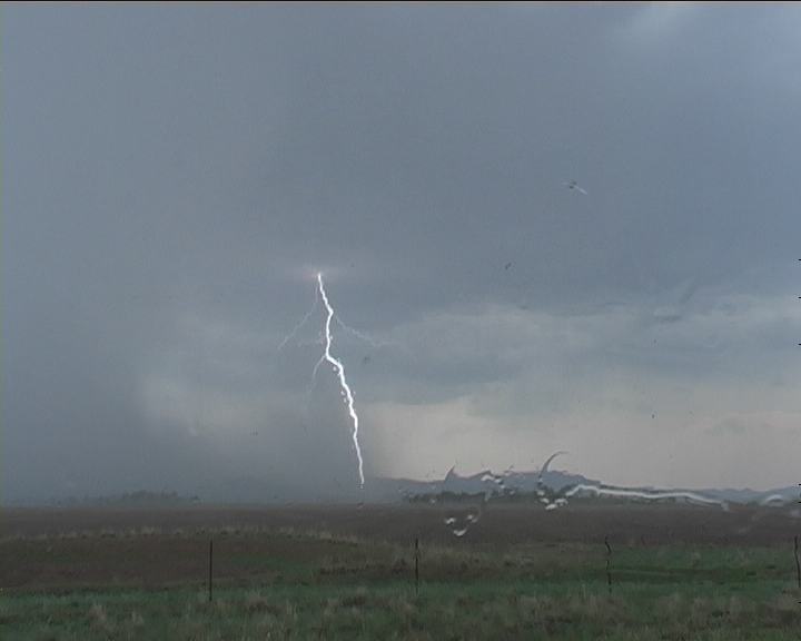
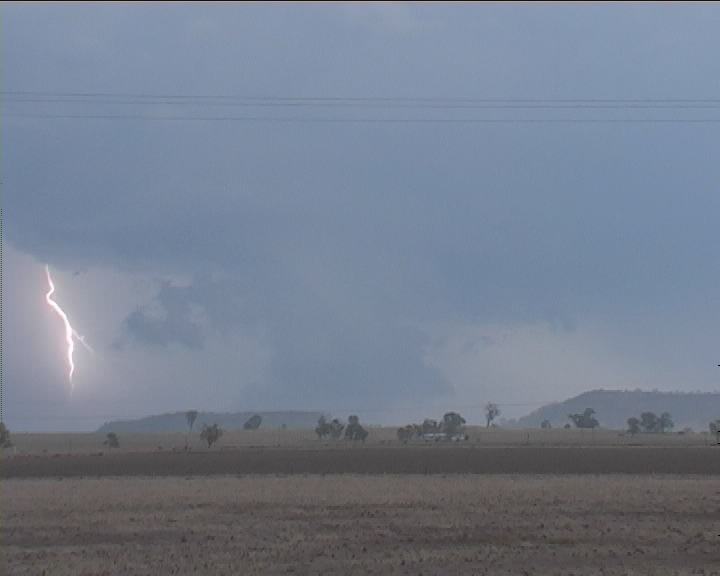
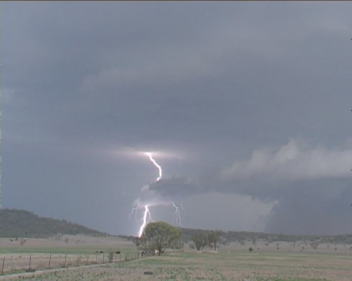
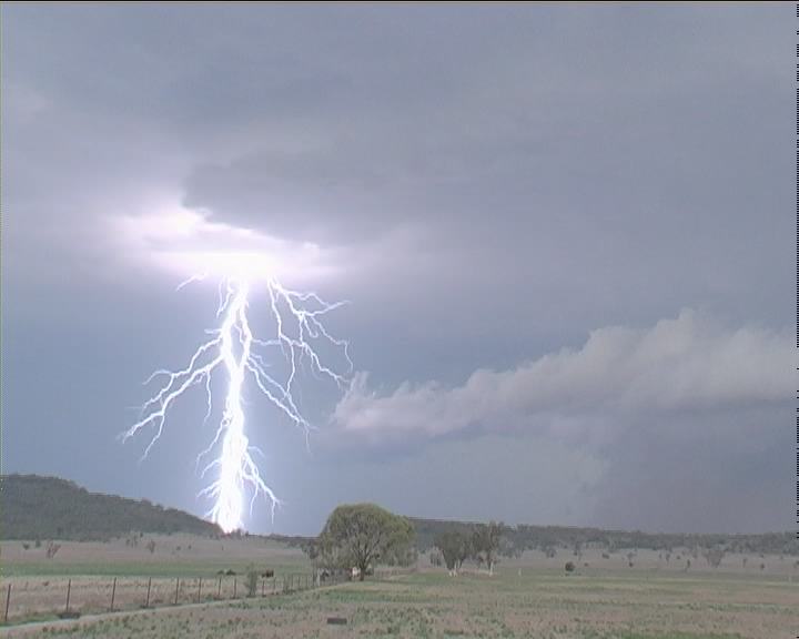
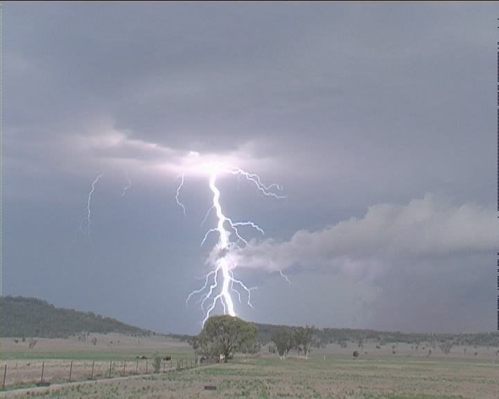
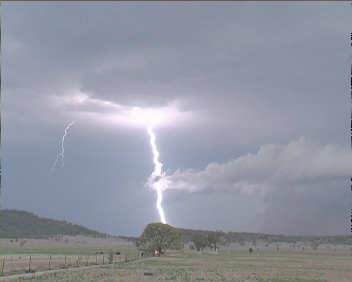
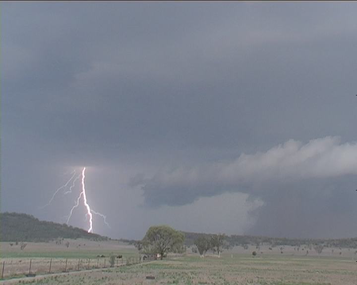
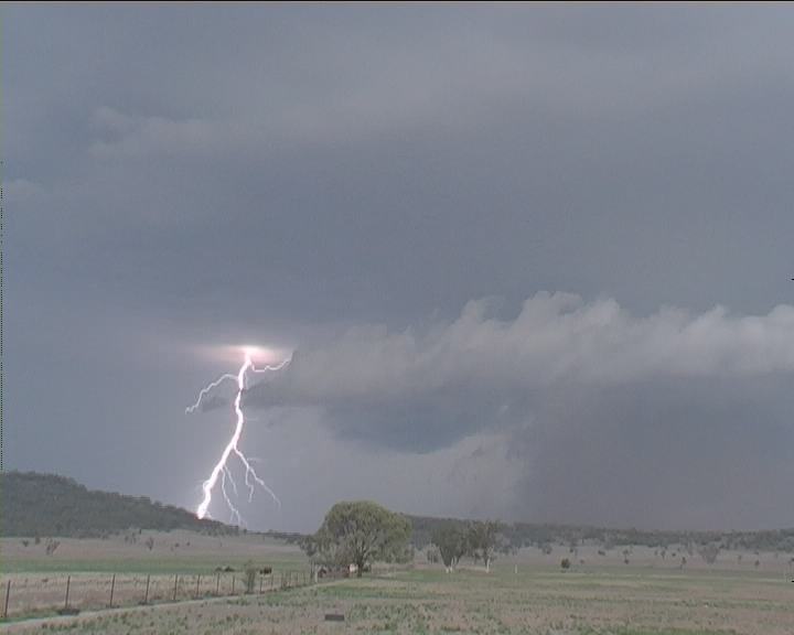
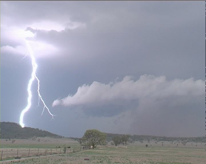
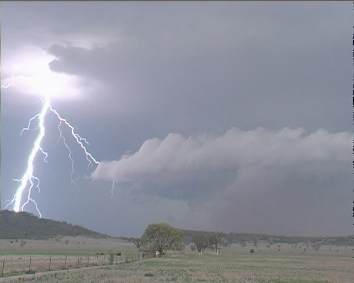
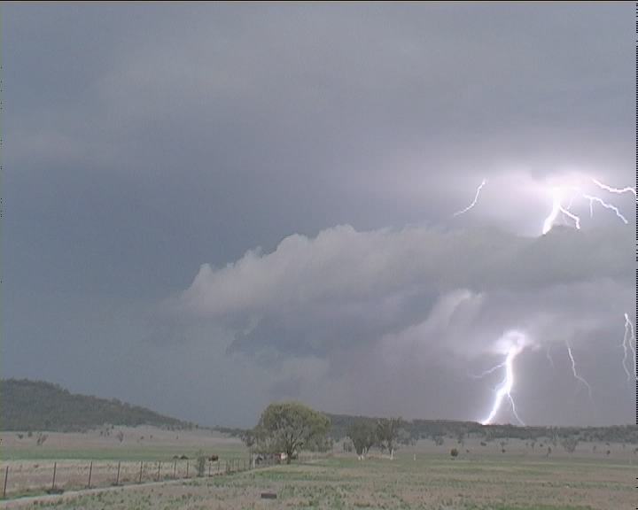
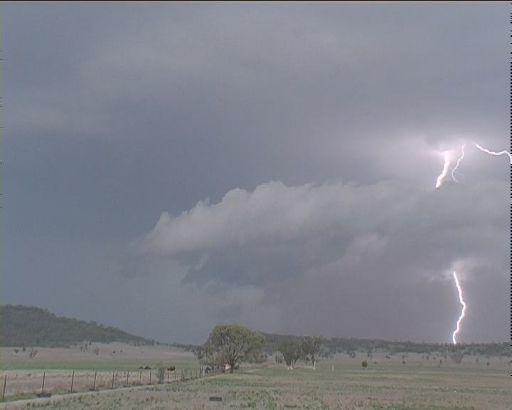
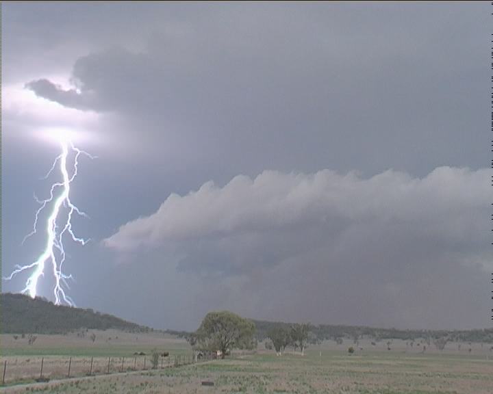
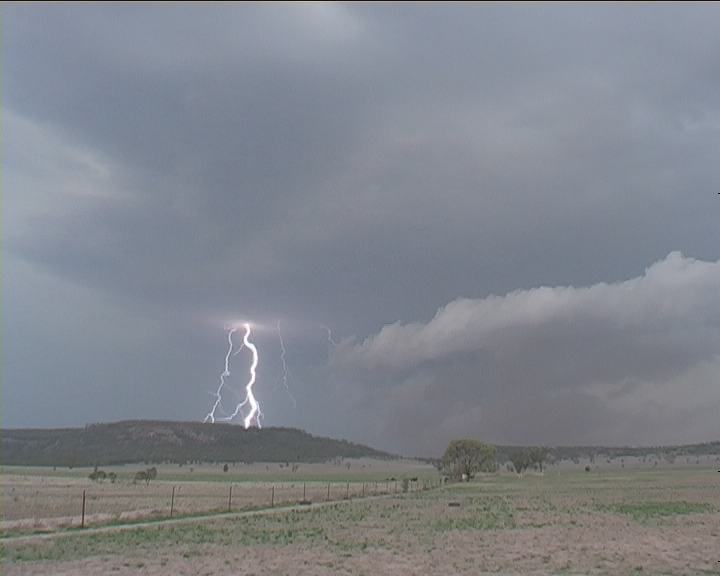
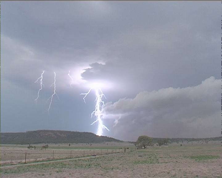
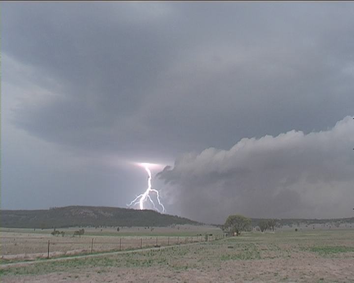
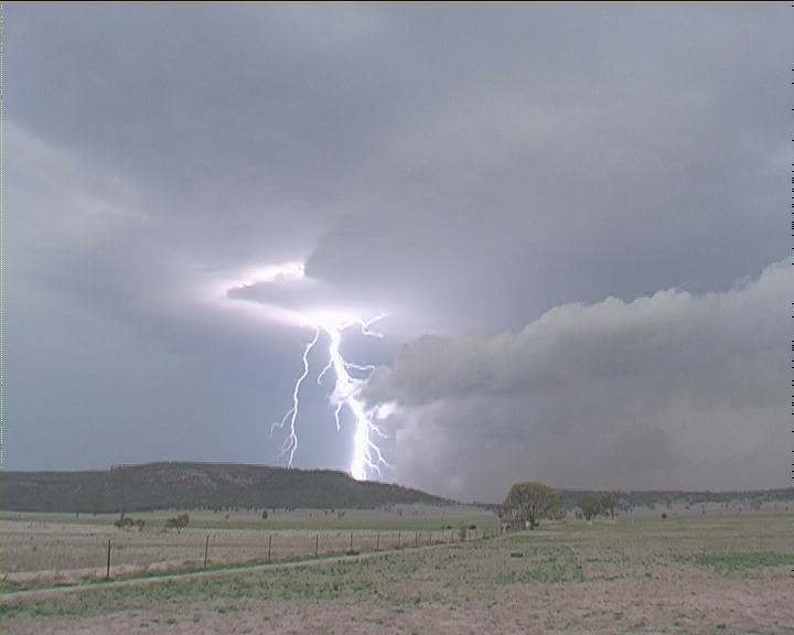
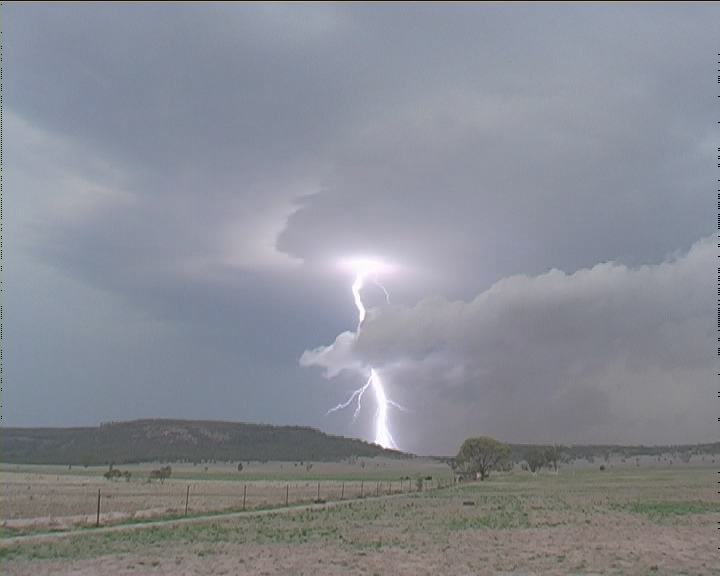
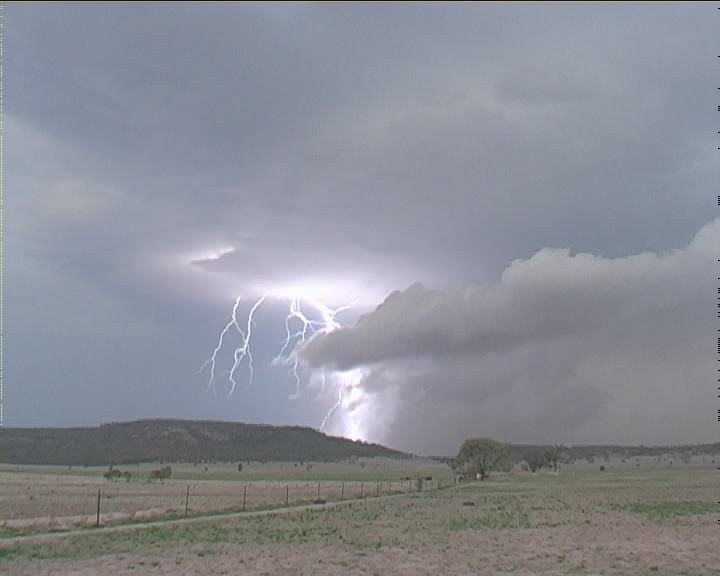
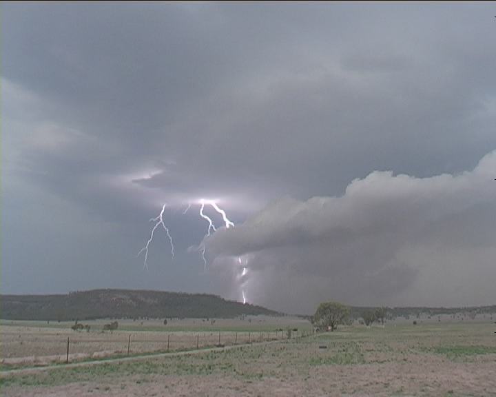
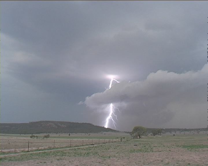
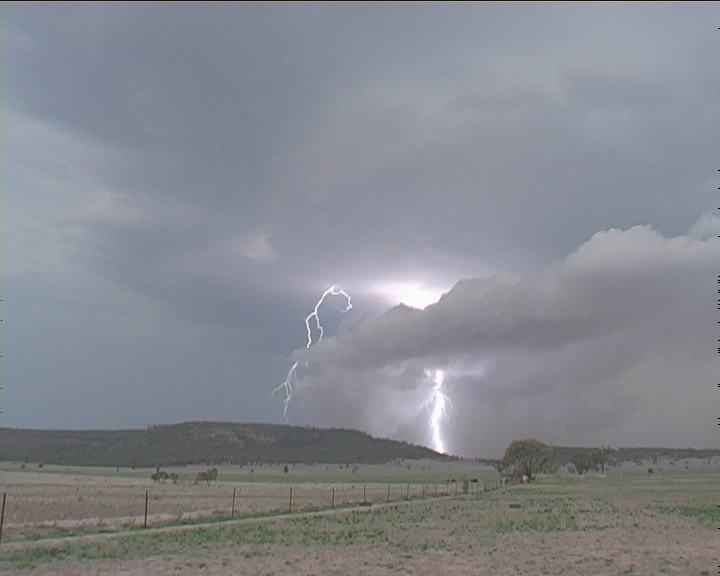
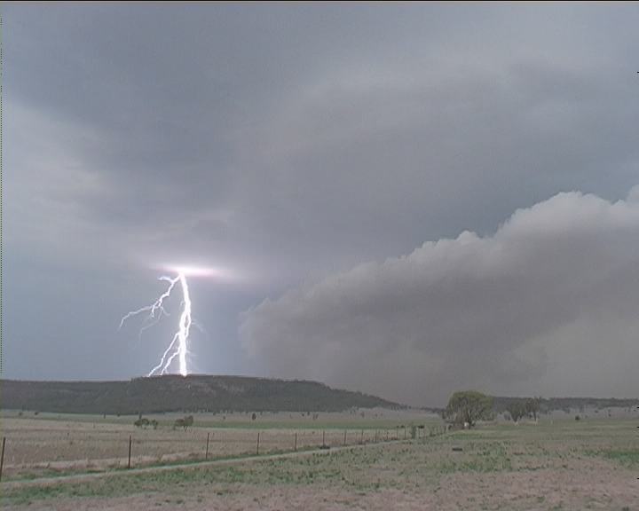
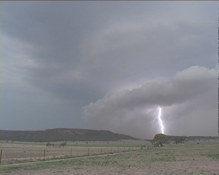
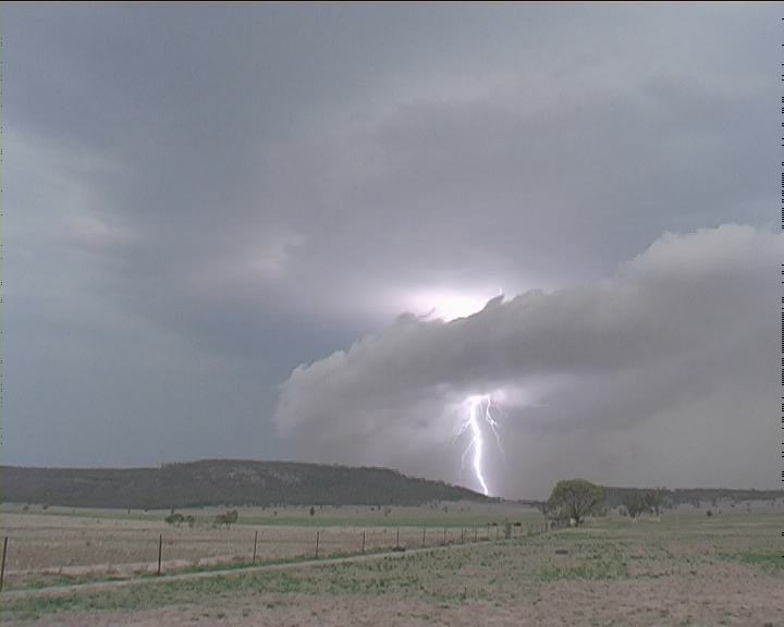
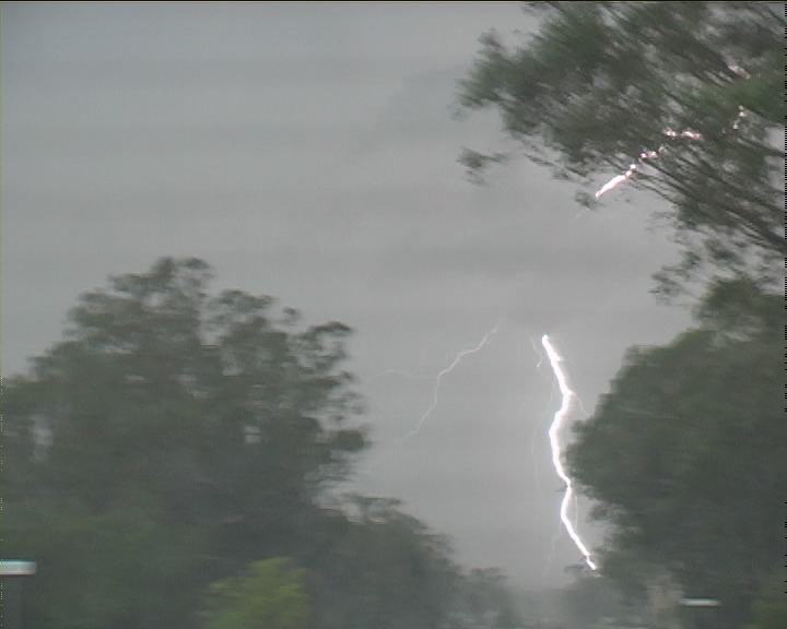
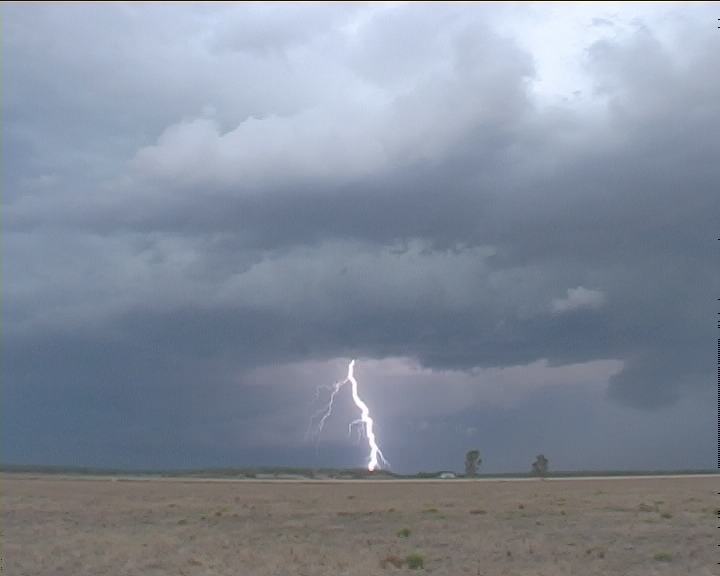
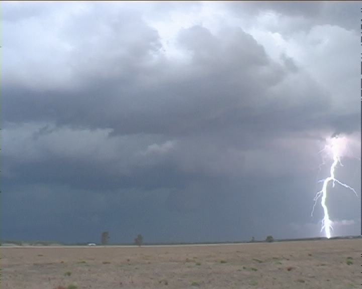
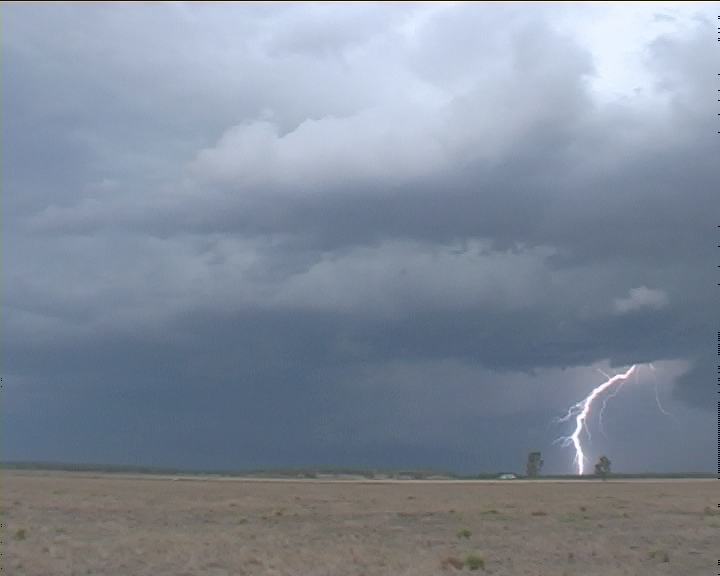
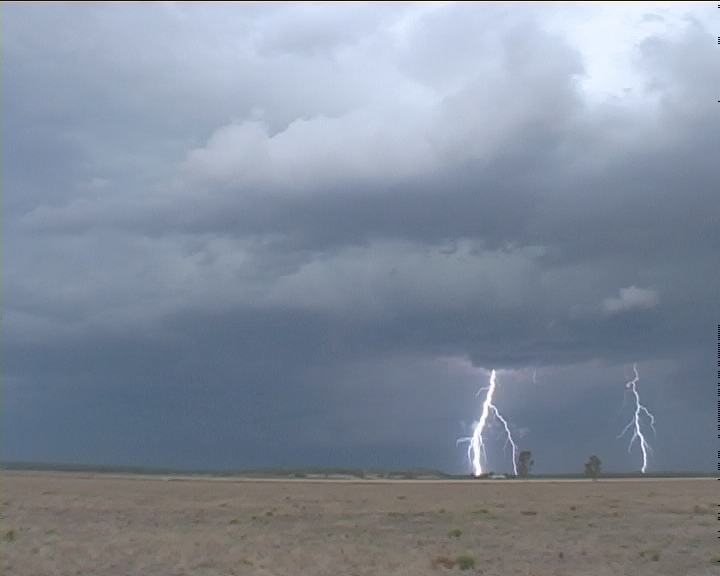
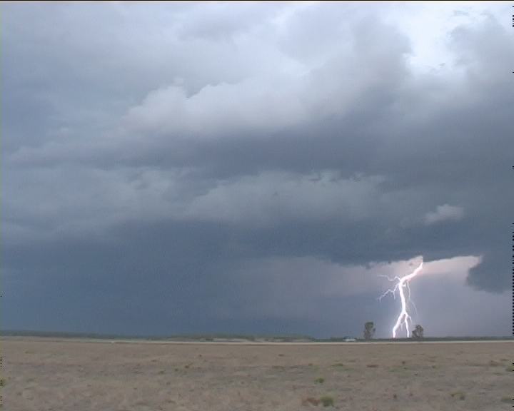
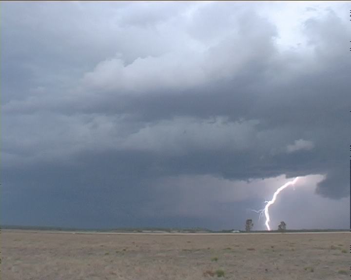
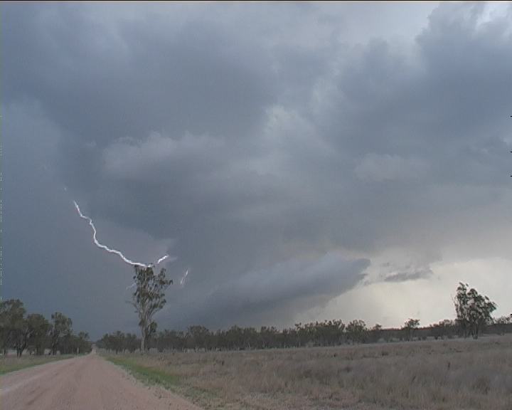
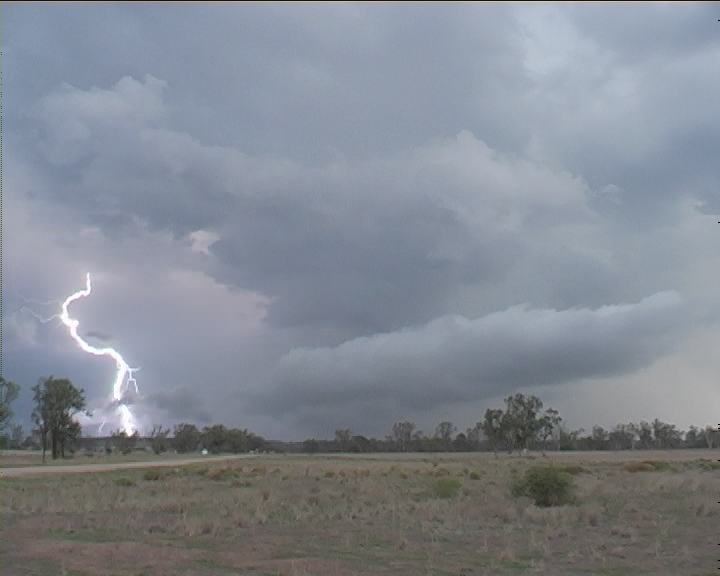
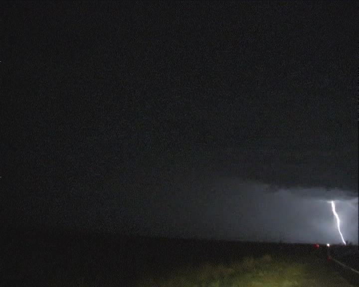
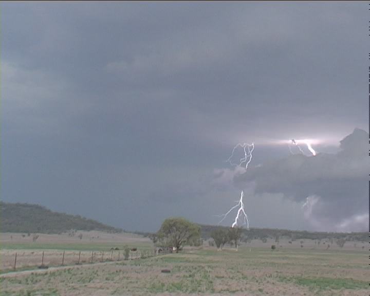 Some of the more spectacular lightning stills obtained mostly in a 5 minute phase. Check these pages for all stills including the lightning.
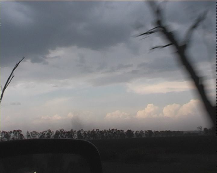
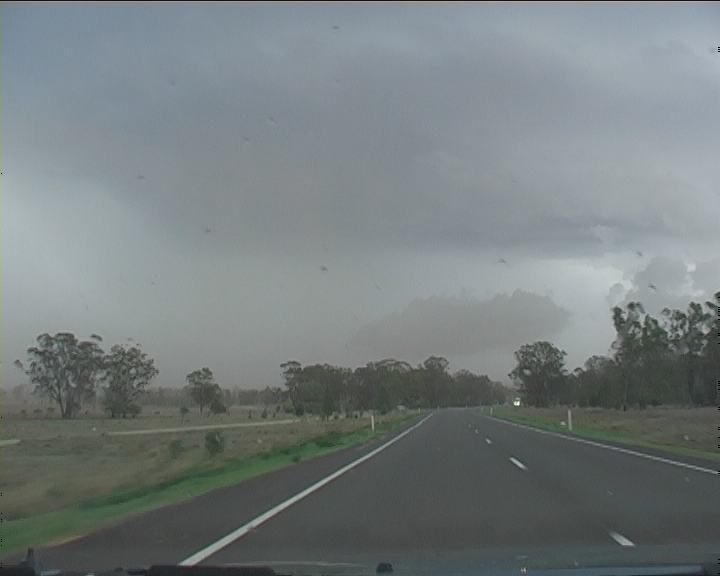 Headed north 5:50pm, we passed through areas of dust obviously within the dust plume extending out. Then finally, we were ahead of it.
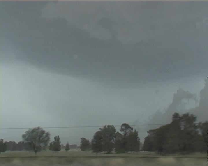
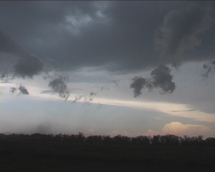
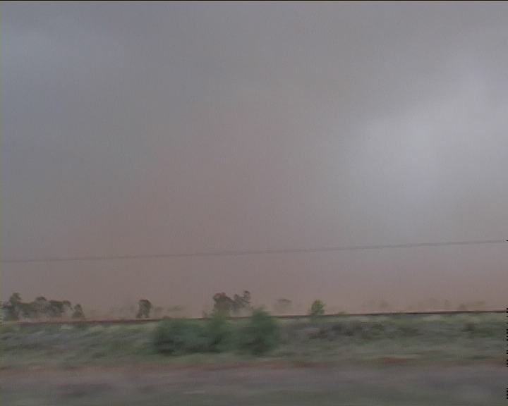 Another rain free base developed again on the northern side. I stopped to get some footage of the red dust and storm complex. It was now virtually impossible to film steadily. The dust extended from down and east of the road (left of the road looking back) to right of the road to the north of the storm. As we anticipated, another core was developing with this downburst. And yet in the previous core, there still was intense lightning activity mainly flashes or bolts on the egde of the precipitation cascades. To remain out of the dust, we moved again. Winds were very strong and the debri fell from trees.
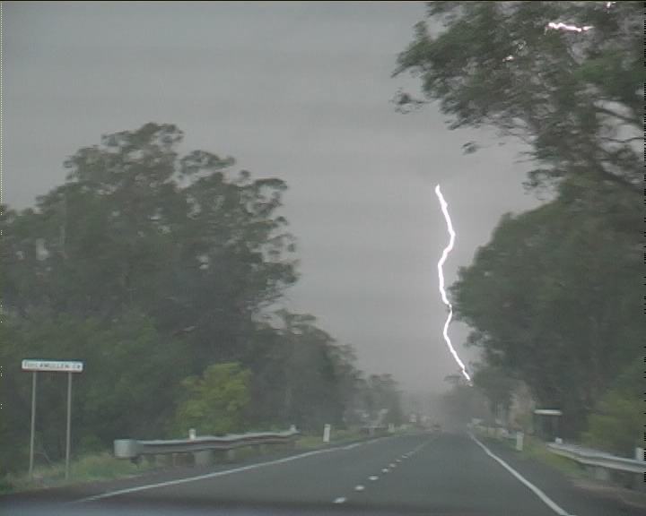
 Then in almost an instant "Bang." I had no time to think or do anything as a small but thick twig landed on the windscreen, thumped loudly and bounced off. Pheww no cracks!!
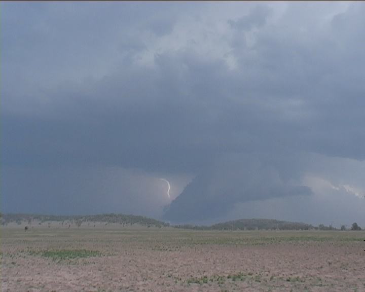
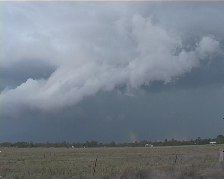
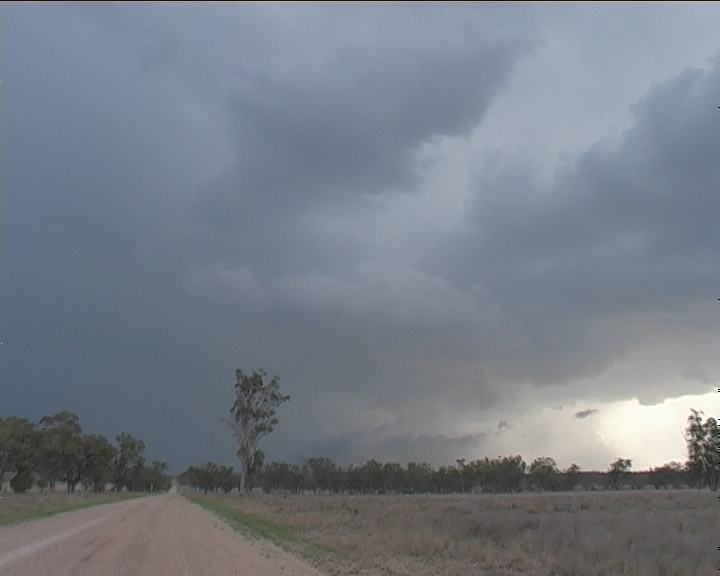
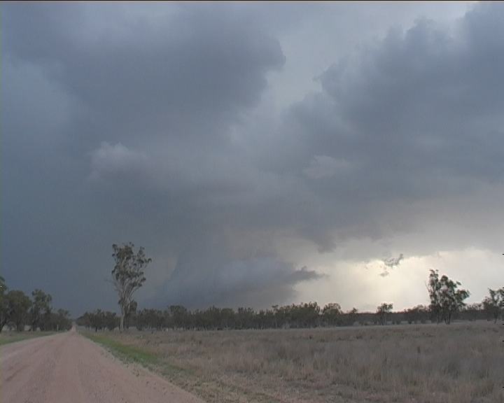
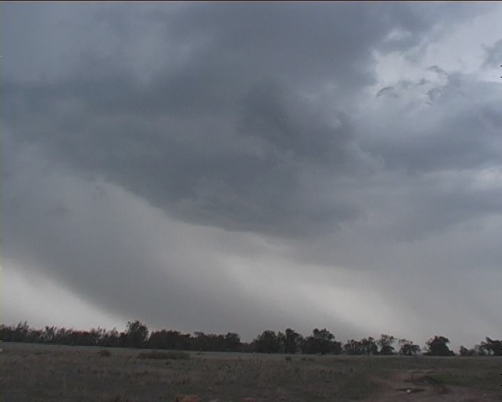
 The new core quickly developed structure. A shelf cloud formation wrapping into a wall cloud with a small inflow tail cloud. Observing this we stopped before Narrabri at 6:13pm. The contrast was truly awesome!! This updraught had developed within 30 - 40 minutes. This storm was now definitely a cyclic supercell system. Added to this, the size of the updraughts were rather large so were able to change dynamics within the outflow and base level inflow quite quickly and yet maintain the its organisation within the rain free base. This wall cloud lowering broke down after about 10 minutes and the dust that had been rising into the lowering again expanded outwards. Dust down the road was racing outwards. Time to move on.
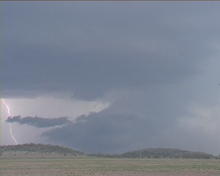
Note wall cloud - circular base and shelf cloud gusting out though dust being lifted upwards.
The new core quickly developed structure. A shelf cloud formation wrapping into a wall cloud with a small inflow tail cloud. Observing this we stopped before Narrabri at 6:13pm. The contrast was truly awesome!! This updraught had developed within 30 - 40 minutes. This storm was now definitely a cyclic supercell system. Added to this, the size of the updraughts were rather large so were able to change dynamics within the outflow and base level inflow quite quickly and yet maintain the its organisation within the rain free base. This wall cloud lowering broke down after about 10 minutes and the dust that had been rising into the lowering again expanded outwards. Dust down the road was racing outwards. Time to move on.
Note wall cloud - circular base and shelf cloud gusting out though dust being lifted upwards.
 With the turn off to Bingara in our sight just north of Narrabri (6:25pm), it was decision time. An update from Michael Bath suggested the storm was moving generally north to northeast based on development. Even though I accepted his advice, further examination of the storm suggested we must head on the road to Bingara. Yes gravel!! The other information Michael in his usual organised nature was able to pass on to me was the 3 overshoots. Three overshoots!!! Wow!! We could only imagine the true extent of the monster we were playing with. More later. Obviously I could not contain my excitement talking to Michael.
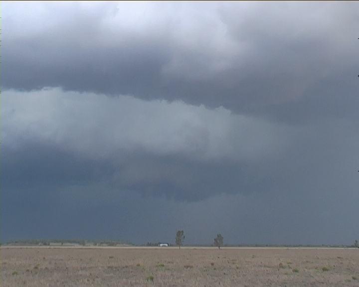 Note the development of the rain free base
 Wall cloud develops
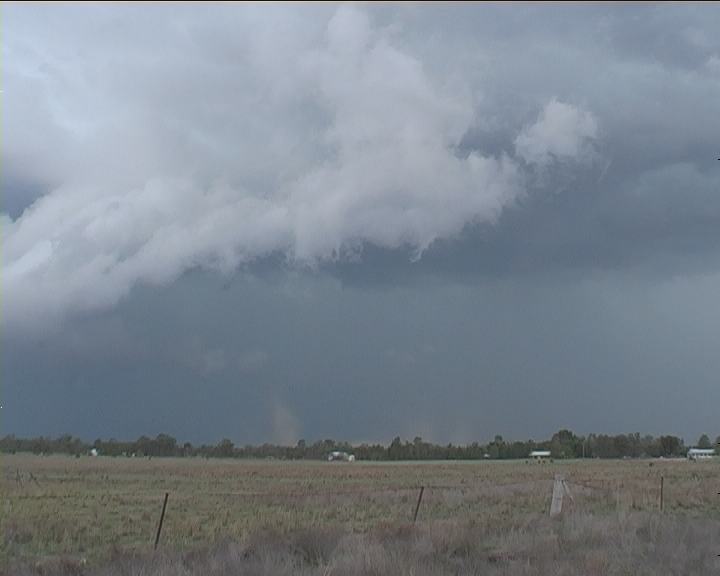
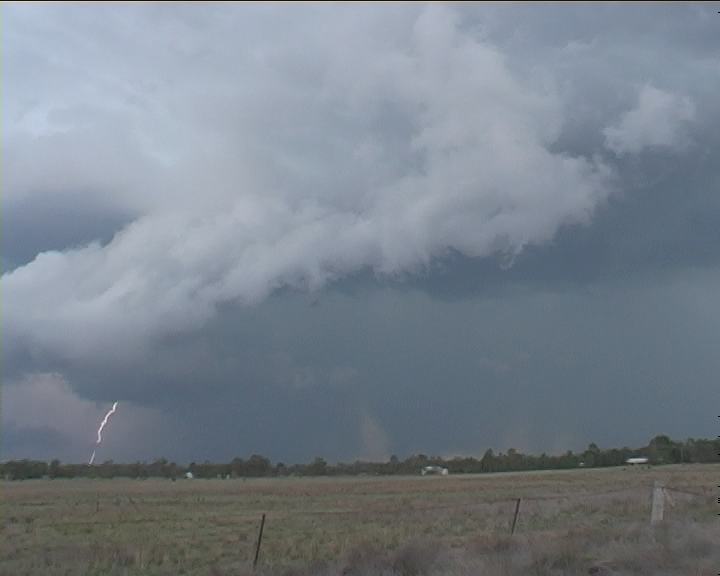
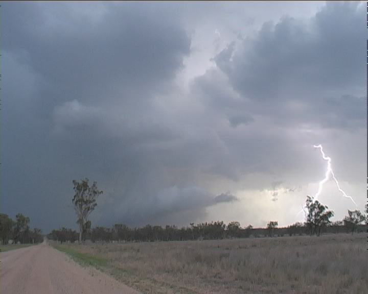 Continuing on, we stopped nearer the intersection to a northern road. Just before 7pm, we watched, an impressive wall cloud develop again anticyclonic (counterclockwise) in circulation. Bolts were still as persistent in the core and the rainfree base of the storm. Suddenly a bolt curled out of the cloud base and hit ground with an offshoot. Meanwhile, the outflow was still powering along unperturbed and persistent even though the storm was still some distance away. It seemed a little stronger now than earlier and again the wall cloud broke down and spat more dust. Again a scuddy roll or arcus cloud developed.
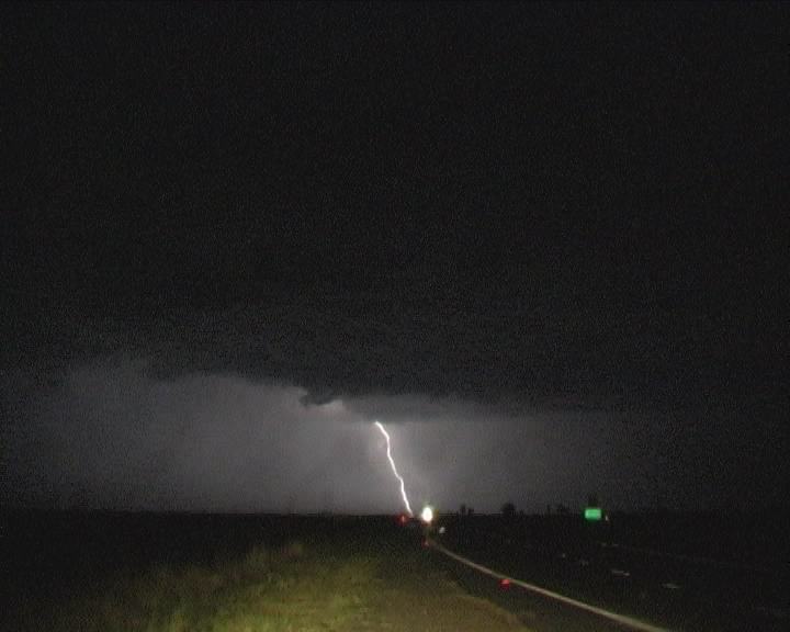
 Finally on the road, we parked well out of town for the nice lightning show. After setting up my tripod in the darkness, spots of rain!!! I was disgusted. Let's stay ahead of it. So we turned to go north of town. It was basically a waste of time. Light rain seemed to remain in phase with us. We opted for the motel. Watching video of the days events was now more appealing for these now weary chasers. Besides we would have had to play cat and mouse to remain constantly ahead of the storm system.
Later Analysis
Radar
Satellite Image Animation
Analysis Chart
AVN Model Analysis
Document: 200212-07.htm
Updated: 30th January, 2003
[Australian Severe Weather index]
[Copyright Notice]
[Email Contacts]
[Search This Site]


