and Chasing
[Index][Archives]
USA Chasing - Isolated supercell moves through Boulder causing flash flooding and hail damage: Saturday 24th June 2006
Report compiled by Michael Thomas
| Storm News and Chasing [Index][Archives] |
USA Chasing - Isolated supercell moves through Boulder causing flash flooding and hail damage: Saturday 24th June 2006 Report compiled by Michael Thomas |
Supercell storms are not uncommon in the plains of eastern Colorado and regularly produce large damaging hail, damaging winds and occasionally tornadoes. However, in the mountainous terrain and along the base of the Front Range, storms of this intensity are considerably less common. The supercell that went through Boulder on the 24/06/06 was one of the strongest storms in the history of the town and resulted in flash flooding, strong winds and hail damage to vegetation, although hail damage to cars was limited due to the small size and softness of the hail.
On 24/06/06 much of eastern Colorado was rated at a slight risk of severe storms, with primary threat believed to be damaging winds and hail. The following was released from the National Weather Service:
   "SURFACE FRONT WILL CONTINUE TO MOVE SWD AIDED AND/OR ENHANCED BY
   CONVECTIVE OUTFLOWS THROUGH ERN NM/W TX THIS FORECAST PERIOD.  ESELY
   LOW LEVEL WINDS IN THE POST-FRONTAL AIR MASS ACROSS THE SRN PLAINS
   AND GENERALLY MORE ELY FARTHER N IN ERN CO BENEATH NNWLY MID LEVEL
   FLOW WILL CONTINUE TO RESULT IN FAVORABLE DEEP LAYER SHEAR FOR
   ROTATING UPDRAFTS.  AIR MASS ALONG THE CENTRAL/SRN PLAINS OF ERN
   CO/ERN NM WILL REMAIN MARGINALLY TO MODERATELY UNSTABLE THROUGH THE
   EVENING.  ASCENT ASSOCIATED WITH A SSEWD MOVING MID LEVEL
   IMPULSE...NOW LOCATED OVER FAR SERN WY/NRN CO...SHOULD CONTINUE TO
   SUPPORT ADDITIONAL THUNDERSTORM DEVELOPMENT SWD THROUGH MUCH OF ERN
   CO SOUTH OF A 30 NW DEN-30 N AKO LINE."
Shown below is the morning sounding for Denver which shows a moist layer extending from the surface, 850hPa, to approximately 750hPa, with an elevated mixed layer above extending to 500 hPa resulting in a CAPE of approximately 1000 j/kg. The surface dew point was 51 F (11C) which is quite high for the Denver area. Winds in the boundary layer were from the NNE while the winds aloft were westerly with 25 knot flow at 500 hPa and 45 knot flow at 300 hPa. By the afternoon the atmosphere was altered considerably by strong daytime heating. This is displayed quite clearly in the afternoon Denver sounding where the capping inversion was no longer present and the surface dew point had dropped to 41F (5C) due to mixing. This sounding also indicates an improvement to both directional and speed shear with the surface winds backing to the east and winds aloft strengthening by 5 knots from 500 hPa to the tropopause. The resulting shear profile was marginal for supercells however the T/Td profile was more favourable for scattered high based multicell storms. The fact that an isolated supercell formed suggests that the surface moisture did not mix out to allow stronger convection along the Front Range.
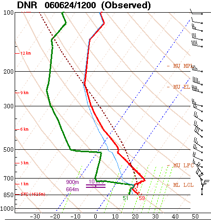
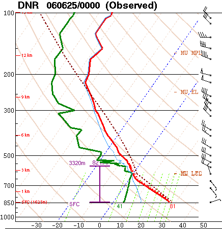
Figure 1 (above) - Soundings from Denver taken at a) 12Z 24/6/06 and b) 0Z 25/6/06.
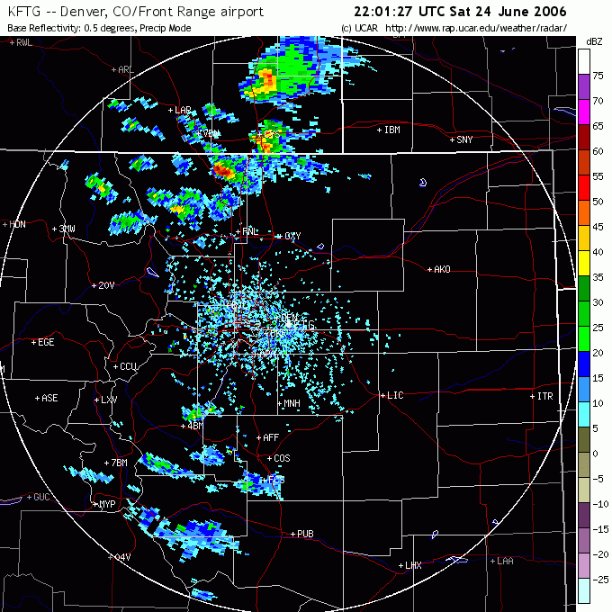
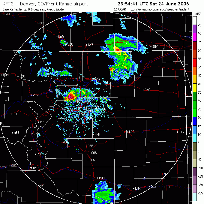
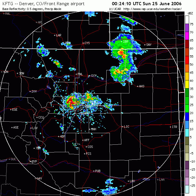
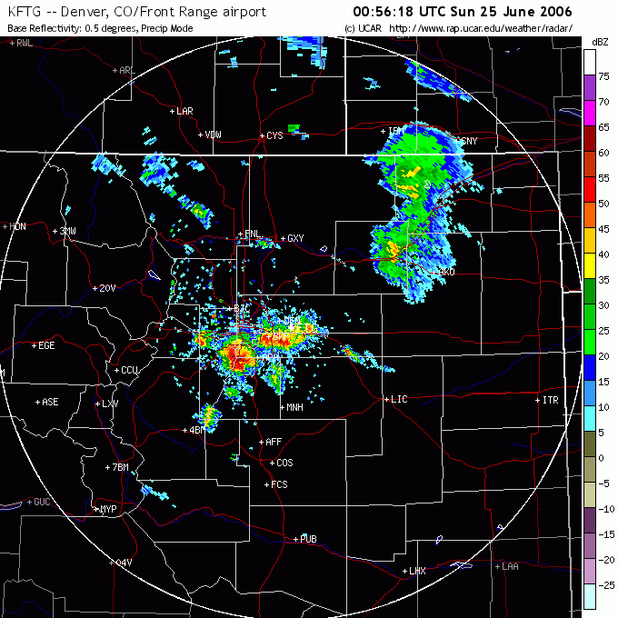
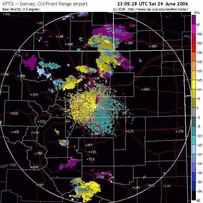
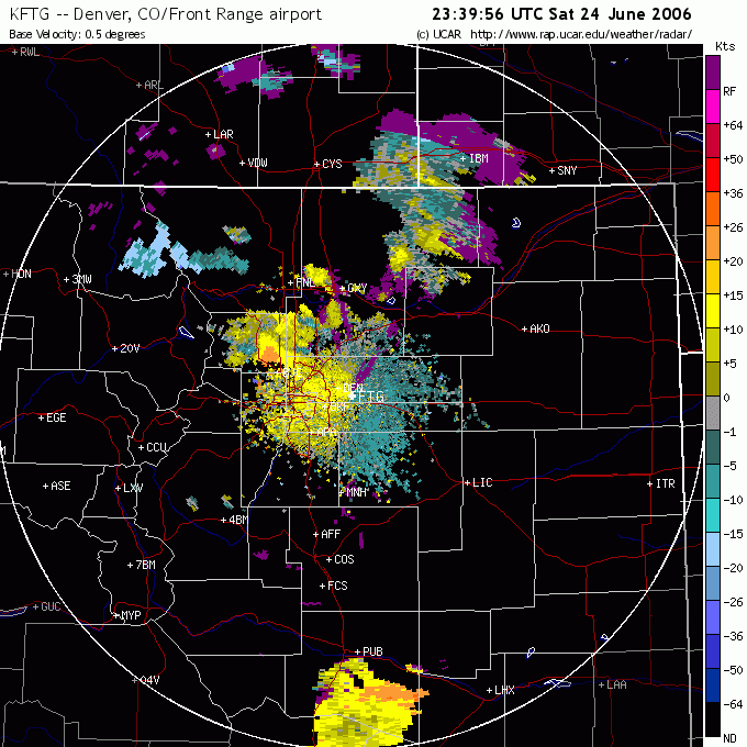
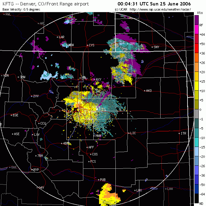
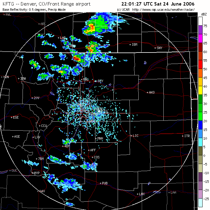
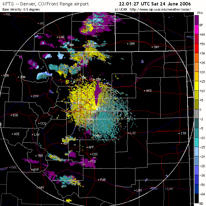
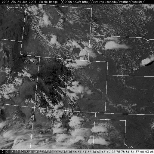
The storm formed on the elevated terrain due west of Fort Collins at approximately 2200 UTC, possibly on an outflow boundary from ongoing convection in Wyoming and far northern Colorado, and quickly intensified while moving in a south-easterly direction (Figure 2a). At 2300 UTC the storm began to move sharply right of the steering winds resulting in the storm travelling almost due south. This was accompanied with the storm taken upon a supercellular appearance by radar and an increase in reflectivity to approximately 50 dBZ (Figure 2b). Between 2330 and 2400 UTC the storm was at its most intense with a maximum reflectivity of approximately 70 dBZ observed, it is at this time the storm passed through Boulder. At this stage the storm also had a clearly defined V-notch as seen on the reflectivity image indicating divergent flow aloft (Figure 2c). The base velocity radar images seem to indicate the presence of a mesocyclone at this stage of the storms lifetime (Figure 3b). Also of interest is the visible satellite image shown in Figure 4 of the storm at peak intensity. Interestingly, after 0 UTC the storm is observed to have two mesocyclones from the base velocity images (Figure 3c) and by 00:20 UTC the storm appears to have two inflow notches in the reflectivity image (Figure 2d). By 0100 UTC the storm had significantly weakened with a maximum reflectivity of approximately 55 dBZ observed (Figure 2e) and a mesocyclone was not present in the base velocity radar image. This change in storm structure was accompanied by a change in the direction of movement from south to south easterly. It appears that the topography may have had a significant effect the intensification of the storm as during its supercellular phase the storm travelled parallel to the Front Range. It may be storm intensification occurred as the storm moved off the higher terrain of the Front Range because it encountered a region of higher CAPE and deeper moisture.
 a
a
 b
b
 c
c
 d
d
 e
e
Figure 2 (above) - The 0.5 degree tilt base reflectivity at a) 2201 UTC b) 2300 UTC c) 2354 UTC d) 0024 UTC and e) 0056 UTC.
 a
a
 b
b
 c
c
Figure 3 (above) - The 0.5 degree tilt base velocity at a) 2305 UTC b) 2340 UTC and c) 0004 UTC.
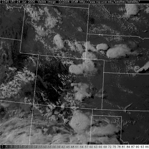
Figure 4 (above)- The visible satellite image at 2345 UTC showing the storm at its peak intensity.
The storm was quite high based and had no wall cloud or gust front. Interestingly, the precipitation core was almost transparent for some time probably due to relatively high hail content as well as the storms high base allowing light to penetrate the precipitation core. The storm did have a very large rain free base and of interest was what appears to be a clear slot formed from the rear flank downdraft. Moderately strong south easterly inflow was observed which increased in strength with the approach of the storm. The wind quickly swung around to the north as outflow from the forward flank down draft hit with gusts of approximately 80-100 km/hr. Within the precipitation core heavy rain and a substantial amount on hail was experienced. The hail observed was very soft with the consistency more of wet snow and maximum hail size in my location was only approximately 1cm. Flash flooding also occurred throughout Boulder however no major damage was reported as a result. In other areas, hail up to 1.75 inches was reported and minor damage as a result of strong outflow winds occurred.
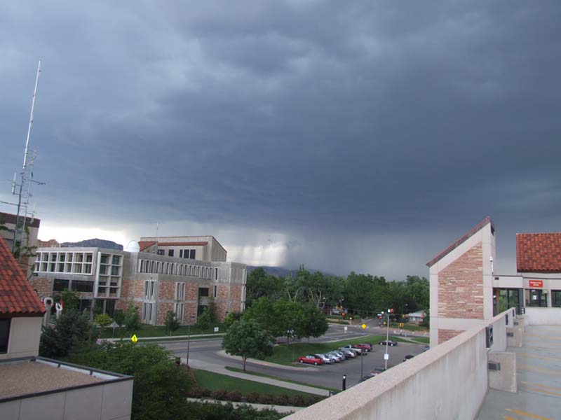
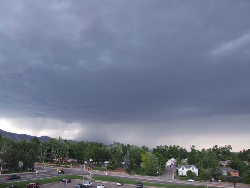
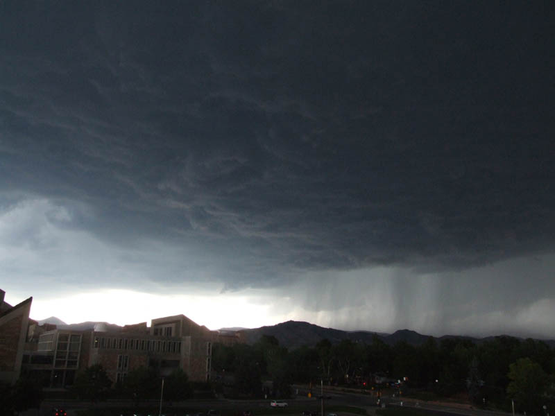
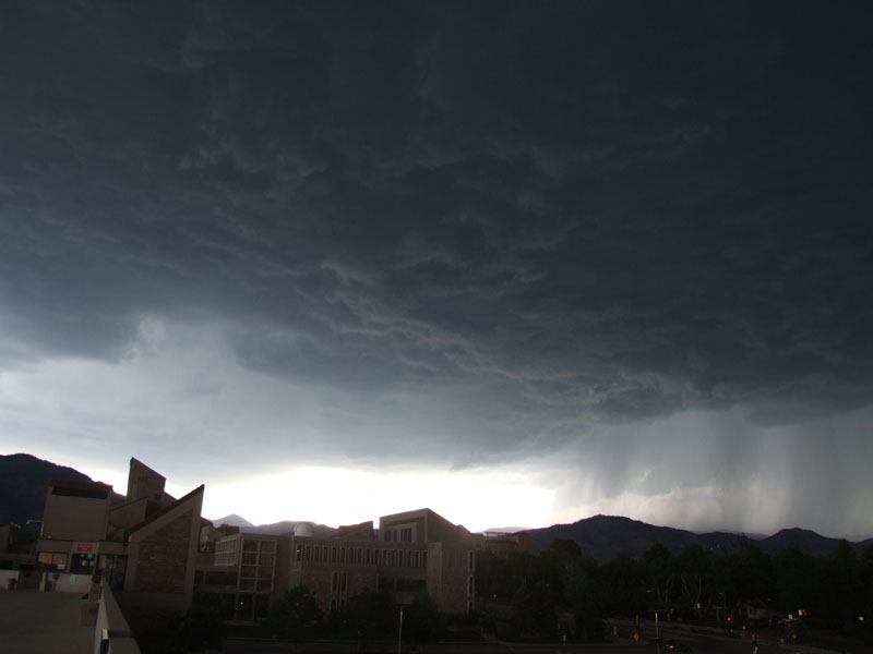
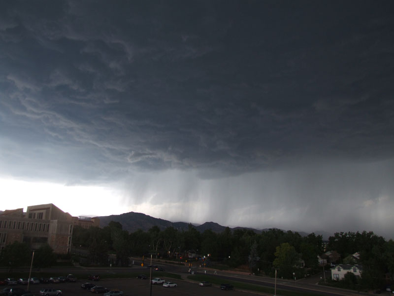
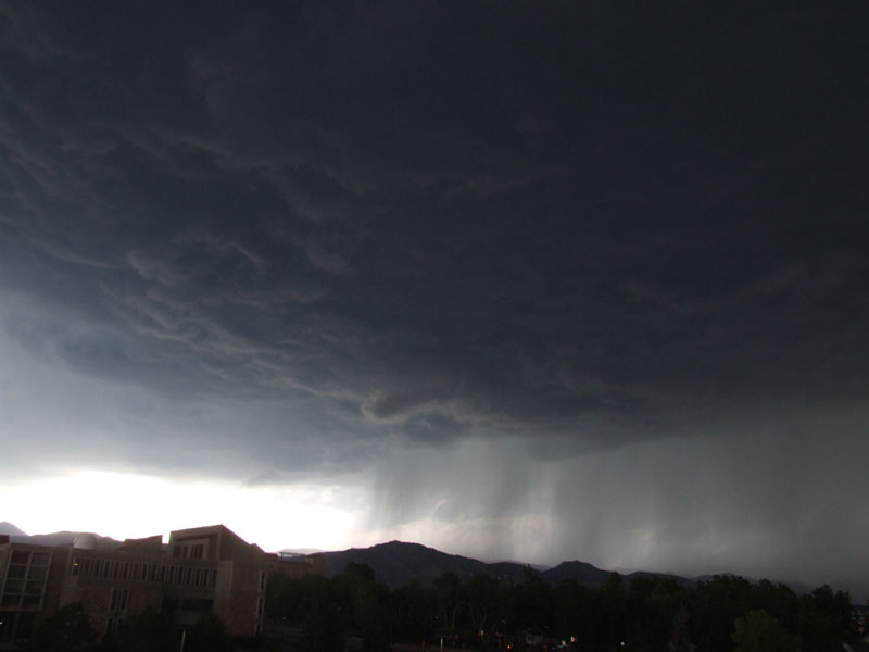
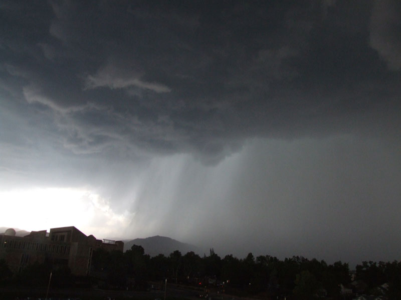
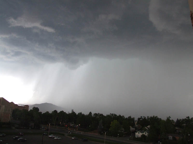
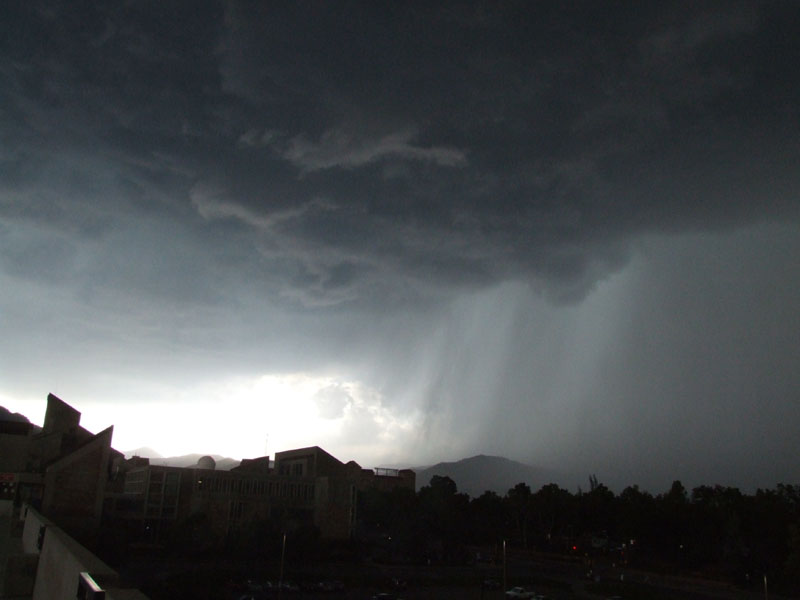
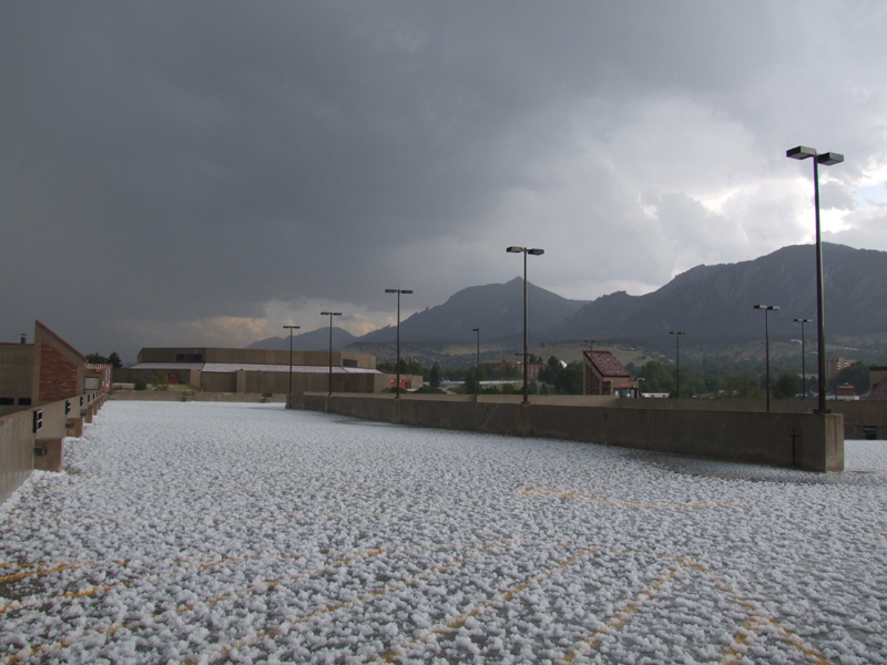
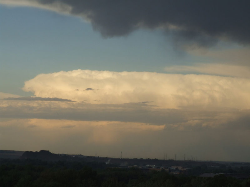
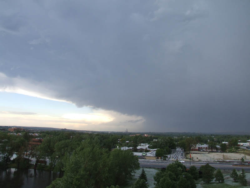
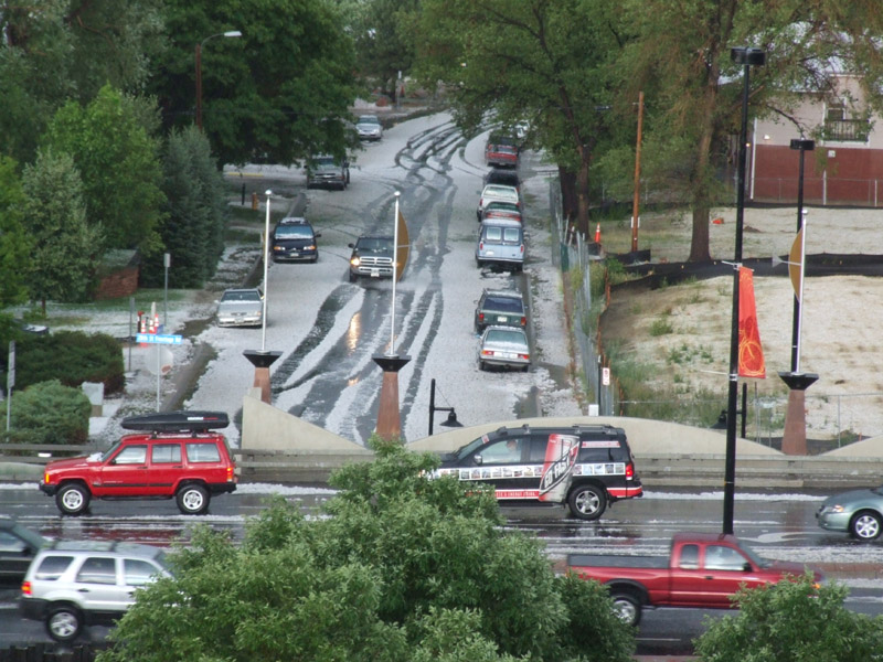
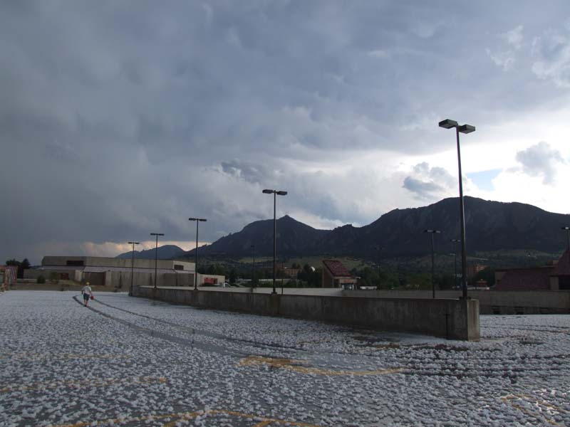
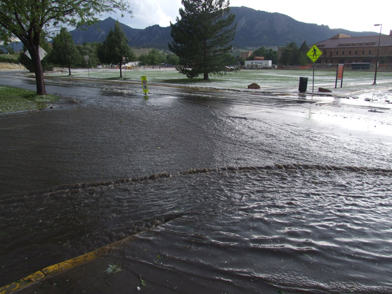
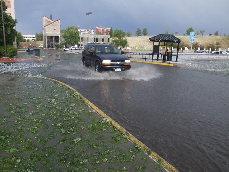
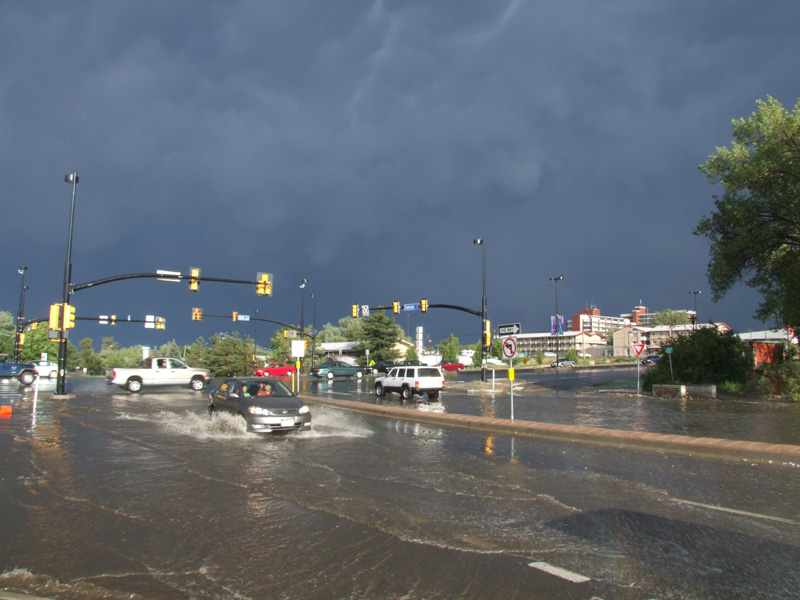
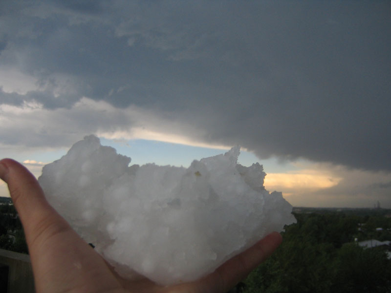
Figure 5 (above)- Photos of the approaching storm, hail and minor flash flooding.
|
Document: 200606-01.htm Updated: 20th September 2006 |
[Australian Severe Weather index] [Copyright Notice] [Email Contacts] [Search This Site] |