[Index]
Observing the effects or aftermath of the weather
[Back to introduction of simple techniques]
| Observation Techniques
[Index] |
Observing the effects or aftermath of the weather [Back to introduction of simple techniques] |
|
This section deals with several different aspects of the weather but concentrates on past weather conditions of up to a few days or even weeks. Certain weather conditions leave evidence that can be used to determine what has actually happened within a locality even if you were not in that area. It may be necessary to include several observations before arriving at a conclusion. In fact, it can be described as 'weather detective work'. You may have already observed the weather conditions but was not actually certain where it occurred.
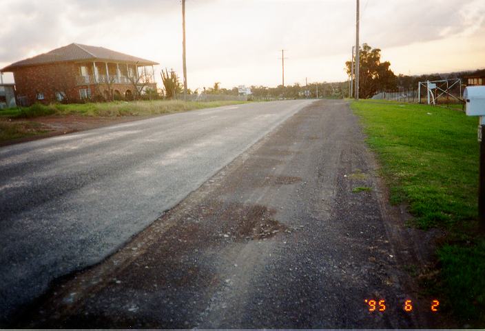
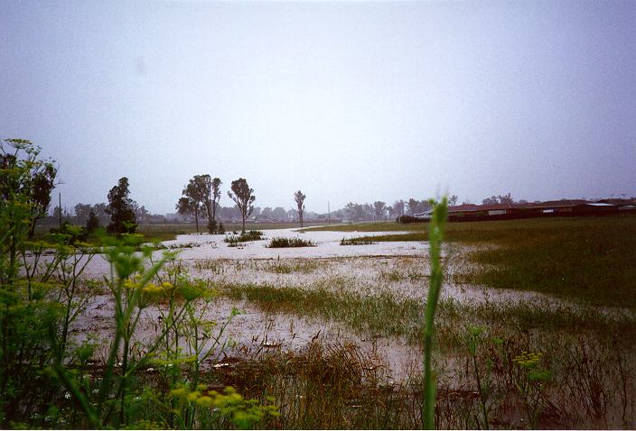
There are several observations that indicate rain has occurred. Although roads provide evidence of recent rainfall, an observer must also take into account the slope or curvature of the road. Level roads will always hold more water in puddles whilst roads that slope either from one side to the other or from the centre outwards will always drain water to the side of the road. The type of surface also affects the rate of evaporation. A rough surface will contain more water than smooth surfaces.
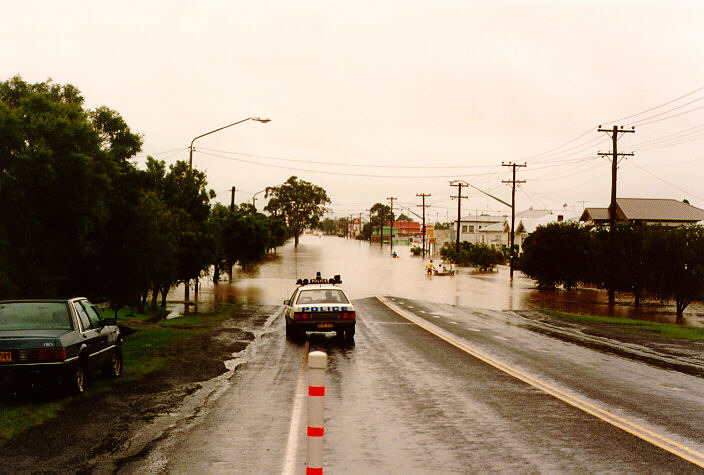
It is not unusual for water mains to burst spilling water over roads and occasionally flooding houses. However, it is easy to distinguish recent rainfall from the situation of a burst water main. A burst water main normally occurs in one area and water runs downstream from the cause. Recent rain or showers are indicated by consistently wet roads and are more widespread.
If you observe trails of wet and dry patterns along the side of the road (and perpendicular to the road), this indicates that there has been some showers or brief rain to heavy rain and water has just started to run off the road when the rain ceased.
Ground water must eventually flow under the influence of gravity to creeks, rivers, lakes or the ocean. Sometimes, excess ground water from recent rainfall can be observed leaking or streaming from hillsides or cracks in rock cliff faces. This situation is common around Sydney since it consists largely of sandstone.
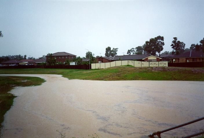
Certain observations indicate rain has been heavy. If soil has been eroded and deposited onto pathways or grass, rain must have been heavy. Landslides or mud slides indicate that very heavy rain has weakened the layers of soil supporting the side of a hill. Buildings built on such hills have been known to collapse with the soil removed from the foundations. Sometimes, roads collapse or are covered by mud and debris due to landslides or mud slides.
To determine the weather conditions using some of these observations may be insufficient. It is advisable to recall and compare with recent whether weather conditions or asking someone in the area that has observed the conditions.
Back to top
Wind has the tendency to move loose objects such as leaves and dust, or break branches depending on the strength of the wind as discussed in the previous section. Therefore, if leaves have been deposited away from trees, or dust has been deposited on areas away from soil, then wind has occurred. It is important to distinguish between the effects of wind and water. Wind can deposit material anywhere whereas water travels downhill.
There are several indicators of stronger winds. Plants such as long grass are usually easily flattened especially if the lower stems break.
Remember if this occurs within a field where the surrounding areas are undisturbed (or not as disturbed), then the wind flow was downwards in the form of down draughts usually associated with thunderstorms. Trees stripped of their leaves and twigs also indicate stronger winds whilst widespread leaves, papers and other forms of loose debris caught on fences or on roves may indicate strong winds. This should not be confused with papers and grass carried by birds for their nests. If large branches or trees have been snapped or trees uprooted, very strong winds have occurred. Other observations include damage to buildings, power lines and vehicles blown onto their side. Sometimes it is difficult to determine the difference between the strong winds from storms and days of windy conditions. The conditions associated with severe thunderstorms are discussed later including some of these observations.
Back to top
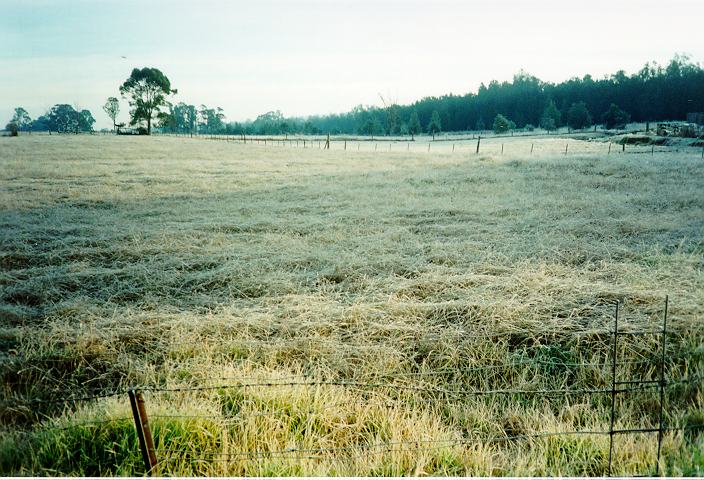
If you observe an area where leaves and twigs have been stripped from the tree and not blown away, it is most probable that large hail has occurred. For some farmers, the effects of frost can be devastating. Certain crops planted during spring, or grass can die under the influence of frost. Other crops particularly fruit rely on a particular growing season of below freezing temperatures in order to produce fruit during the following summer. Therefore, it may be important to study the effects of frost conditions and how to notice such effects.
Droughts occur regularly in Australia and are devastating to farmers. Most people are aware of the following observations which indicate dry areas or areas which are experiencing drought (drier than average conditions). Areas that are dry or are in drought obviously are those areas that are lacking water. Typical observations include creeks that are at low levels or completely dry; drier than usual or dead vegetation including trees; lean or dead animals; and cracks in soil particularly in dams or creeks that have had most or all water evaporated. Dry areas also tend to become dusty and dust storms during droughts are quite common.
Back to top
Having discussed bush fires above, it may be useful to learn about areas that have experienced fires. In fact, certain observations may indicate that fires are still in progress. If you observe recently burnt twigs or ash passing overhead, it may indicate precipitation from the smoke of a major bush fire upwind.
Blackened areas of forest indicate recent bush fires. The length of time from the event of the fire to the time of observation is indicated by the amount of regenerated growth on trees and new undergrowth. Precipitation increases the rate of regeneration. Therefore, until precipitation occurs, regeneration will be slow. It normally takes a few years for forests to fully regenerate although severe fires can permanently scar some forested areas.
For more on hailstorms go to hailstorm forecasts.
|
|
Document: aftermth.htm
Updated: 20th March 2008 |
[Australian Severe Weather index] [Copyright Notice] [Email Contacts] [Search This Site] |
 This can be backed up with evidence of roof damage to buildings, cars and broken windows. Hail may also damage crops and strip trees of bark with wind. Hail may also penetrate mud or wet soil and melt leaving holes.
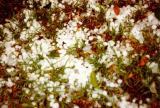
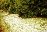 If a reasonable cover of hail has fallen, it may lay on grass for hours even a few days.